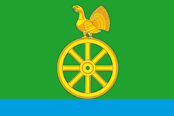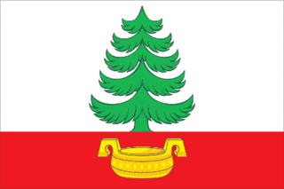
Krasnokamensky District is an administrative and municipal district (raion), one of the thirty-one in Zabaykalsky Krai, Russia. It is located in the southeast of the krai, and borders with Priargunsky District in the north, and with Zabaykalsky District in the west. The area of the district is 5,300 square kilometers (2,000 sq mi). Its administrative center is the town of Krasnokamensk. Population: 64,597 (2010 Census); 9,987 ; 71,037 (1989 Soviet census). The population of Krasnokamensk accounts for 86.2% of the district's total population.
Kyrinsky District is an administrative and municipal district (raion), one of the thirty-one in Zabaykalsky Krai, Russia. It is located in the southwest of the krai, and borders with Ulyotovsky District in the north. The area of the district is 16,200 square kilometers (6,300 sq mi). Its administrative center is the rural locality of Kyra. Population: 13,650 (2010 Census); 16,016 ; 19,593 (1989 Soviet census). The population of Kyra accounts for 33.4% of the district's total population.

Nerchinsko-Zavodsky District is an administrative and municipal district (raion), one of the thirty-one in Zabaykalsky Krai, Russia. It is located in the east and southeast of the krai, and borders with Gazimuro-Zavodsky District in the north, and Kalgansky District in the south. The area of the district is 9,700 square kilometers (3,700 sq mi). Its administrative center is the rural locality of Nerchinsky Zavod. Population: 10,782 (2010 Census); 12,499 ; 15,605 (1989 Soviet census). The population of Nerchinsky Zavod accounts for 26.4% of the district's total population.

Bolshiye Dvory is an urban locality in Pavlovo-Posadsky District of Moscow Oblast, Russia. Population: 4,952 (2010 Census); 4,841 (2002 Census); 5,283 (1989 Soviet census).

Cherusti is an urban locality in Shatursky District of Moscow Oblast, Russia. Population: 2,862 (2010 Census); 2,891 (2002 Census); 3,779 (1989 Soviet census).

Nekrasovsky is an urban locality in Dmitrovsky District of Moscow Oblast, Russia. Population: 10,292 (2010 Census); 9,693 (2002 Census); 7,267 (1989 Soviet census).

Pravdinsky is an urban locality in Pushkinsky District of Moscow Oblast, Russia. Population: 10,587 (2010 Census); 10,458 (2002 Census); 11,295 (1989 Soviet census).
Arefyeva is a rural locality in Yorgvinskoye Rural Settlement, Kudymkarsky District, Perm Krai, Russia. The population was 26 as of 2010.
Buslayeva is a rural locality in Leninskoye Rural Settlement, Kudymkarsky District, Perm Krai, Russia. The population was 9 as of 2010.
Vaskina Gar is a rural locality in Leninskoye Rural Settlement, Kudymkarsky District, Perm Krai, Russia. The population was 6 as of 2010.
Vizyay is a rural locality in Verkh-Invenskoye Rural Settlement, Kudymkarsky District, Perm Krai, Russia. The population was 72 as of 2010. There is 1 street.
Vil-Chigas is a rural locality in Beloyevskoye Rural Settlement, Kudymkarsky District, Perm Krai, Russia. The population was 10 as of 2010.
Kirshina is a rural locality in Oshibskoye Rural Settlement, Kudymkarsky District, Perm Krai, Russia. The population was 95 as of 2010. There are 10 streets.
Sidorshor is a rural locality in Leninskoye Rural Settlement, Kudymkarsky District, Perm Krai, Russia. The population was 182 as of 2010. There are 6 streets.
Tarova is a rural locality in Stepanovskoye Rural Settlement, Kudymkarsky District, Perm Krai, Russia. The population was 497 as of 2010. There are 7 streets.
Shaydyrova is a rural locality in Leninskoye Rural Settlement, Kudymkarsky District, Perm Krai, Russia. The population was 22 as of 2010.
Zotov is a rural locality in Khopyoropionerskoye Rural Settlement, Uryupinsky District, Volgograd Oblast, Russia. The population was 33 as of 2010.
Nizhneantoshinsky is a rural locality in Verkhnebezymyanovskoye Rural Settlement, Uryupinsky District, Volgograd Oblast, Russia. The population was 140 as of 2010. There are 2 streets.
Nizhnekrasnyansky is a rural locality in Mikhaylovskoye Rural Settlement, Uryupinsky District, Volgograd Oblast, Russia. The population was 80 as of 2010.
Santyrsky is a rural locality in Mikhaylovskoye Rural Settlement, Uryupinsky District, Volgograd Oblast, Russia. The population was 84 as of 2010.


