
Ault Park is the fourth-largest park in Cincinnati at 223.949 acres (0.9 km²), owned and operated by the Cincinnati Park Board. It lies in the Mount Lookout neighborhood on the city's east side. The hilltop park has an overlook which commands extensive panoramic views of the Little Miami River valley.

Fort Ancient is a Native American earthworks complex located in Washington Township, Warren County, Ohio, along the eastern shore of the Little Miami River about seven miles (11 km) southeast of Lebanon on State Route 350. The site is the largest prehistoric hilltop enclosure in the United States with three and one-half miles (18,000 ft) of walls in a 100-acre (0.40 km2) complex. Built by the Hopewell culture, who lived in the area from the 200 BC to AD 400, the site is situated on a wooded bluff 270 feet (82 m) above the Little Miami. It is the namesake of a culture known as Fort Ancient who lived near the complex long after it was constructed.
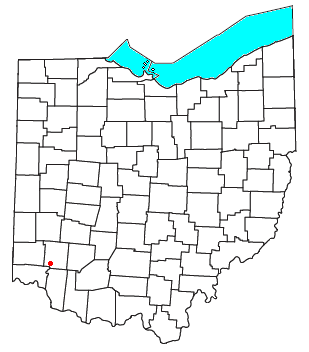
Twenty Mile Stand is an unincorporated community in southeastern Deerfield Township, Warren County, Ohio, United States. It lies on the old 3C Highway in Town 4 East, Range 2 North, Section 21 of the Symmes Purchase and in the center of the area known as "Landen". It is about three miles south-south west of Kings Mills, two miles southwest of Fosters, and twenty miles northeast of Cincinnati.

Evanston is one of the 52 neighborhoods of Cincinnati, Ohio. A mostly African-American neighborhood since the 1960s, it is known as "the educating community," and is bordered by the neighborhoods of East Walnut Hills, Hyde Park, North Avondale, and Walnut Hills, as well as the City of Norwood. The population was 8,838 at the 2020 census.

California, Cincinnati is one of the 52 neighborhoods of Cincinnati, Ohio. Located at the confluence of the Little Miami River and Ohio River, it is the southeastern-most neighborhood in the city. California borders the Cincinnati neighborhoods of Mt. Washington and the East End, as well as Anderson Township. The population was 944 at the 2020 census.

The Mount Adams Incline was a funicular, or inclined railway, located in the Cincinnati neighborhood of Mount Adams. Completed in 1872, it was the longest-running of the city's five inclines, closing in 1948. It has since been demolished.

The Cincinnati Southern Bridge, originally the Cincinnati Southern Railroad Swinging Truss Bridge, is a vertical lift bridge that carries the Norfolk Southern Railway's Cincinnati, New Orleans and Texas Pacific Railway over the Ohio River between Cincinnati, Ohio, and Ludlow, Kentucky in the United States.

A serpentine shape is any of certain curved shapes of an object or design, which are suggestive of the shape of a snake. Serpentine shapes occur in architecture, in furniture, and in mathematics.

The Duke Energy Children's Museum, formerly the Cinergy Children's Museum, is a museum in Cincinnati, Ohio, in the United States. It is one of the museums comprising the Cincinnati Museum Center at Union Terminal. Opened in 1998, the museum was moved from historic Longworth Hall near downtown Cincinnati location following the Ohio River Valley Flood of March 1997 that inundated it.

Hyde Park is one of the 52 neighborhoods of Cincinnati, Ohio. Originally established as a retreat for the city's wealthy, the neighborhood is predominately residential, with a central business district known as Hyde Park Square. The population was 14,193 at the 2020 census.

The Banks is a mixed-use development along the Ohio River in downtown Cincinnati, Ohio, on the land between Paycor Stadium and Great American Ball Park.

Cincinnati Work House and Hospital was a registered historic building in the neighborhood of Camp Washington, Cincinnati, Ohio, listed in the National Register on March 3, 1980. The jail was built between 1867 and 1869 on 6 acres (2.4 ha) of land.

Sayler Park is one of the 52 neighborhoods of Cincinnati, Ohio. Situated along the Ohio River, it is the westernmost neighborhood in the city. The population was 2,825 at the 2020 census.

East End Park was a former major league baseball park located in the East End neighborhood of Cincinnati in the United States. The ballpark, which is also known to baseball historians as Pendleton Park, was home to the Cincinnati Reds of the American Association during the 1891 baseball season. The club was led by the flamboyant star, Mike "King" Kelly.

Piatt Park is the oldest park in Cincinnati, Ohio. The urban park stretches two blocks between Elm Street and Vine Street on Garfield Place/8th Street. The park is owned and maintained by the Cincinnati Park Board.

Downtown Cincinnati is the central business district of Cincinnati, Ohio, United States, as well the economic and symbiotic center of the Cincinnati metropolitan area. Originally the densely populated core of the city, the neighborhood was transformed into a commercial zone in the mid-20th century. The population was 5,835 at the 2020 census.
Guilford School is a historic former schoolhouse, now housing commercial offices, on the east side of Downtown Cincinnati at 421 E 4th Street. The building is adjacent to Lytle Park is a contributing property to the Lytle Park Historic District.

The Bunbury Music Festival is a three-day music festival in Cincinnati, Ohio, United States, at Sawyer Point Park & Yeatman's Cove on the banks of the Ohio River. Each annual event typically features over 100 acts performing on three to six separate stages through the park. The festival was founded by MidPoint Music Festival co-founder and former Fountain Square managing director Bill Donabedian. The festival's inaugural event took place July 13–15, 2012. In 2014, Bunbury was purchased by PromoWest Productions, an entertainment company operating out of Columbus, Ohio.

Mt. Echo Park is an 84-acre (34 ha) urban park in the Price Hill neighborhood of Cincinnati, Ohio, United States. Located on a hilltop, the park offers scenic overlooks of Downtown Cincinnati, the Ohio River, and Northern Kentucky.

The Cincinnati Pride Parade and Festival is a week-long celebration of the city's Lesbian, Gay, Bisexual, Transgender, Queer, and other identities ([LGBTQ+]) community. The festivities are typically held annually at the end of June but have happened as early as April and as late as July in various locations of Cincinnati, Ohio.

