The Balts or Baltic peoples are a group of peoples inhabiting the eastern coast of the Baltic Sea who speak Baltic languages. Among the Baltic peoples are modern-day Lithuanians and Latvians — all East Balts — as well as the Old Prussians, Curonians, Sudovians, Skalvians, Yotvingians and Galindians — the West Balts — whose languages and cultures are now extinct.

The Northern Crusades or Baltic Crusades were Christianization campaigns undertaken by Catholic Christian military orders and kingdoms, primarily against the pagan Baltic, Finnic and West Slavic peoples around the southern and eastern shores of the Baltic Sea.

East Prussia was a province of the Kingdom of Prussia from 1772 to 1829 and again from 1878 ; following World War I it formed part of the Weimar Republic's Free State of Prussia, until 1945. Its capital city was Königsberg. East Prussia was the main part of the region of Prussia along the southeastern Baltic Coast.

Klaipėda, historically also Memel, is a city in Lithuania on the Baltic Sea coast. It is the third largest city in Lithuania, the fifth largest city in the Baltic States and the capital of Klaipėda County, as well as the only major seaport in the country.

Neringa or Neringa Municipality is a municipality of Klaipėda County in westernmost Lithuania, comprising several villages in the Curonian Spit. In terms of population, it is the smallest municipality of the country. Nida is the seat of government and largest town in Neringa Municipality.

Prussia is a historical region in Central Europe on the south-eastern coast of the Baltic Sea, that ranges from the Vistula delta in the west to the end of the Curonian Spit in the east and extends inland as far as Masuria, divided between Poland, Russia and Lithuania. This region is often also referred to as Old Prussia.

The Curonian (Courish) Spit is a 98-kilometre (61 mi) long, thin, curved sand-dune spit that separates the Curonian Lagoon from the Baltic Sea. It is a UNESCO World Heritage Site shared by Lithuania and Russia. Its southern portion lies within Kaliningrad Oblast of Russia, and its northern within southwestern Klaipėda County of Lithuania.

Old Prussians, Baltic Prussians or simply Prussians were a Baltic people that inhabited the region of Prussia, on the southeastern shore of the Baltic Sea between the Vistula Lagoon to the west and the Curonian Lagoon to the east. As Balts, they spoke an Indo-European language of the Baltic branch now known as Old Prussian and worshipped pre-Christian deities. Their ethnonym was later adopted by predominantly Low German-speaking inhabitants of the region.

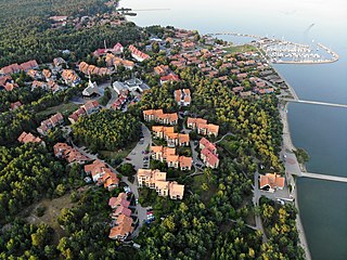
Nida is a resort town in Lithuania, the administrative centre of Neringa municipality. Located on the Curonian Spit between the Curonian Lagoon and the Baltic Sea, it is the westernmost point of Lithuania and the Baltic states, close to the border with the Russian Kaliningrad Oblast exclave. It currently has about 2,385 residents.

Drużno is a body of water historically considered a lake in northern Poland on the east side of the Vistula delta, near the city of Elbląg. As it is currently not deep enough to qualify as a lake hydrologically and receives some periodic inflow of sea water from the Vistula Lagoon along the Elbląg River, some suggest that it be termed an estuary reservoir. A village of recent origin also called Drużno is situated near the lake.

Lithuania Minor or Prussian Lithuania is a historical ethnographic region of Prussia, where Prussian Lithuanians lived, now located in Lithuania and the Kaliningrad Oblast of Russia. Lithuania Minor encompassed the northeastern part of the region and got its name from the territory's substantial Lithuanian-speaking population. Prior to the invasion of the Teutonic Knights in the 13th century, the main part of the territory later known as Lithuania Minor was inhabited by the tribes of Skalvians and Nadruvians. The land depopulated during the incessant war between Lithuania and the Teutonic Order. The war ended with the Treaty of Melno and the land was repopulated by Lithuanian newcomers, returning refugees, and the remaining indigenous Baltic peoples; the term Lithuania Minor appeared for the first time between 1517 and 1526.

Tauragė is an industrial city in Lithuania, and the capital of Tauragė County. In 2020, its population was 20,956. Tauragė is situated on the Jūra River, close to the border with the Kaliningrad Oblast, and not far from the Baltic Sea coast.

Šilutė is a city in the south of the Klaipėda County in western Lithuania. The city was part of the Klaipėda Region and ethnographic Lithuania Minor. Šilutė was the interwar capital of Šilutė County and is currently the capital of Šilutė District Municipality.

The Nadruvians were a now-extinct Prussian tribe. They lived in Nadruvia, a large territory in northernmost Prussia. They bordered the Skalvians on the Neman (Nemunas) River just to the north, the Sudovians to the east, and other Prussian tribes to the south and west. Most information about the clan is provided in a chronicle by Peter von Dusburg.

The Scalovians, also known as the Skalvians, Schalwen and Schalmen, were a Baltic tribe related to the Prussians. According to the Chronicon terrae Prussiae of Peter of Dusburg, the now extinct Scalovians inhabited the land of Scalovia south of the Curonians and Samogitians, by the lower Neman River ca. 1240.

The Western Baltic culture was the westernmost branch of the Balts, representing a distinct archaeological culture of the Bronze Age and Iron Age, along the southern coast of the Baltic Sea. It is a zone of several small archaeological cultures that were ethnically Baltic and had similar cultural features. They included tribes such as the Old Prussians, Galindians, Yotvingians and Skalvians, in addition to the little-known Pomeranian Balts or Western Balts proper, in the area now known as Pomerania.

The Curonian Lagoon is a freshwater lagoon separated from the Baltic Sea by the Curonian Spit. Its surface area is 1,619 square kilometers (625 sq mi). The Neman River supplies about 90% of its inflows; its watershed consists of about 100,450 square kilometres in Lithuania and Russia's Kaliningrad Oblast.

The Curonians or Kurs were a medieval Baltic tribe living on the shores of the Baltic Sea in the 5th–16th centuries, in what are now western parts of Latvia and Lithuania. They eventually merged with other Baltic tribes contributing to the ethnogenesis of present-day Latvians and Lithuanians. Curonians gave their name to the region of Courland (Kurzeme), and they spoke the Curonian language.

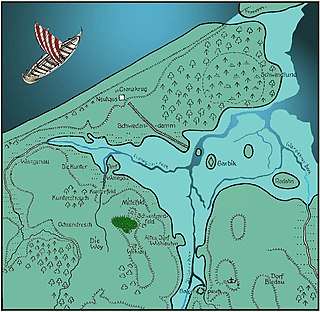
Kaup is a hill on the bank of the Curonian Lagoon, immediately north of the village of Mokhovoye, Kaliningrad Oblast, Russia. It is a large early medieval burial site with Norse grave goods. Kaup has been viewed by historians as an important early medieval emporium and a likely starting point of the Amber Road to the south. The original name of this medieval settlement is uncertain.


