Soay is an island just off the coast of Skye, in the Inner Hebrides of Scotland.

Càrn Eige, sometimes spelt Càrn Eighe, is a mountain in the north of Scotland. At an elevation of 1,183 metres (3,881 ft) above sea level, it is the highest mountain in Scotland north of the Great Glen, the twelfth-highest summit above sea level in the British Isles, and, in terms of relative height, it is the second-tallest mountain in the British Isles after Ben Nevis. The highpoint of the historic county of Ross and Cromarty, it is the twin summit of the massif, being mirrored by the 1,181-metre (3,875 ft) Mam Sodhail, to the south on the same ridge.
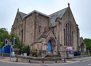
Crown is an area situated beside the city centre of Inverness, the capital city of the Scottish Highlands. In general, the area's housing dates back to the Victorian or Edwardian era.
Ballindalloch is a small village on the River Spey in Scotland.

Slioch is a mountain in the Scottish Highlands situated in Wester Ross, eight kilometres north of the village of Kinlochewe. Slioch reaches a height of 981 metres (3218 feet) and towers above the south east end of Loch Maree to give one of the best known and most photographed sights in the Highlands. VisitScotland, the Scottish national tourist agency, has used video footage of Slioch in its television advertisements.

Soay Mòr is an island in West Loch Tarbert, between the northern and southern parts of Harris. The uninhabited island is separated from the southwest coast of North Harris by the Soay Sound. The adjacent Soay Beag is accessible on foot at low tide.
Stockinish Island is an uninhabited island off Harris, in the Outer Hebrides.

Loch Coruisk is an inland fresh-water loch, lying at the foot of the Black Cuillin in the Isle of Skye, in the Scottish Highlands.

The River Truim is a right bank tributary of the River Spey in the Scottish Highlands. Its headwaters meet to the north of the Pass of Drumochter and flow northwards as the Truim past the dam at the northern end of Loch Ericht and through the village of Dalwhinnie, highest village in the Scottish Highlands. The distillery at Dalwhinnie producing Dalwhinnie Single Malt is also the highest in Scotland. The waters of its most significant tributary, the Allt Cuaich, are diverted in part along an aqueduct to Loch Ericht. The river continues north-northeastwards down Glen Truim, over the Falls of Truim and on to meet the Spey 2.5 miles (4 km) southwest of Newtonmore. It is closely followed for almost its entire length by both the A9 road and the mainline railway from Perth to Inverness.

Strathaird is a peninsula on the island of Skye, Scotland, situated between Loch Slapin and Loch Scavaig on the south coast.
Minginish is a peninsula on the Isle of Skye in Scotland. It is situated on the west coast of the island and runs from Loch Scavaig in the south, along the western coast of Skye to Loch Bracadale in the north west, to Loch Harport in the north east, and Glen Sligachan in the south east. It includes most of the peaks of the Cuillin hills including Sgurr Alasdair, the highest point on the island at 992 metres (3,255 ft). The island of Soay lies offshore across the Soay Sound, with the Small Isles further south across the Cuillin Sound.

Bearreraig Waterfall is a waterfall of Scotland.

Victoria Falls is a waterfall on the southern side of Loch Maree in Wester Ross in the north-west of Scotland. It is on the Abhainn Garbhaig, a short river that flows from Loch Garbhaig to Loch Maree. The falls are within Slattadale Forest, owned by the Forestry Commission.
Falls of Glas Allt is a 50-metre (160 ft) waterfall near the head of Loch Muick, Aberdeenshire, Scotland. Queen Victoria liked to take walks here beside the stream flowing from Lochnagar down to Loch Muick. After the death of Prince Albert she had a cottage, Glas-allt-Shiel, rebuilt for her on the delta where the stream flows into the loch.

The River Druie is a right bank tributary of the River Spey in northeast Scotland. The Druie tributary, Am Beanaidh, emerges from Loch Einich and flows north through Gleann Einich. To its east, the Allt Drùidh flows northeastwards out of the Lairig Ghru. At their confluence in Rothiemurchus Forest some 4 miles (6 km) southeast of Aviemore, the Druie is born. Their combined waters flow as the River Druie beneath the Cairngorm Club Footbridge and on to meet the waters of the River Luineag immediately above the bridge carrying the B970 road over the river at Coylumbridge. The Druie flows a further 1.5 miles (2.5 km) past Inverdruie to meet the Spey at the southern end of Aviemore. The Luineag emerges from Loch Morlich within the Glenmore Forest Park and receives all the drainage from the northern slopes of Cairn Gorm.

The River Tromie is a right bank tributary of the River Spey in northeast Scotland. It emerges from the northern end of Loch an t-Seilich within the Gaick Forest and flows northwards, then northwestwards down through Glen Tromie to Bhran Cottage where it turns to the north-northeast. It is bridged by the B970 road at Tromie Bridge near Drumguish and flows a further 1.25 miles (2 km) northwest to meet the Spey near Lynchat.

The River E is a river in the Highlands of Scotland. It begins in the north-west of the Monadh Liath, to the south-east of Loch Ness. It runs in a north-westerly direction for about 10 km, before flowing into Loch Mhòr.

The Black Water is a river in the Highlands of Scotland. It begins at the confluence of the Glascarnoch River with the Abhainn Srath a' Bhàthaich, near where it is crossed by the Black Bridge, carrying the A835 road. It flows in a south-easterly direction past the village of Garve, then passing through Loch Garve and Loch na Cròic, and around Eilean nan Daraich. It flows over Rogie Falls, then past Contin, around Contin Island, before flowing into the River Conon near Moy Bridge.

Sgùrr nan Eag is a 924-metre (3,031 ft) mountain, a Munro, in the Cuillin range on the Isle of Skye in Scotland. It is the southernmost Munro on the Cuillin ridge and it lies between Loch Brittle to the west and the Scavaig River, the outlet from Loch Coruisk, to the east.


