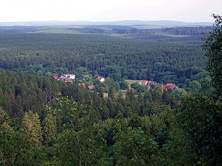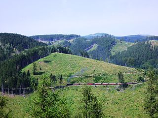
Ilsenburg is a town in the district of Harz, in Saxony-Anhalt in Germany. It is situated under the north foot of the Harz Mountains, at the entrance to the Ilse valley with its little river, the Ilse, a tributary of the Oker, about six 6 miles (9.7 km) north-west of the town of Wernigerode. It received town privileges in 1959. Owing to its surrounding of forests and mountains as well as its position on the edge of the Harz National Park, Ilsenburg is a popular tourist resort. Since 2002, it is officially an air spa.

Benneckenstein is a town in the district of Harz, in Saxony-Anhalt, Germany. Since 1 January 2010, it has been part of the town of Oberharz am Brocken. Benneckenstein is in the eastern Harz, 14 km southeast of Braunlage, and 24 km south of Wernigerode.

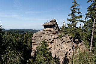
The Wolfsklippen, also called the Wolfsklippe, is a granite mountain in the Harz mountains in Central Germany with an observation platform on the summit. Its height is frequently given as about 723 m above sea level (NN), but occasionally also as only around 710 m above NN.

The Stapenberg is a 443-metre-high (1,453 ft) hill spur in the Harz Mountains of central Germany in Harz district in the federal state of Saxony-Anhalt.

The Ottofels, named after Prince Otto of Stolberg-Wernigerode, is a tor and natural monument near Wernigerode in the Harz mountains of central Germany.

Drei Annen Hohne is the name of a small settlement within the municipal area of Wernigerode in Saxony-Anhalt, Germany.

Trautenstein is a village in the borough of Oberharz am Brocken in the district of Harz in the German state of Saxony-Anhalt. Trautenstein has 493 inhabitants (1-1-2010).

The Renneckenberg is a mountain, roughly 933 metres (3,061 ft) high, in the High Harz part of the Harz mountain range of central Germany within the borough of Wernigerode in the state of Saxony-Anhalt.

The Bremen Hut in the Harz Mountains is a refuge hut and shelter in that part of the Harz National Park lying within the borough of Ilsenburg (Harz) in Harz district in the German state of Saxony-Anhalt.

The Scharfenstein is a mountain, 697.6 m above sea level (NN) high, in the Harz Mountains of Germany, near Ilsenburg in the district of Harz in Saxony-Anhalt. It is part of the Harz National Park.
The Ahrensklint or Ahrentsklint in the Harz Mountains is a granite rock formation, 822.4 m above sea level (NN), on the Erdbeerkopf in Harz district in the German state of Saxony-Anhalt.

The Ackeburg, also called the Ackenburg, in the Harz Mountains of central Germany, is the site of a high medieval hill castle, 333.2 m above sea level (NN), in the borough of Falkenstein/Harz in Harz district in the state of Saxony-Anhalt. It was first mentioned in 1216 and was abandoned or destroyed in 1400. There was also a village associated with it, known as Akkeburg.

The Barenberg, also called the Bärenberg or Bärenkopf, is a mountain, 695.5 m above sea level (NN), in the Harz Mountains of Germany near the village of Schierke, Harz county, in the state of Saxony-Anhalt.

The Kapitelsberg in the Harz Mountains of Germany is a hill, 535.7 m above sea level (NN), near the village of Tanne in the county of Harz, Saxony-Anhalt.
The Wilhelmsblick in the Harz Mountains of central Germany is a viewing point near the village of Treseburg in the Bode Gorge in the county of Harz, Saxony-Anhalt. From this single point, four different stretches of the River Bode may be seen as it swings in great loops around the spur on which the viewing point is located.

The Elversstein in the Harz Mountains of Germany is a granite rock formation with a maximum elevation of 499 m above sea level (NN) on the Steinberg near Hasserode in the county of Harz in Saxony-Anhalt.
The Drei-Länder-Stein is a boundary stone at the tripoint of the German federal states of Lower Saxony, Saxony-Anhalt and Thuringia near the Großer Ehrenberg mountain in the Harz.

The Ölbergshöhe in the Harz Mountains of central Germany is a mountain spur, 320.6 m, of the Ramberg ridge near Bad Suderode in the Saxony-Anhalt county of Harz.

The Stierbergsteich in the Harz Mountains of central Germany is a storage pond near Rothesütte on the boundary of the counties of Harz (Saxony-Anhalt) and Nordhausen (Thuringia).

The Sandlünz is a hill in the Harz Mountains of Germany. It is 516.2 m above sea level (NN) and located near Netzkater in the county of Nordhausen in the state of Thuringia.


