Thuringia, officially the Free State of Thuringia, is a state of central Germany, covering 16,171 square kilometres (6,244 sq mi), the sixth smallest of the sixteen German states. It has a population of about 2.1 million.
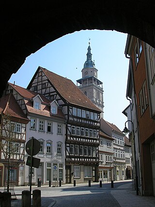
Bad Langensalza is a spa town of 17,500 inhabitants in the Unstrut-Hainich district, Thuringia, central Germany.

Naumburg is a town in the district Burgenlandkreis, in the state of Saxony-Anhalt, Central Germany. It has a population of around 33,000. The Naumburg Cathedral became a UNESCO World Heritage Site in 2018. This UNESCO designation recognizes the processes that shaped the European continent during the High Middle Ages between 1000 and 1300: Christianization, the so-called "Landesausbau" and the dynamics of cultural exchange and transfer characteristic for this very period.

Pforta, or Schulpforta, is a school located in Pforta monastery, a former Cistercian monastery (1137–1540), near Naumburg on the Saale River in the German state of Saxony-Anhalt.
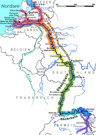
Between Bingen and Bonn, Germany, the river Rhine flows as the Middle Rhine through the Rhine Gorge, a formation created by erosion, which happened at about the same rate as an uplift in the region, leaving the river at about its original level, and the surrounding lands raised. This gorge is quite deep, about 130 metres (430 ft) from the top of the rocks down to the average water-line.

Freyburg is a town in the Burgenlandkreis district, in Saxony-Anhalt, Germany. It is situated on the river Unstrut, 9 km northwest of Hanseatic Naumburg, 63 km from Leipzig and 231 km from Berlin. It is part of the Verwaltungsgemeinschaft Unstruttal. On 1 July 2009 it absorbed the former municipalities Pödelist, Schleberoda, Weischütz and Zeuchfeld. Freyburg consists of the Ortsteile (divisions) Dobichau, Freyburg, Nißmitz, Pödelist, Schleberoda, Weischütz, Zeuchfeld and Zscheiplitz.

Naumburg Cathedral, located in Naumburg, Germany, is the former cathedral of the Bishopric of Naumburg-Zeitz. The church building, most of which dates back to the 13th century, is a renowned landmark of the German late Romanesque and was recognised as a UNESCO World Heritage Site in 2018. The west choir with the famous donor portrait statues of the twelve cathedral founders (Stifterfiguren) and the Lettner, works of the Naumburg Master, is one of the most significant early Gothic monuments.
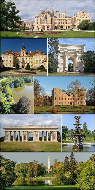
The Lednice–Valtice Cultural Landscape is a cultural-natural landscape complex of 283.09 square kilometres (109.30 sq mi) in the South Moravian Region of the Czech Republic. It comprises the municipalities of Lednice, Valtice and Hlohovec, and the rural area of Břeclav.
Ebersroda is a village and a former municipality in the Burgenlandkreis district, in Saxony-Anhalt, Germany. Since 1 July 2009, it is part of the municipality Gleina.
Zeuchfeld is a village and a former municipality in the Burgenlandkreis district, in Saxony-Anhalt, Germany. Since 1 July 2009, it is part of the town Freyburg.
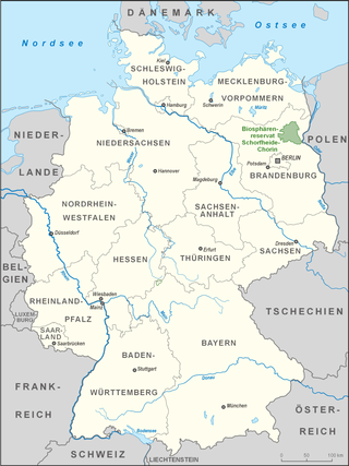
The Wendland is a region in Germany on the borders of the present states of Brandenburg, Mecklenburg-Western Pomerania, Lower Saxony and Saxony-Anhalt. Its heart is the Hanoverian Wendland in the county of Lüchow-Dannenberg in Lower Saxony.

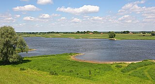
The Naumburg Cathedral and the High Medieval Cultural Landscape of the Rivers Saale and Unstrut is situated in the state of Saxony-Anhalt, Germany. Naumburg Cathedral and the surrounding cultural landscape were proposed by Germany as a World Heritage Site. On July 1, 2018, only Naumburg Cathedral was designated by UNESCO as a World Heritage Site. This article discusses the cathedral and its cultural landscape based on the submissions in 1998 (cathedral) and 2005.
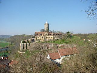
Schönburg Castle, is in the municipality of Schönburg, Saxony-Anhalt, Germany. It has been proposed by Germany as a World Heritage Site.
Goseck, a monastery built on the foundations of a castle, as well as the vineyard of Dechantenberg is located in the municipality of Goseck of Saxony-Anhalt in Germany. It has been proposed by Germany for inscription in the List of World Heritage. The World Heritage nomination Naumburg Cathedral and the High Medieval Cultural Landscape of the Rivers Saale and Unstrut is a representative of the processes that shaped the continent during the High Middle Ages between 1000 and 1300: Christianization, the so-called "Landesausbau" and the dynamics of cultural exchange and transfer characteristic for this very period.
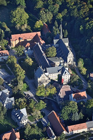
The Pforta monastery is a former Cistercian monastery located near Naumburg in Saxony-Anhalt, Germany. It was established in the 1130s and prospered in the Middle Ages. In the course of the Reformation the monastery was disbanded in 1540. Today the buildings are used by the school Landesschule Pforta. The site is located on the tourist route Romanesque Road and has been nominated by Germany for inclusion in the UNESCO list of World Heritage Sites.
The village of Großwilsdorf and the Rödel Plateau are situated in Saxony-Anhalt in the middle of Germany. It has been proposed by Germany as a World Heritage Site. The World Heritage nomination Naumburg Cathedral and the High Medieval Cultural Landscape of the Rivers Saale and Unstrut is representative for the processes that shaped the continent during the High Middle Ages between 1000 and 1300: Christianization, the so-called Landesausbau and the dynamics of cultural exchange and transfer characteristic for this very period.
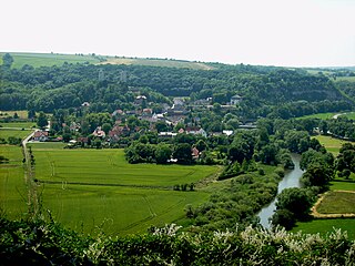
Saaleck is a village in the former municipality of Bad Kösen, since 2010 part of the town of Naumburg in the district of Burgenlandkreis in the German state of Saxony-Anhalt.

Kleinjena is situated 4 kilometres north of Naumburg on a long spur at the foot of the Finne mountain range above the village of Kleinjena, at the heart of Federal Republic of Germany in the State of Saxony-Anhalt. It has been proposed by Germany for inscription in the List of World Heritage. The World Heritage nomination is representative for the processes that shaped the continent during the High Middle Ages between 1000 and 1300: Christianization, the so-called "Landesausbau" and the dynamics of cultural exchange and transfer characteristic for this very period.
The village of Flemmingen is one of the eleven components of the cultural landscape Naumburg Cathedral and the High Medieval Cultural Landscape of the Rivers Saale and Unstrut that has been proposed by the Federal Republic of Germany for inscription in the List of World Heritage. The World Heritage nomination is representative for the processes that shaped the continent during the High Middle Ages between 1000 and 1300: Christianization, the so-called “Landesausbau” and the dynamics of cultural exchange and transfer characteristic for this very period.