Schlieben (Amt)

Last updated

Schlieben is an Amt ("municipal federation") in the district of Elbe-Elster, in Brandenburg, Germany. Its seat is in Schlieben.

Elbe-Elster is a Kreis (district) in the southern part of Brandenburg, Germany. Neighboring districts are Teltow-Fläming, Dahme-Spreewald, Oberspreewald-Lausitz, Meißen, Nordsachsen and Wittenberg. The district has a partnership with the Märkischer Kreis.

Brandenburg State in Germany

Brandenburg is a state of Germany.

Germany Federal parliamentary republic in central-western Europe

Germany, officially the Federal Republic of Germany is a country in Central and Western Europe, lying between the Baltic and North Seas to the north and the Alps, Lake Constance and the High Rhine to the south. It borders Denmark to the north, Poland and the Czech Republic to the east, Austria and Switzerland to the south, France to the southwest, and Luxembourg, Belgium and the Netherlands to the west.

The Amt Schlieben consists of the following municipalities:

  1. Fichtwald
  2. Hohenbucko
  3. Kremitzaue
  4. Lebusa
  5. Schlieben

Demography

Census in Germany Wikimedia list article

A national census in Germany was held every five years from 1875 to 1910. After the World Wars, only a few full population censuses have been held, the last in 1987. The most recent census, though not a national census, was the 2011 European Union census.


Amt Schlieben: Population development
within the current boundaries (2017) [1]
YearPop.±% p.a.
1875 6,874    
1890 6,746−0.13%
1910 6,470−0.21%
1925 6,489+0.02%
1933 6,470−0.04%
1939 6,200−0.71%
1946 9,812+6.78%
1950 9,957+0.37%
1964 8,434−1.18%
1971 8,330−0.18%
1981 7,658−0.84%
1985 7,545−0.37%
1989 7,288−0.86%
1990 7,193−1.30%
YearPop.±% p.a.
1991 7,125−0.95%
1992 7,107−0.25%
1993 7,217+1.55%
1994 7,202−0.21%
1995 7,164−0.53%
1996 7,110−0.75%
1997 7,131+0.30%
1998 7,116−0.21%
1999 6,790−4.58%
2000 6,743−0.69%
2001 6,637−1.57%
2002 6,616−0.32%
2003 6,507−1.65%
2004 6,413−1.44%
YearPop.±% p.a.
2005 6,292−1.89%
2006 6,104−2.99%
2007 6,030−1.21%
2008 5,946−1.39%
2009 5,854−1.55%
2010 5,779−1.28%
2011 5,651−2.21%
2012 5,609−0.74%
2013 5,531−1.39%
2014 5,458−1.32%
2015 5,369−1.63%
2016 5,303−1.23%
2017 5,242−1.15%
2018 5,239−0.06%
  1. Detailed data sources are to be found in the Wikimedia Commons.Population Projection Brandenburg at Wikimedia Commons

Coordinates: 51°45′00″N13°25′01″E / 51.750°N 13.417°E / 51.750; 13.417

Geographic coordinate system Coordinate system

A geographic coordinate system is a coordinate system that enables every location on Earth to be specified by a set of numbers, letters or symbols. The coordinates are often chosen such that one of the numbers represents a vertical position and two or three of the numbers represent a horizontal position; alternatively, a geographic position may be expressed in a combined three-dimensional Cartesian vector. A common choice of coordinates is latitude, longitude and elevation. To specify a location on a plane requires a map projection.


Related Research Articles

Barnim is a district in Brandenburg, Germany. It is bounded by Poland, the district of Märkisch-Oderland, the city state of Berlin and the districts of Oberhavel and Uckermark.

Lieberose/Oberspreewald is an Amt in the district of Dahme-Spreewald, in Brandenburg, Germany. Its seat is in the town Lieberose.

Schenkenländchen is an Amt in the district of Dahme-Spreewald, in Brandenburg, Germany. Its seat is in the town Teupitz.

Biesenthal-Barnim is an Amt in the district of Barnim, in Brandenburg, Germany. Its seat is in the town Biesenthal.

Joachimsthal (Schorfheide) is an Amt in the district of Barnim, in Brandenburg, Germany. Its seat is in the town of Joachimsthal in the Schorfheide region.

Unterspreewald is an Amt in the district of Dahme-Spreewald, in Brandenburg, Germany. Its seat is in the town Golßen.

Elsterland is an Amt in the district of Elbe-Elster, in Brandenburg, Germany. Its seat is in Schönborn.

Amt Kleine Elster (Niederlausitz)

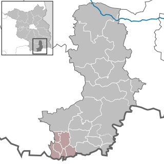
Kleine Elster (Niederlausitz) is an Amt in the district of Elbe-Elster, in Brandenburg, Germany. Its seat is in Massen-Niederlausitz.

Plessa is an Amt in the district of Elbe-Elster, in Brandenburg, Germany. Its seat is in Plessa.

Falkenberg-Höhe

Falkenberg-Höhe is an Amt in the district of Märkisch-Oderland, in Brandenburg, Germany. Its seat is in Falkenberg.

Lebus is an Amt in the district of Märkisch-Oderland, in Brandenburg, Germany. Its seat is in Lebus.

Ortrand (Amt) Collective municipality in Brandenburg state, Germany

Ortrand is an Amt in the district of Oberspreewald-Lausitz, in Brandenburg, Germany. Its seat is in Ortrand.

Altdöbern (Amt) collective municipality in Brandenburg state, Germany

Altdöbern is an Amt in the district of Oberspreewald-Lausitz, in Brandenburg, Germany. Its seat is in Altdöbern.

Ruhland (Amt) collective municipality in Brandenburg state, Germany

Ruhland is an Amt in the district of Oberspreewald-Lausitz, in Brandenburg, Germany. Its seat is in Ruhland.

Odervorland is an Amt in the district of Oder-Spree, in Brandenburg, Germany. Its seat is in Briesen.

Schlaubetal (Amt) collective municipality in Brandenburg state, Germany

Schlaubetal is an Amt in the district of Oder-Spree, in Brandenburg, Germany. Its seat is in Müllrose.

Peitz (Amt) collective municipality in Brandenburg state, Germany

Peitz is an Amt in the district of Spree-Neiße, in Brandenburg, Germany. Its seat is in Peitz.

Burg (Spreewald) is an Amt in the district of Spree-Neiße, in Brandenburg, Germany. Its seat is in Burg (Spreewald).

Dahme/Mark is an Amt in the district of Teltow-Fläming, in Brandenburg, Germany. Its seat is in Dahme.

Britz-Chorin-Oderberg collective municipality in Brandenburg state, Germany

Britz-Chorin-Oderberg is an Amt in the district of Barnim, in Brandenburg, Germany. Its seat is in the town Britz. It was formed on 1 January 2009 by the merger of the former Ämter Britz-Chorin and Oderberg.