Spreenhagen (Amt)

Last updated

Spreenhagen is an Amt ("municipal federation") in the district of Oder-Spree, in Brandenburg, Germany. Its seat is in Spreenhagen.

Oder-Spree is a Kreis (district) in the eastern part of Brandenburg, Germany. Neighboring are the district Märkisch-Oderland, the district-free city Frankfurt (Oder), Poland, the districts Spree-Neiße and Dahme-Spreewald, and the Bundesland Berlin.

Brandenburg State in Germany

Brandenburg is a state of Germany.

Germany Federal parliamentary republic in central-western Europe

Germany, officially the Federal Republic of Germany is a country in Central and Western Europe, lying between the Baltic and North Seas to the north and the Alps, Lake Constance and the High Rhine to the south. It borders Denmark to the north, Poland and the Czech Republic to the east, Austria and Switzerland to the south, France to the southwest, and Luxembourg, Belgium and the Netherlands to the west.

The Amt Spreenhagen consists of the following municipalities:

  1. Gosen-Neu Zittau
  2. Rauen
  3. Spreenhagen

Demography

Nazi Germany The German state from 1933 to 1945, under the dictatorship of Adolf Hitler

Nazi Germany is the common English name for Germany between 1933 and 1945, when Adolf Hitler and his Nazi Party (NSDAP) controlled the country through a dictatorship. Under Hitler's rule, Germany was transformed into a totalitarian state where nearly all aspects of life were controlled by the government. The official name of the state was Deutsches Reich until 1943 and Großdeutsches Reich from 1943 to 1945. Nazi Germany is also known as the Third Reich, meaning "Third Realm" or "Third Empire", the first two being the Holy Roman Empire (800–1806) and the German Empire (1871–1918). The Nazi regime ended after the Allies defeated Germany in May 1945, ending World War II in Europe.

East Germany Former communist state, 1949-1990

East Germany, officially the German Democratic Republic, was a state that existed from 1949 to 1990, when the eastern portion of Germany was part of the Eastern Bloc during the Cold War. Commonly described as a communist state in English usage, it described itself as a socialist "workers' and peasants' state." It consisted of territory that was administered and occupied by Soviet forces at the end of World War II — the Soviet occupation zone of the Potsdam Agreement, bounded on the east by the Oder–Neisse line. The Soviet zone surrounded West Berlin but did not include it; as a result, West Berlin remained outside the jurisdiction of the GDR.

Census in Germany Wikimedia list article

A national census in Germany was held every five years from 1875 to 1910. After the World Wars, only a few full population censuses have been held, the last in 1987. The most recent census, though not a national census, was the 2011 European Union census.

Amt Spreenhagen: Population development
within the current boundaries (2017) [1]
YearPop.±% p.a.
1875 5,898    
1890 5,807−0.10%
1910 6,995+0.94%
1925 7,168+0.16%
1933 7,909+1.24%
1939 8,995+2.17%
1946 8,679−0.51%
1950 8,518−0.47%
1964 7,365−1.03%
1971 7,397+0.06%
1981 7,063−0.46%
1985 6,871−0.69%
1989 6,873+0.01%
1990 6,732−2.05%
YearPop.±% p.a.
1991 6,665−1.00%
1992 6,682+0.26%
1993 6,618−0.96%
1994 6,838+3.32%
1995 6,922+1.23%
1996 7,124+2.92%
1997 7,346+3.12%
1998 7,563+2.95%
1999 7,737+2.30%
2000 7,785+0.62%
2001 7,931+1.88%
2002 8,075+1.82%
2003 8,125+0.62%
2004 8,140+0.18%
YearPop.±% p.a.
2005 8,152+0.15%
2006 8,227+0.92%
2007 8,236+0.11%
2008 8,331+1.15%
2009 8,309−0.26%
2010 8,289−0.24%
2011 8,223−0.80%
2012 8,200−0.28%
2013 8,160−0.49%
2014 8,175+0.18%
2015 8,263+1.08%
2016 8,288+0.30%
2017 8,413+1.51%
2018 8,529+1.38%

Coordinates: 52°20′37″N13°52′28″E / 52.34361°N 13.87444°E / 52.34361; 13.87444

Geographic coordinate system Coordinate system

A geographic coordinate system is a coordinate system that enables every location on Earth to be specified by a set of numbers, letters or symbols. The coordinates are often chosen such that one of the numbers represents a vertical position and two or three of the numbers represent a horizontal position; alternatively, a geographic position may be expressed in a combined three-dimensional Cartesian vector. A common choice of coordinates is latitude, longitude and elevation. To specify a location on a plane requires a map projection.

Related Research Articles

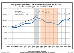
Schenkenländchen is an Amt in the district of Dahme-Spreewald, in Brandenburg, Germany. Its seat is in the town Teupitz.

Biesenthal-Barnim is an Amt in the district of Barnim, in Brandenburg, Germany. Its seat is in the town Biesenthal.

Joachimsthal (Schorfheide) is an Amt in the district of Barnim, in Brandenburg, Germany. Its seat is in the town of Joachimsthal in the Schorfheide region.

Rhinow is an Amt in the district of Havelland, in Brandenburg, Germany. Its seat is in Rhinow.

Barnim-Oderbruch

Barnim-Oderbruch is an Amt in the district of Märkisch-Oderland, in Brandenburg, Germany. Its seat is in Wriezen, itself not part of the Amt.

Seelow-Land is an Amt in the district of Märkisch-Oderland, in Brandenburg, Germany. Its seat is in Seelow, itself not part of the Amt.

Falkenberg-Höhe

Falkenberg-Höhe is an Amt in the district of Märkisch-Oderland, in Brandenburg, Germany. Its seat is in Falkenberg.

Ortrand (Amt) Collective municipality in Brandenburg state, Germany

Ortrand is an Amt in the district of Oberspreewald-Lausitz, in Brandenburg, Germany. Its seat is in Ortrand.

Neuzelle is an Amt in the district of Oder-Spree, in Brandenburg, Germany. Its seat is in Neuzelle.

Odervorland is an Amt in the district of Oder-Spree, in Brandenburg, Germany. Its seat is in Briesen.

Temnitz is an Amt in the district of Ostprignitz-Ruppin, in Brandenburg, Germany. Its seat is in Walsleben.

Lindow (Mark) is an Amt in the district of Ostprignitz-Ruppin, in Brandenburg, Germany. Its seat is in Lindow.

Neustadt (Dosse) is an amt in the district of Ostprignitz-Ruppin, in Brandenburg, Germany. Its seat is Neustadt (Dosse).

Beetzsee is an Amt in the district of Potsdam-Mittelmark, in Brandenburg, Germany. Its seat is in Beetzsee.

Niemegk is an Amt in the district of Potsdam-Mittelmark, in Brandenburg, Germany. Its seat is in Niemegk.

Wusterwitz is an Amt in the district of Potsdam-Mittelmark, in Brandenburg, Germany. Its seat is in Wusterwitz.

Ziesar is an Amt in the district of Potsdam-Mittelmark, in Brandenburg, Germany. Its seat is in Ziesar.

Bad Wilsnack/Weisen

Bad Wilsnack/Weisen is an Amt in the district of Prignitz, in Brandenburg, Germany. Its seat is in Bad Wilsnack.

Dahme/Mark is an Amt in the district of Teltow-Fläming, in Brandenburg, Germany. Its seat is in Dahme.

Britz-Chorin-Oderberg collective municipality in Brandenburg state, Germany

Britz-Chorin-Oderberg is an Amt in the district of Barnim, in Brandenburg, Germany. Its seat is in the town Britz. It was formed on 1 January 2009 by the merger of the former Ämter Britz-Chorin and Oderberg.

References

  1. Detailed data sources are to be found in the Wikimedia Commons.Population Projection Brandenburg at Wikimedia Commons