Gosen-Neu Zittau

Last updated
Gosen-Neu Zittau
Location of Gosen-Neu Zittau within Oder-Spree district
Gosen-Neu Zittau in LOS.PNGBriesenFriedlandGrünheideStorkowVogelsangWoltersdorf
Germany adm location map.svg
Red pog.svg
Gosen-Neu Zittau
Brandenburg location map.svg
Red pog.svg
Gosen-Neu Zittau
Coordinates: 52°23′36″N13°42′46″E / 52.39333°N 13.71278°E / 52.39333; 13.71278
Country Germany
State Brandenburg
District Oder-Spree
Municipal assoc. Spreenhagen
Subdivisions4 districts
Government
   Mayor (202429) Frank Nakoinz [1]
Area
  Total15.07 km2 (5.82 sq mi)
Elevation
37 m (121 ft)
Population
 (2022-12-31) [2]
  Total3,388
  Density220/km2 (580/sq mi)
Time zone UTC+01:00 (CET)
  Summer (DST) UTC+02:00 (CEST)
Postal codes
15537
Dialling codes 03362
Vehicle registration LOS
Website www.amt-spreenhagen.de

Gosen-Neu Zittau is a municipality in the Oder-Spree district, in Brandenburg, Germany. Neu Zittau is situated in the Spree valley, near the Oder-Spree-Canal.

Contents

Geography

Neighbouring places

Division of the town

Demography

Development of population since 1875 within the current boundaries (Blue line: Population; Dotted line: Comparison to population development of Brandenburg state; Grey background: Time of Nazi rule; Red background: Time of communist rule) Bevolkerungsentwicklung Gosen-Neu Zittau.pdf
Development of population since 1875 within the current boundaries (Blue line: Population; Dotted line: Comparison to population development of Brandenburg state; Grey background: Time of Nazi rule; Red background: Time of communist rule)
Gosen-Neu Zittau: Population development
within the current boundaries (2013) [3]
YearPop.±% p.a.
1875 1,672    
1890 1,573−0.41%
1910 2,109+1.48%
1925 2,279+0.52%
1933 2,667+1.98%
1939 2,851+1.12%
1946 3,074+1.08%
1950 2,873−1.68%
1964 2,522−0.93%
1971 2,536+0.08%
1981 2,311−0.92%
1985 2,203−1.19%
1989 2,192−0.13%
1990 2,123−3.15%
1991 2,100−1.08%
1992 2,133+1.57%
1993 2,093−1.88%
1994 2,095+0.10%
1995 2,106+0.53%
1996 2,217+5.27%
YearPop.±% p.a.
1997 2,366+6.72%
1998 2,480+4.82%
1999 2,502+0.89%
2000 2,455−1.88%
2001 2,543+3.58%
2002 2,634+3.58%
2003 2,688+2.05%
2004 2,726+1.41%
2005 2,731+0.18%
2006 2,764+1.21%
2007 2,797+1.19%
2008 2,880+2.97%
2009 2,888+0.28%
2010 2,900+0.42%
2011 3,020+4.14%
2012 2,991−0.96%
2013 3,002+0.37%
2014 2,970−1.07%
2015 3,055+2.86%
2016 3,072+0.56%

Related Research Articles

Dahme-Spreewald is a district in Brandenburg, Germany. It is bounded by the districts of Oder-Spree, Spree-Neiße, Oberspreewald-Lausitz, Elbe-Elster and Teltow-Fläming, and by the city of Berlin.

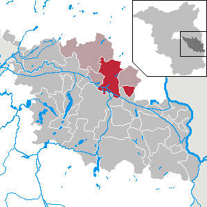
Oder-Spree is a Kreis (district) in the eastern part of Brandenburg, Germany. Neighboring are the district Märkisch-Oderland, the district-free city Frankfurt (Oder), Poland, the districts Spree-Neiße and Dahme-Spreewald, and the Bundesland Berlin.

Gosen may refer to:

<span class="mw-page-title-main">Briesen (Mark)</span> Municipality in Brandenburg, Germany

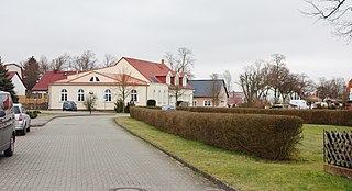
Briesen (Mark) is a village and a municipality in the Oder-Spree district, Brandenburg, Germany. It is situated east of the capital Berlin, between the towns Fürstenwalde and Frankfurt an der Oder. Briesen was first mentioned in 1403.

<span class="mw-page-title-main">Fürstenwalde</span> Town in Brandenburg, Germany

Fürstenwalde/Spree is the most populous town in the Oder-Spree District of Brandenburg, in eastern Germany.

<span class="mw-page-title-main">Erkner</span> Town in Brandenburg, Germany

Erkner is a town in the Oder-Spree District of Brandenburg, Germany, located on the south-eastern edge of the German capital city Berlin.

<span class="mw-page-title-main">Schöneiche</span> Municipality in Brandenburg, Germany

Schöneiche is a municipality in the Oder-Spree District of Brandenburg, Germany. It is situated directly at the edge to Berlin/Friedrichshagen and next to Rüdersdorf and Woltersdorf, Brandenburg on the eastern edge of the German capital Berlin.

<span class="mw-page-title-main">Storkow, Brandenburg</span> Town in Brandenburg, Germany

Storkow (Mark) is a town in Oder-Spree district, in Brandenburg, Germany.

<span class="mw-page-title-main">Dahme (river)</span> River in Germany

The Dahme is a river that flows through the German states of Brandenburg and Berlin. It is a left bank tributary of the River Spree and is approximately 95 kilometres (59 mi) long.

<span class="mw-page-title-main">Bad Saarow</span> Spa town in Brandenburg, Germany

Bad Saarow is a municipality in the Oder-Spree district, in Brandenburg, Germany.

<span class="mw-page-title-main">Berkenbrück</span> Municipality in Brandenburg, Germany

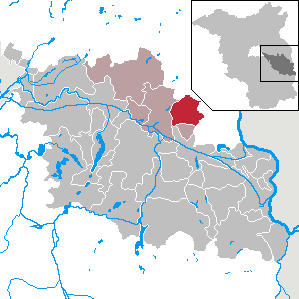
Berkenbrück is a municipality in the Oder-Spree district, in Brandenburg, Germany.

<span class="mw-page-title-main">Grünheide (Mark)</span> Municipality in Brandenburg, Germany

Grünheide (Mark) is a municipality in the Oder-Spree District, in Brandenburg, Germany. It is situated 30 kilometres south-east of Berlin city centre, on the River Löcknitz. In 2020 Tesla, Inc. began to build Gigafactory Berlin-Brandenburg in Grünheide near the Autobahn A10.

<span class="mw-page-title-main">Jacobsdorf</span> Municipality in Brandenburg, Germany

Jacobsdorf is a municipality in the Oder-Spree district, in Brandenburg, Germany.

Amt Spreenhagen is an Amt in the district of Oder-Spree, in Brandenburg, Germany. Its seat is in Spreenhagen.

<span class="mw-page-title-main">Dämeritzsee</span>

The Dämeritzsee is a lake located in Brandenburg and Berlin, Germany. At an elevation of 32 metres (105 ft), its surface area is 93.5 hectares. It is located partly in the municipality of Erkner and part in Rahnsdorf, a Berliner locality in Treptow-Köpenick district.

<span class="mw-page-title-main">Müggelheim</span> Quarter of Berlin in Germany

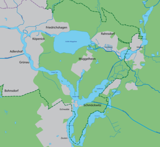
Müggelheim is a German locality (Ortsteil) within the Berlin borough (Bezirk) of Treptow-Köpenick. Until 2001 it was part of the former borough of Köpenick.

<span class="mw-page-title-main">Schmöckwitz</span> Quarter of Berlin in Germany

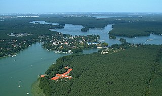
Schmöckwitz is a German locality (Ortsteil) within the Berlin borough (Bezirk) of Treptow-Köpenick. Until 2001 it was part of the former borough of Köpenick.

<span class="mw-page-title-main">Rahnsdorf</span> Quarter of Berlin in Germany

Rahnsdorf is a locality (Ortsteil) of Berlin, Germany, located in the southeast of the Berlin borough (Bezirk) of Treptow-Köpenick. Until 2001 it was part of the former borough of Köpenick.

<span class="mw-page-title-main">Gosen Canal</span>

The Gosen Canal is a canal in the eastern suburbs of Berlin, the capital city of Germany. It takes its name from the village Gosen, at the southern end of the canal. It is 4 kilometres (2.5 mi) in length and links the Dämeritzsee and Seddinsee lakes. The Dämeritzsee and Seddinsee are both navigable, with the Seddinsee providing a link to the River Dahme and the Oder-Spree Canal, and the Dämeritzsee providing a link to the Müggelspree reach of the River Spree and to the Flakensee.

<span class="mw-page-title-main">Berlin/Brandenburg Metropolitan Region</span> Place in Germany

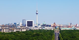
The Berlin/Brandenburg metropolitan region or capital region is one of eleven metropolitan regions of Germany, consisting of the entire territories of the state of Berlin and the surrounding state of Brandenburg. The region covers an area of 30,545 square kilometres (11,793 sq mi) with a total population of about 6.2 million.

References

  1. Landkreis Oder-Spree Wahl der Bürgermeisterin / des Bürgermeisters. Retrieved 10 July 2024.
  2. "Bevölkerungsentwicklung und Bevölkerungsstandim Land Brandenburg Dezember 2022" (PDF). Amt für Statistik Berlin-Brandenburg (in German). June 2023.
  3. Detailed data sources are to be found in the Wikimedia Commons.Population Projection Brandenburg at Wikimedia Commons