
The Albula Pass is a Swiss mountain pass in the canton of Graubünden. It lies at the heart of the Albula Alps, on the watershed between the Albula, tributary of the Rhine and the Ova d'Alvra, tributary of the Inn. Overlooking the pass are the ranges of Piz Üertsch (north) and Crasta Mora (south).
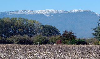
Le Crêt de la Neige is the highest peak in the Jura Mountains and the department of Ain in France. Its elevation is 1720 m above sea level. Its prominence is 1260 m. It is located in the commune of Thoiry.
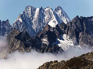
The Lauteraarhorn is a peak of the Bernese Alps, located in the canton of Bern. Together with the higher Schreckhorn, to which it is connected by a high ridge, it lies between the valleys of the Lower Grindelwald Glacier and the Unteraar Glacier, about 10 kilometres southeast of Grindelwald, the closest locality. The Lauteraarhorn belongs to the Aaremassif and is surrounded by large glaciers: the Lauteraargletscher and the Strahlegg-Gletscher and the Obers Ischmeer. Being off the main ridge of the Bernese Alps, all the glaciers surrounding the Lauteraarhorn and the Schreckhorn are part of the Aare basin. The Lauteraarhorn is the second highest summit lying wholly within the canton of Bern. Administratively, it is split between the municipalities of Grindelwald and Guttannen.

The Chasseral is a mountain of the Jura Mountains, overlooking Lake Biel in the Swiss canton of Bern. With an elevation of 1,606 metres above sea level, the Chasseral is the highest summit in the canton of Bern outside the Alps. It is also both the northernmost and easternmost mountain reaching over 1,500 metres in the Jura Mountains. West of the summit is located the Chasseral Ouest, where runs the border with the canton of Neuchâtel. The Chasseral Pass is located further on the west.

The Irchel is an elevation in the Canton of Zürich, located at the Rhine between the Töss and Thur rivers, on the territory of Buch am Irchel, Berg am Irchel and Freienstein-Teufen, separating the Andelfingen and Bülach districts. It is an outlying ridge of the Jura, rising to 694 m, lying east of the Lägern. Historically, it was part of the Germanic Limes. The name is from a Helvetic word for "stag".
The Pointe d'Orny is a mountain of the Mont Blanc massif, located west of Orsières in the canton of Valais. It lies north-east of the Plateau du Trient.

The Tour Noir is a mountain in the Mont Blanc massif on the Swiss-French border. It is located between the Aiguille d'Argentière and Mont Dolent.
Le Génépi is a mountain of the Swiss Mont Blanc massif, located west of Champex in the canton of Valais. It is the culminating point of the group lying north of the Fenêtre d'Arpette.
La Breya is a mountain of the Mont Blanc massif, overlooking Champex in the canton of Valais. It is accessible by chair lift from Champex, the upper station being located at Grands Plans. From there a trail leads to its summit.
The Grande Lui is a mountain of the Mont Blanc massif, located west of La Fouly in the canton of Valais. It lies east of the Aiguille de l'A Neuve, on the range between the glaciers of Saleina and L'A Neuve.

The Grand Darray is a mountain of the Mont Blanc massif, located north of La Fouly in the canton of Valais. It lies on the range east of the Aiguille de l'A Neuve, between the Saleina Glacier and the main Ferret valley.
Le Catogne is a mountain on the extreme north-eastern edge of the Mont Blanc massif, overlooking Champex in the Swiss canton of Valais. Some sources consider this summit as being within the Pennine Alps.
The Fil Spadla is a mountain of the Silvretta Alps, located north of Scuol in the canton of Graubünden, Switzerland. It has two secondary summits: the western summit and the eastern summit.
The Tita Neire is a mountain of the Mont Blanc massif, located west of La Fouly in the canton of Valais.
The Grande Pointe des Planereuses is a mountain of the Mont Blanc massif, located west of Praz de Fort in the canton of Valais, Switzerland. It lies on the range south of the Saleina Glacier.
The Aiguille de l'A Neuve is a mountain of the Mont Blanc massif, located on the border between Switzerland and France. It lies close to the Tour Noir to the south.

Le Châtelet is a mountain of the Swiss Mont Blanc massif, overlooking Orsières in the canton of Valais. It lies between the valleys of Orny and Saleina.

Le Soliat is a mountain of the Jura, overlooking Lake Neuchâtel in western Switzerland. The main summit is located within the canton of Neuchâtel. A secondary summit is located within the canton of Vaud.
Mont Racine is a peak in the Jura Mountains, located between La Sagne and Les Geneveys-sur-Coffrane in the canton of Neuchâtel.
Mont Vully is a hill of the Swiss Plateau, located between Lake Morat and Lake Neuchâtel in the canton of Fribourg, east of the border with the canton of Vaud.

