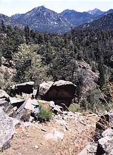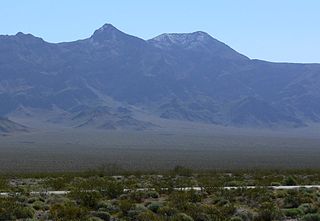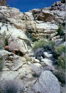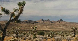
The Great Basin Desert is part of the Great Basin between the Sierra Nevada and the Wasatch Range. The desert is a geographical region that largely overlaps the Great Basin shrub steppe defined by the World Wildlife Fund, and the Central Basin and Range ecoregion defined by the U.S. Environmental Protection Agency and United States Geological Survey. It is a temperate desert with hot, dry summers and snowy winters. The desert spans a large part of the state of Nevada, and extends into western Utah, eastern California, and Idaho. The desert is one of the four biologically defined deserts in North America, in addition to the Mojave, Sonoran, and Chihuahuan Deserts.

Walker Pass is a mountain pass by Lake Isabella in the southern Sierra Nevada. It is located in northeastern Kern County, approximately 53 mi (85 km) ENE of Bakersfield and 10 mi (16 km) WNW of Ridgecrest. The pass provides a route between the Kern River Valley and San Joaquin Valley on the west, and the Mojave Desert on the east.

The Owens Peak Wilderness is a 73,767-acre (298.52 km2) wilderness area comprising the rugged eastern face of the Sierra Nevada Mountains. Owens Peak (8,445 ft) is the high point. The land was set aside with the passage of the California Desert Protection Act of 1994 by the US Congress.

The Bristol Mountains are found in the Mojave Desert of California, USA, just west of Mojave National Preserve. The range, which reaches an elevation of 3,874 feet, is located in San Bernardino County, and crosses Interstate 40 between Ludlow and the Granite Mountains. At the southern end of the range lies the town of Amboy, the Amboy Crater, and Bristol Dry Lake.

The Sheep Hole Mountains are a mountain range in the Mojave Desert, to the north of Joshua Tree National Park, in San Bernardino County, California. The mountains were once Chemehuevi hunting grounds.

The Whipple Mountains are located in eastern San Bernardino County, California. They are directly west of the Colorado River, Parker Dam, and Lake Havasu; south of Needles, California; north of Parker, Arizona and Vidal, California; and northeast of Vidal Junction, California.

The Nopah Range is a mountain range located in Inyo County, California, United States, near the eastern border with Nevada.

The Resting Spring Range is found in the eastern Mojave Desert of California near the Nevada state line in the United States. The range lies in a generally north–south direction to the west of the Nopah Range and southeast of the Amargosa Range and Greenwater Range.

The Newberry Mountains of California are located southeast of Barstow in the Mojave Desert, in San Bernardino County, California. The Rodman Mountains lie to the southeast of the range, while the Ord Mountains lie to the southwest.

The Jawbone–Butterbredt Area of Critical Environmental Concern (ACEC), is located in the Mojave Desert and Southern Sierra Nevada, northwest of California City and California State Route 14, in Kern County, California.

Old Woman Mountains Wilderness is a wilderness area in the Old Woman Mountains of the eastern Mojave Desert. It is located south of Essex in San Bernardino County, California.
The Kern Plateau salamander is a species of salamander in the family Plethodontidae, endemic to California, in Tulare and Inyo, and Kern Counties in the western United States.

Bright Star Wilderness is a 8,190-acre (3,314 ha) wilderness area in Kern County in the U.S. state of California.

The Kiavah Wilderness is a federally designated wilderness area located in the Mojave Desert, Scodie Mountains, and southern Sierra Nevada in Kern County, California, United States. California State Route 178 connects the town of Lake Isabella to State Highway 14 in the east, crossing Walker Pass at the north boundary of the wilderness.

The Piper Mountain Wilderness is a federally designated wilderness area located in the White Mountains 20 miles (32 km) northeast of Big Pine, California in Inyo County, California.

The Sylvania Mountains Wilderness is a federally designated wilderness area located 30 miles (48 km) east of Bishop in the state of California. The wilderness is 18,677acres in size and is managed by the Bureau of Land Management (BLM). The California Desert Protection Act of 1994 created the Sylvania Mountains Wilderness and was added to the National Wilderness Preservation System. The wilderness is bordered by Nevada stateline on the east, Piper Mountain Wilderness on the west and Death Valley National Park to the south.

The Deserts of California have unique ecosystems and habitats, a sociocultural and historical "Old West" collection of legends, districts, and communities, and they also form a popular tourism region of dramatic natural features and recreational development. All of the deserts are located in eastern Southern California, in the Western United States.

The Chimney Peak Wilderness is a 13,134-acre (53.15 km2) wilderness area located 20 miles (32 km) northwest of Ridgecrest, in southeastern Tulare County, California.

The Mesquite Mountains are a mountain range in eastern San Bernardino County, California, near the border with Nevada. They are north of Interstate 15 in California and southeast of Death Valley.

Castle Mountains National Monument is a U.S. National Monument located in the eastern Mojave Desert and northeastern San Bernardino County, in the state of California.


