Scoop Lake | |
---|---|
Location | Custer County, Idaho |
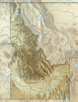
Coordinates | 44°04′24″N114°35′39″W / 44.073226°N 114.594253°W |
Type | Glacial |
Primary outflows | Little Boulder Creek to East Fork Salmon River |
Basin countries | United States |
Max. length | 842 ft (257 m) |
Max. width | 535 ft (163 m) |
Surface area | 8.2 acres (3.3 ha) |
Surface elevation | 9,649 ft (2,941 m) [1] |
Scoop Lake is an alpine lake in Custer County, Idaho, United States, located in the White Cloud Mountains in the Sawtooth National Recreation Area. The lake is accessed from Sawtooth National Forest trail 683. [2]
Scoop Lake is northwest of Merriam Peak and located in the lower section of the Boulder Chain Lakes Basin.
In 1970, Dan Pence, District Forest Ranger of Challis National Forest submitted a USDA Forest Service Form FS-7100-48 titled "Proposal of Name for an Unnamed Domestic Feature", in which it was proposed that this lake be named "Scoop Lake". [3] Under the section titled "Description and extent of feature," Pence wrote, "A glacier obviously spilled down from the lake above, scooped this lake out of solid rock in the area, and moved on to form lakes below." Under the section titled "If the name is descriptive, state why it is appropriate," Pence wrote, "For apparent glacial action forming the lake." The name was made official when the United States Board on Geographic Names approved it on January 9, 1973. [4]
The Sawtooth Wilderness is a federally-protected wilderness area that covers 217,088 acres (87,852 ha) of the state of Idaho. Managed by the U.S. Forest Service in the U.S. Department of Agriculture, it was designated the Sawtooth Primitive Area in 1937 to preserve the exceptional scenic beauty of the Sawtooth Mountains. On August 22, 1972 Public Law 92-400 designated the Primitive Area as the Sawtooth Wilderness and part of the newly created Sawtooth National Recreation Area. As part of the National Wilderness Preservation System, the Sawtooth Wilderness is an area where human development and use are restricted and people are to remain only visitors. According to the United States Environmental Protection Agency, the Sawtooth Wilderness has some of the clearest air in the lower 48 states.
Sawtooth National Forest is a National Forest that covers 2,110,408 acres in the U.S. states of Idaho and Utah. Managed by the U.S. Forest Service in the U.S. Department of Agriculture, it was originally named the Sawtooth Forest Reserve in a proclamation issued by President Theodore Roosevelt on May 29, 1905. On August 22, 1972 a portion of the forest was designated as the Sawtooth National Recreation Area (SNRA), which includes the Sawtooth, Cecil D. Andrus–White Clouds, and Hemingway–Boulders wilderness areas. The forest is managed as four units: the SNRA and the Fairfield, Ketchum, and Minidoka Ranger Districts.
Castle Peak is a mountain in the western United States, the highest peak in the White Cloud Mountains of central Idaho and the Idaho Batholith. Located in Custer County, it is the 25th highest peak in the state, and the ninth most prominent.
Baker Lake is an alpine lake in Custer County, Idaho, United States, located in the White Cloud Mountains in the Sawtooth National Recreation Area. The name is derived from the fact that the lake is adjacent to mining claims held by the Baker family for many years.
Sullivan Lake is a landslide-dammed mountain lake in Custer County, Idaho, United States, located at the northern end of the White Cloud Mountains in the Sawtooth National Recreation Area. The lake is accessed from Sawtooth National Forest trail 677 from Idaho State Highway 75.
Sliderock Lake is an alpine lake in Custer County, Idaho, United States, located in the White Cloud Mountains in the Sawtooth National Recreation Area. The lake is named for a jumbled rock slide that extends into the lake from the south side.
Shelf Lake is an alpine lake in Custer County, Idaho, United States, located in the White Cloud Mountains in the Sawtooth National Recreation Area. The lake is named for a distinct rock shelf extending around the south and west shores of the lake.
Hatchet Lake is an alpine lake in Custer County, Idaho, United States, located in the White Cloud Mountains in the Sawtooth National Recreation Area. The lake is named for its distinct hatchet shape as seen from above.
Hummock Lake is an alpine lake in Custer County, Idaho, United States, located in the White Cloud Mountains in the Sawtooth National Recreation Area. The lake is accessed from Sawtooth National Forest trail 683.
Hourglass Lake is an alpine lake in Custer County, Idaho, United States, located in the White Cloud Mountains in the Sawtooth National Recreation Area. The lake is accessed from Sawtooth National Forest trail 683.
Headwall Lake is an alpine lake in Custer County, Idaho, United States, located in the White Cloud Mountains in the Sawtooth National Recreation Area. The lake is accessed from Sawtooth National Forest trail 683.
Lonesome Lake is an alpine lake in Custer County, Idaho, United States, located in the White Cloud Mountains in the Sawtooth National Recreation Area. The lake is accessed from Sawtooth National Forest trail 683.
Scree Lake is an alpine lake in Custer County, Idaho, United States, located in the White Cloud Mountains in the Sawtooth National Recreation Area. While no trails lead to the lake, it can be accessed from Sawtooth National Forest trail 047.
Hoodoo Lake is an alpine lake in Custer County, Idaho, United States, located in the White Cloud Mountains in the Sawtooth National Recreation Area. No trails lead to the lake, but it can be accessed from Sawtooth National Forest road 666.
Chamberlain Basin is a drainage basin that contains a chain of ten alpine and glacial Paternoster lakes in Custer County, Idaho, United States, located in the White Cloud Mountains in the Sawtooth National Recreation Area. Lakes are located on the upper portion of Chamberlain Creek in the Germania Creek watershed, a tributary of the East Fork Salmon River. Castle Peak, the highest summit in the White Cloud Mountains, rises to the east and north of Chamberlain Basin. Sawtooth National Forest trail 047 crosses the basin, although most people begin their trips at the Fourth of July Creek trailhead. Individual lakes do not have official names and are listed from lowest to highest elevation.
Merriam Peak, at 10,920 feet (3,330 m) is one of the peaks of the White Cloud Mountains of Custer County, Idaho. It was named for John H. Merriam who played an instrumental role in protecting the area from being mined for molybdenum. Merriam Peak is located in the middle of the range just north of Castle Peak, the highest point in the range. The peak is located in the White Clouds roadless area of Sawtooth National Recreation Area.
D. O. Lee Peak, also known as Lee Peak, at 11,347 feet (3,459 m) above sea level, is the third-highest peak in the White Cloud Mountains of the U.S. state of Idaho. It is one of the White Cloud Peaks and the 56th-highest peak in Idaho. It was named after Challis native David Oliver Lee (1934–1982), the first United States Forest Service ranger to be assigned to the Sawtooth Wilderness.
Horton Peak at 9,896 feet (3,016 m) above sea level is a peak in the White Cloud Mountains of Idaho. The peak is located in Sawtooth National Recreation Area in Custer County. Horton Peak rises above the southeastern end of the Sawtooth Valley west of the Sawtooth Range and Idaho State Highway 75. A trail goes to the summit from the end of forest road 459 in the Sawtooth Valley.
The East Fork Salmon River is a 34-mile (55 km) tributary of the Salmon River, flowing through Custer County, Idaho in the United States. It joins the Salmon River about 3.7 miles (6.0 km) east of Clayton and 17 miles (27 km) south-southwest of Challis. The East Fork Salmon River is formed at the confluence of the West Fork East Fork Salmon River and the South Fork East Fork Salmon River between the Boulder and White Cloud mountains in Sawtooth National Recreation Area.