
Lake Ontario is one of the five Great Lakes of North America. It is bounded on the north, west, and southwest by the Canadian province of Ontario, and on the south and east by the U.S. state of New York. The Canada–United States border spans the centre of the lake.

Lake Pontchartrain is an estuary located in southeastern Louisiana in the United States. It covers an area of 630 square miles (1,600 km2) with an average depth of 12 to 14 feet. Some shipping channels are kept deeper through dredging. It is roughly oval in shape, about 40 miles (64 km) from west to east and 24 miles (39 km) from south to north.

The Thousand Islands – Frontenac Arch region or the Frontenac Axis is an exposed strip of Precambrian rock in Canada and the United States that links the Canadian Shield from Algonquin Park with the Adirondack Mountain region in New York, an extension of the Laurentian mountains of Québec. The Algonquin to Adirondacks region, which includes the Frontenac Axis or Arch, is a critical linkage for biodiversity and resilience, and one with important conservation potential. The axis separates the St. Lawrence Lowlands and the Great Lakes Lowlands. It has many distinctive plant and animal species. It is one of four ecoregions of the Mixedwood Plains.

Beckwith is a township in eastern Ontario, Canada. It is located in Lanark County on the Mississippi River. It is located within Canada's National Capital Region.

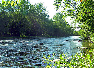
The Mississippi River is a tributary of the Ottawa River in Eastern Ontario, Canada which has no relation with the Mississippi River in the United States. It is 200 kilometres (120 mi) in length from its source at Mackavoy Lake, has a drainage area of 4,450 square kilometres (1,720 sq mi), and has a mean discharge of 40 cubic metres per second (1,400 cu ft/s). There are more than 250 lakes in the watershed.

Lanark County is a county located in the Canadian province of Ontario. Its county seat is Perth, which was first settled in 1816.

Drummond/North Elmsley is a township in eastern Ontario, Canada in Lanark County. It is situated on the north shore of the Rideau River between the town of Perth and the town of Smiths Falls. It is a predominantly rural municipality. The township offices are located in the hamlet of Port Elmsley.

Missisquoi National Wildlife Refuge is a National Wildlife Refuge located in the eastern shore of Lake Champlain in the U.S. state of Vermont. The refuge is in Franklin County in the northwest corner of the state near the International Boundary with Canada. It is the only National Wildlife Refuge located entirely in Vermont, and is administered by the United States Fish and Wildlife Service.
Cootes Paradise is a property of the Royal Botanical Gardens at the western end of Lake Ontario, and a remnant of the larger 3700 acre Dundas Marsh Crown Game Preserve established by the Province of Ontario in 1927. It is a 600 hectare environmental protection and education area, dominated by a 4.5km long rivermouth wetland, representing the lake's western terminus. It is found on the west side of Hamilton Harbour and is located in the municipality of Hamilton, Ontario, Canada.
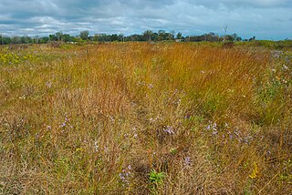
Matchedash Bay is a bay and Ramsar wetland in Simcoe County in Central Ontario, Canada. It is the "final inland extension of Severn Sound" on Lake Huron's Georgian Bay, and is "situated at the interface between the Saint Lawrence Lowlands and the Canadian Shield ". It exhibits geologically unique features at the junction of the Canadian Shield and southern Ontario limestone. Wetland habitats in Matchedash Bay are varied, and include swamps, fens, cattail marshes, wet meadows and beaver ponds. Other features include "permanent freshwater lakes; upland hardwood forest, agricultural lands, native grass meadows and a unique, coniferous wetland forest".
Westmeath Provincial Park is a provincial park on the Ottawa River in Renfrew County, Ontario, Canada. Located on the section of the river known as Bellows Bay, it features a long sandy beach and an active sandspit. It is one of the most pristine sand dune and wetland complexes along the southern Ottawa River.

A pond is a small, still, land-based body of water formed by pooling inside a depression, either naturally or artificially. A pond is smaller than a lake and there are no official criteria distinguishing the two, although defining a pond to be less than 5 hectares in area, less than 5 metres (16 ft) in depth and with less than 30% with emergent vegetation helps in distinguishing the ecology of ponds from those of lakes and wetlands. Ponds can be created by a wide variety of natural processes, or they can simply be isolated depressions filled by runoff, groundwater, or precipitation, or all three of these. They can be further divided into four zones: vegetation zone, open water, bottom mud and surface film. The size and depth of ponds often varies greatly with the time of year; many ponds are produced by spring flooding from rivers. Ponds may be freshwater or brackish in nature. 'Ponds' consisting of saltwater, with a direct connection to the sea to maintain full salinity, are normally regarded as part of the marine environment. These bodies of water do not support fresh or brackish water-based organisms, and are not considered to be ponds.
Mississippi Lake is a lake in Lanark County in Ontario, Canada. Ontario's Mississippi River flows northeast and north through the lake. Several small creeks including Cranberry Creek, McCrearys Creek, and McGibbon Creek drain into the lake from adjoining forest and agricultural land. The lake is distinctive for having one side that is part of the Canadian shield, while the other is mostly limestone. The lake is a remnant of the old Champlain Sea, which flooded eastern Ontario at the end of last ice age. The former shoreline of the sea can still be traced inland from the north shore of the lake.

White Lake is a medium-sized lake of Ontario, Canada. It is located in Renfrew County, 60 kilometres (37 mi) west of Ottawa, Ontario near Calabogie to the west and Arnprior to the north. It may be accessed via Highway 417 from Ottawa or Renfrew Country Road 511 from Perth. The town of White Lake lies on the northern shore of the lake.
The Neversink Preserve is located in Deerpark, Orange County, New York. It was created in 1993 by The Nature Conservancy. They purchased 170 acres (69 ha) of land on the Neversink River and created the Neversink Preserve in order to protect the newly discovered and federally endangered species of mussel, the dwarf wedge mussel. Over time they have purchased more land so that the Neversink Preserve covers 550 acres (220 ha). Theodore Gordon, considered the father of modern American fly-fishing, perfected his dry-fly techniques here in the 19th century. Nearly 15 million people rely on the waters of the Delaware River Basin for drinking water and industrial use, making the Neversink Preserve a top priority of The Nature Conservancy.
Chiwaukee Prairie is a 485-acre (1.96 km2) prairie in Pleasant Prairie, Wisconsin managed by the Wisconsin Department of Natural Resources. It is located on Lake Michigan at the Illinois state line and includes grassy wetlands, wooded areas, and the Kenosha Sand Dunes at its northern tip. It is home to an abundance of wildlife. It was designated a Wisconsin State Natural Area in 1967 and a National Natural Landmark in 1973.

The Burnt Lands is an alvar between Almonte and Ottawa near Upper Huntley, Ontario, Canada. It probably obtained its name from one of the forest fires that swept the area during early European settlement.
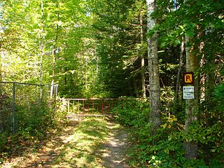
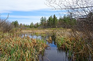
The Keddy Nature Sanctuary consists of approximately one square mile of forest and wetland on the very edge of the Canadian shield, just an hour west of Ottawa on the east side of Lanark County, in Ontario, Canada. It is mostly second growth temperate deciduous forest, interspersed with wetlands and beaver ponds, as well as sedge-dominated rock-ridges. A central ridge has more than twenty hectares of hemlock forest. There are also old fields that remain from pastures created in the previous century. Parts of this property, as well as adjoining lands, are designated as the Scotch Corners Provincially Significant Wetland. The property is one of several protected by the Mississippi Madawaska Land Trust.
The Carp Hills are a small range of rocky hills between the shallow valleys of the Carp River and Constance Creek, entirely within the West Carleton-March Ward of Canada's capital, Ottawa, Ontario. It runs roughly from Kinburn Side Road southeast to the village of Carp and the South March Highlands at March Road.

Kankakee Sands is a 10,000-acre (4,000 ha) restored tallgrass prairie in Kankakee County, Illinois and Newton County, Indiana. It is managed by The Nature Conservancy staff and volunteers. The Efroymson Restoration at Kankakee Sands is 8,400 acres (3,400 ha) of prairies and wetlands connecting Willow Slough Fish and Wildlife Area, Beaver Lake Nature Preserve, Conrad Savanna Nature Preserve and Conrad Station Savanna. This creates over 20,000 acres (8,100 ha) of dry, mesic and wet sand prairies, sand blows, sedge meadows, wetlands, and black oak savannas.
