Olympic College is a public community college in Bremerton, Washington. It opened as Olympic Junior College on September 5, 1946. Olympic College serves Kitsap and Mason counties in Washington. The college's service area contains two major naval installations: Naval Base Kitsap and Naval Hospital Bremerton.
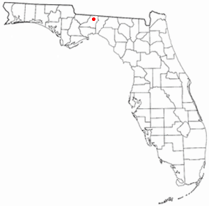
Scotland is an unincorporated community in Gadsden County, Florida, United States. It is located south of Havana at the intersection of County Roads 159 and 270.

Felkel is an unincorporated community in Leon County, Florida, United States.

Mount Lookout, Ohio is one of the Eastern neighborhoods of Cincinnati, just northwest of Linwood and overlooking the Ohio River valley. The neighborhood is named for the Mount Lookout Observatory, which moved to the neighborhood in 1873. The population was 4,814 at the 2010 census.

Chaires is an unincorporated community located just east of Tallahassee in Leon County, Florida, United States. It is located near the intersection of Chaires Cross Road and Capitola Road, northeast of Lake Lafayette and the Edwards Wildlife Area.

Mount Pleasant is an unincorporated community in Gadsden County, Florida, United States. It is located near the intersection of Veterans' Memorial Highway and Mt. Pleasant Road. Mt. Pleasant borders the city of Gretna and the St. John/Robertsville community. It also borders the city of Chattahoochee.
Wakulla Beach is an unincorporated community in Wakulla County, Florida, United States. It is located on the northern shore of Goose Creek Bay, near the Gulf of Mexico.

Port Leon, Florida was a river port town located in what is now Wakulla County, Florida, which existed for only about six years in the first half of the 19th century. Port Leon is classified as an "extinct city" by the State Library and Archives of Florida and only remnants can be found today.

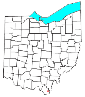
Scottown is an unincorporated community in eastern Windsor Township, Lawrence County, Ohio, United States. Although it is unincorporated, it has a post office, with the ZIP code of 45678.

Ingomar is a small unincorporated community in northwestern Rosebud County, Montana, United States, along the route of U.S. Route 12. The town was established in 1908, as a station stop on the Chicago, Milwaukee, St. Paul and Pacific Railroad, then under construction in Montana. Although the land around Ingomar attracted numerous homesteaders during the decade following the railroad's completion, the region proved to be far too arid and inhospitable for intensive agricultural use, and by the 1920s the town was in decline. The railroad through the area was abandoned in 1980, and only a handful of people remain in Ingomar today.

Beal is an unincorporated community in Vincennes Township, Knox County, Indiana.

Moseley is a former settlement in Butte County, California. It lay at an elevation of 1811 feet.
St.John and Robertsville are two unincorporated communities in Gadsden County, Florida, United States. They are located near the intersection of Old Philadelphia Road and Old Bainbridge Road. Unlike some people think, the communities are not a part of the Mount Pleasant area. They recently had a zipcode change which split the community into two zip codes, however the community considers itself a part of Quincy. They are approximately 5 miles outside of the city limits of Quincy, Florida. St. John borders the city of Gretna and the Robertsville community borders the Georgia state line, Attapulgus, Georgia, Faceville, Georgia and Chattahoochee, Florida. These two communities are usually spoken of and thought of together although they are separate and distinct. St.John is known for its former school, St.John's elementary school, the St.John/Robertsville park, the St.John volunteer fire department and most recently the St.John Church of God in Christ,. The church has been a staple in the community for over 50 years but is noted because of its new building on Old Philadelphia highway. The church was featured in the local newspaper The Gadsden County Times, because of its expansion. The church was also granted St. John Church of God in Christ day in May 2010 by then commission chair Angela Sapp. The church has launched many Christian leaders over the years. These achievements have made St.John Church of God In Christ #86 among the top 1000 black (African-American) churches. Other churches in the area include the St. John AME church. St. John AME has been a staple nearly 100 years. It has a cemetery within the community. It is also known for the McCloud’s Assisted Living Facility, which was the oldest assisted living facility in Quincy, Florida until it closed in 2006 due to health concerns of the administrator. The community has also gained notoriety for the Florida A&M research center. The center helps farmers start their own companies and hosts a farm within the community that it opens to the public during certain times of the year. It is sponsored by Tallahassee's Florida Agricultural and Mechanical University. The community is proud of its growth and achievements. St. John shares its facilities with Robertsville and other communities in Gadsden County. It also borders the city of Gretna, Florida. The communities associate themselves with the city of Quincy as their city.
St. Hebron is a small unincorporated community in Gadsden County, Florida, United States, which borders St. John, Scottown and Havana. St. Hebron, along with its neighboring communities, is located on the outside of the city limits of Quincy, between Quincy and Havana.
Pilkinton is an unincorporated community in Powhatan County, in the U.S. state of Virginia.

Hellín is a ward (barrio) of Madrid belonging to the district of San Blas-Canillejas.

Amposta is a ward (barrio) of Madrid belonging to the district of San Blas-Canillejas.
Larissa is an historic town located along Hunter Creek in Douglas County, Missouri. The GNIS classifies it as a populated place. Larissa was located on the north part of the floodplain of Hunter Creek along county road VV-210 at an elevation of 935 feet. The location is about one mile upstream (northeast) of the Crystal Springs fish hatchery.
Keota is an unincorporated community in Macon County, in the U.S. state of Missouri.


