Gretna, Florida | |
|---|---|
| City of Gretna | |
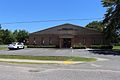
 Gretna City Hall | |
| Motto(s): "A Vision for Tomorrow" "Come Grow With Us" [1] | |
 Location in Gadsden County and the state of Florida | |
| Coordinates: 30°36′56″N84°39′45″W / 30.61556°N 84.66250°W | |
| Country | |
| State | |
| County | Gadsden |
| Settled | 1897 [2] |
| Platted | 1905 [2] |
| Incorporated | 1909 [2] [3] |
| Government | |
| • Type | Commission–Manager |
| • Mayor | Gary L. Russ Jr. |
| • Mayor Pro Tem | James Payne |
| • Commissioners | Evelyn Riley Goldwire, Jeff McNealy, and Anthony J. Baker |
| • City Manager | Antonio Jefferson |
| • City Attorney | Harold Knowles |
| Area | |
• Total | 8.61 sq mi (22.30 km2) |
| • Land | 8.56 sq mi (22.17 km2) |
| • Water | 0.05 sq mi (0.12 km2) |
| Elevation | 299 ft (91 m) |
| Population (2020) | |
• Total | 1,357 |
| • Density | 158.51/sq mi (61.20/km2) |
| Time zone | UTC-5 (Eastern (EST)) |
| • Summer (DST) | UTC-4 (EDT) |
| ZIP code | 32332 |
| Area code | 850 |
| FIPS code | 12-27650 [5] |
| GNIS feature ID | 0294791 [6] |
| Website | mygretna |
Gretna is a city in Gadsden County, Florida, United States. It is part of the Tallahassee, Florida Metropolitan Statistical Area. The majority of the population is African American, and as of the 2020 census, had 1,357 residents, down from 1,460 at the 2010 census.
Contents
- History
- Geography
- Climate
- Demographics
- 2010 and 2020 census
- 2000 census
- Government and infrastructure
- Education
- Gallery
- References
- External links
The city is on U.S. 90, approximately 8 miles (13 km) south of the Florida-Georgia border.