Bristol, Florida | |
|---|---|
 Bristol City Hall and Fire Station | |
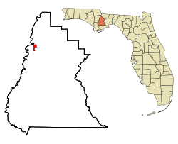 Location in Liberty County and the state of Florida | |
| Coordinates: 30°25′32″N84°58′38″W / 30.42556°N 84.97722°W | |
| Country | United States |
| State | Florida |
| County | Liberty |
| Settled | 1859 [1] |
| Incorporated | June 19, 1958 [2] [3] |
| Government | |
| • Type | Mayor-Council |
| • Mayor [3] [4] | James P. Kersey |
| • Council Chair [5] | Thomas "Tommy" Rankin |
| • Councilmembers [5] | Micah McCaskill, Tara Miller, and Council Vice Chair Mattie "Janie" Boyd |
| • City Clerk [4] | Christian "Chris" Vowell |
| • City Attorneys [4] | Dan Hartman and Joshua Pasqualone |
| Area | |
• Total | 1.64 sq mi (4.24 km2) |
| • Land | 1.64 sq mi (4.24 km2) |
| • Water | 0 sq mi (0.00 km2) |
| Elevation | 164 ft (50 m) |
| Population (2020) | |
• Total | 918 |
| • Density | 560.5/sq mi (216.41/km2) |
| Time zone | UTC-5 (Eastern (EST)) |
| • Summer (DST) | UTC-4 (EDT) |
| ZIP code | 32321 |
| Area code | 850 |
| FIPS code | 12-08600 [8] |
| GNIS feature ID | 2403928 [7] |
| Website | www |
Bristol is a city in and the county seat of Liberty County, Florida, United States. It is the only incorporated city in Liberty County. [9] The population was 918 at the 2020 census.


