St. John, Florida

Last updated

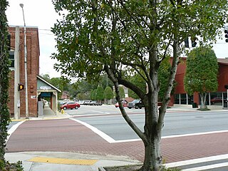
St.John and Robertsville are two unincorporated communities in Gadsden County, Florida, United States. They are located near the intersection of Old Philadelphia Road and Old Bainbridge Road. Unlike some people think, the communities are not a part of the Mount Pleasant area. They recently had a zipcode change which split the community into two zip codes, however the community considers itself a part of Quincy. They are approximately 5 miles outside of the city limits of Quincy, Florida. St. John borders the city of Gretna and the Robertsville community borders the Georgia state line, Attapulgus, Georgia, Faceville, Georgia and Chattahoochee, Florida. These two communities are usually spoken of and thought of together although they are separate and distinct. St.John is known for its former school, St.John's elementary school, the St.John/Robertsville park, the St.John volunteer fire department and most recently the St.John Church of God in Christ,. [1] The church has been a staple in the community for over 50 years but is noted because of its new building on Old Philadelphia highway. The church was featured in the local newspaper The Gadsden County Times, [2] because of its expansion. The church was also granted St. John Church of God in Christ day in May 2010 by then commission chair Angela Sapp. The church has launched many Christian leaders over the years. These achievements have made St.John Church of God In Christ #86 among the top 1000 black (African-American) churches. [3] Other churches in the area include the St. John AME church. St. John AME has been a staple nearly 100 years. It has a cemetery within the community. [4] It is also known for the McCloud’s Assisted Living Facility, which was the oldest assisted living facility in Quincy, Florida until it closed in 2006 due to health concerns of the administrator. The community has also gained notoriety for the Florida A&M research center. [5] The center helps farmers start their own companies and hosts a farm within the community that it opens to the public during certain times of the year. It is sponsored by Tallahassee's Florida Agricultural and Mechanical University. The community is proud of its growth and achievements. St. John shares its facilities with Robertsville (its closest neighbor) and other communities in Gadsden County. It also borders the city of Gretna, Florida. The communities associate themselves with the city of Quincy as their city.

Unincorporated area Region of land not governed by own local government

In law, an unincorporated area is a region of land that is not governed by a local municipal corporation; similarly an unincorporated community is a settlement that is not governed by its own local municipal corporation, but rather is administered as part of larger administrative divisions, such as a township, parish, borough, county, city, canton, state, province or country. Occasionally, municipalities dissolve or disincorporate, which may happen if they become fiscally insolvent, and services become the responsibility of a higher administration. Widespread unincorporated communities and areas are a distinguishing feature of the United States and Canada. In most other countries of the world, there are either no unincorporated areas at all, or these are very rare; typically remote, outlying, sparsely populated or uninhabited areas.

Gadsden County, Florida County in Florida, United States

Gadsden County is a county located in the panhandle of the U.S. state of Florida. As of the 2010 census, the population was 46,389. Its county seat is Quincy.

Florida State of the United States of America

Florida is the southernmost contiguous state in the United States. The state is bordered to the west by the Gulf of Mexico, to the northwest by Alabama, to the north by Georgia, to the east by the Atlantic Ocean, and to the south by the Straits of Florida. Florida is the 22nd-most extensive, the 3rd-most populous, and the 8th-most densely populated of the U.S. states. Jacksonville is the most populous municipality in the state and the largest city by area in the contiguous United States. The Miami metropolitan area is Florida's most populous urban area. Tallahassee is the state's capital.

Contents

Geography

St.John is located at 30°39′26″N84°41′28″W / 30.65722°N 84.69111°W / 30.65722; -84.69111 Coordinates: 30°39′26″N84°41′28″W / 30.65722°N 84.69111°W / 30.65722; -84.69111 (30.65722, -84.69111). [6] link to photo of st john elementary school

Geographic coordinate system Coordinate system

A geographic coordinate system is a coordinate system that enables every location on Earth to be specified by a set of numbers, letters or symbols. The coordinates are often chosen such that one of the numbers represents a vertical position and two or three of the numbers represent a horizontal position; alternatively, a geographic position may be expressed in a combined three-dimensional Cartesian vector. A common choice of coordinates is latitude, longitude and elevation. To specify a location on a plane requires a map projection.

Government and infrastructure

The Robertsville-St. Johns Volunteer Fire Department operates one fire station. [7]

Education


The district operated St. John Elementary School until it closed in July 2017. The former school's slogan was soaring to success and the mascot, previously a red devil was changed to a rocket, because of the mascot controversy against mascots that implied negativity. The school and district agreed to change the mascot of St. John Elementary(from a devil to a rocket) and George W. Munroe elementary(from a pirate to a parrot). They decided to continue to allow the other schools at that time to maintain their original mascots. The school colors were red and white and the school had a B grade. [8] The district chose to close St. John because of the small population. The district moved the students of St. John Elementary along with the students of Gretna Elementary to George Munroe elementary, some 5 miles away. The citizens spoke out against this but the district assured them it would save money and be better for the students to be with a larger population. [9] So far since the merger George munroe has went from an F school in 2017 to an A school in 2018. [10] No other schools are in the St. John community.

Related Research Articles

Leon County, Florida County in Florida, United States

Leon County is a county located in the Panhandle of the U.S. state of Florida. It was named after the Spanish explorer Juan Ponce de León. As of 2017 Census estimates, the population was 290,292.

Chattahoochee, Florida City in Florida, United States

Chattahoochee is a city in Gadsden County, Florida, United States. The population was 3,652 as of the 2010 census, up from 3,287 at the 2000 census. It is part of the Tallahassee, Florida Metropolitan Statistical Area. Chattahoochee sits on the banks of the Apalachicola River, and is separated by the Apalachicola and Victory bridges from neighboring Sneads, Florida, which is in Jackson County. Its local paper is the Twin City News, which covers Sneads and Chattahoochee as well as the surrounding areas. Chattahoochee has its own police force with over ten sworn officers and a police chief. Chattahoochee is a name derived from the Creek language meaning "marked rocks".

Greensboro, Florida Town in Florida, United States

Greensboro is a town in Gadsden County, Florida, United States. The population was 602 at the 2010 census.

Gretna, Florida City in Florida, United States

Gretna is a city in Gadsden County, Florida, United States. The population was 1,460 as of the 2010 census, down from 1,709 at the 2000 census. It is on U.S. 90 approximately 8 miles (13 km) south of the Florida-Georgia border.

Havana, Florida Town in Florida, United States

Havana is a town in Gadsden County, Florida, United States, and a suburb of Tallahassee. The population was 1,754 at the 2010 census. It is part of the Tallahassee Metropolitan Statistical Area.

Midway, Gadsden County, Florida City in Florida, United States

Midway is a city in Gadsden County, Florida, United States. The population was 3,004 at the 2010 census, up from 1,446 at the 2000 census. It is part of the Tallahassee, Florida Metropolitan Statistical Area.

Quincy, Florida City in Florida, United States

Quincy is a city in Gadsden County, Florida, United States. The population was 7,972 at the 2010 census, up from 6,982 at the 2000 census. It is the county seat of Gadsden County. Quincy is part of the Tallahassee, Florida Metropolitan Statistical Area.

Mount Pleasant, Florida human settlement in Florida, United States of America

Mount Pleasant is an unincorporated community in Gadsden County, Florida, United States. It is located near the intersection of Veterans' Memorial Highway and Mt. Pleasant Road. Mt. Pleasant borders the city of Gretna and the St. John/Robertsville community. It also borders the city of Chattahoochee.

The history of Tallahassee, like the history of Leon County, begins with the Native American population and its interaction with British and Spanish colonists as well as colonial Americans and fugitive slaves, as the Florida Territory moved toward statehood. Growing numbers of cotton plantations increased the settlement's population greatly. It became a city and capital in 1821.

Tallahassee Memorial HealthCare

Tallahassee Memorial HealthCare (TMH) is a private, not-for-profit community healthcare system founded in 1948. Located in Tallahassee, Florida, United States and serving a 16-county region in North Florida and South Georgia, TMH comprises a 772-bed acute care hospital, a psychiatric hospital, multiple specialty care centers, three residency programs, 22 affiliated physician practices, and partnerships with Doctors’ Memorial Hospital, UF Health, and Weems Memorial Hospital.

Innovation Park is the location of the National High Magnetic Field Laboratory, the Applied Superconductivity Center, Danfoss Turbocor and related advanced research facilities. The Leon County Research and Development Authority's Innovation Park is located near the campuses of Florida State University, Florida A&M University and Tallahassee Community College in Tallahassee, Florida.

The Quincy Municipal Airport is a public-use airport located 2 miles (3.2 km) northeast of the central business district of the city of Quincy in Gadsden County, Florida, United States. The airport is publicly owned. The nearest airline service and jet fuel is 20 miles (32 km) away at Tallahassee International Airport (KTLH). The airport appears on the western edge of the Jacksonville VFR sectional. Taxi service is limited to none at all.

Gadsden County High School

Gadsden County High School, known as East Gadsden High School (EGHS) until 2016, is a public high school in unincorporated Gadsden County, Florida, operated by Gadsden County School District. It is between Havana and Quincy, and it has a "Havana, Florida" postal address. Starting in fall 2017 it is the zoned high school of all of Gadsden County.

Gadsden County School District

Gadsden County School District (GCPS), or Gadsden County Schools (GCS), or Gadsden County Public Schools (GCPS), is a school district headquartered in the Max D. Walker School Administration Building in Quincy, Florida. It serves Gadsden County.

West Gadsden High School (WGHS) was a public secondary school in unincorporated Gadsden County, Florida, operated by Gadsden County School District. It is adjacent to the city of Greensboro, and served grades 5–12. Its building now houses West Gadsden Middle School.

Robert F. Munroe Day School

Robert F. Munroe Day School is a K-12 private school in Gadsden County, Florida. The main campus is in Mount Pleasant, an unincorporated area near Quincy, while the kindergarten campus, the Robert F. Munroe Day Kindergarten, is in Quincy proper.

Tallavana Christian School

Tallavana Christian School (TCS) is a private K–12 school Christian school in unincorporated Gadsden County, Florida, near Havana. It is a ministry of the Tallavana Church, and it is in proximity to Quincy and Tallahassee.

Greensboro High School was a public high school in Greensboro, Florida. It was a part of Gadsden County Public Schools

References

  1. http://stjohncogicquincy.org/pastor-ronald-mccloud.html
  2. http://www.gadcotimes.com/section/features
  3. http://www.blackchurchtop1000.com/
  4. https://www.findagrave.com/cemetery/2334325/saint-john-ame-church
  5. https://www.famu.edu/cesta/main/index.cfm/cooperative-extension-program/famu-farm/#my-menu
  6. "US Gazetteer files: 2010, 2000, and 1990". United States Census Bureau. 2011-02-12. Retrieved 2011-04-23.
  7. "Fire Station Locations." Gadsden County, Florida. Retrieved on April 7, 2017.
  8. https://www.schooldigger.com/go/FL/schools/0060000857/school.aspx
  9. https://www.tallahassee.com/story/sports/preps/2017/04/07/miller-gadsden-county-school-merger-good-athletics-needs-rallying-cry/100170548/
  10. {{cite web|author=anonymous|url=https://www.wtxl.com/news/gadsden-county-schools-improve-grades-in---academic-year/article_3d0c13c8-7b16-11e8-ad4e-8f4e3b625494.html