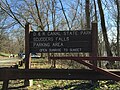
Scudders Falls (Delaware River)

Last updated
Scudders Falls
2015-04-12 15 37 36 Kayakers at Scudders Falls on the Delaware River in Ewing, New Jersey.jpg
Kayakers at Scudders Falls
Scudders Falls (Delaware River)
Location Ewing, New Jersey and Lower Makefield, Pennsylvania, United States
Coordinates 40°16′01″N74°51′10″W / 40.26694°N 74.85278°W / 40.26694; -74.85278
Elevation23 feet (7.0 m)
Total height10 feet (3.0 m)
Total width600 feet (180 m)
Watercourse Delaware River
Average
flow rate
15,000 cubic feet (420 m3)

Scudders Falls is an area of whitewater rapids on the Delaware River between Ewing, New Jersey and Lower Makefield, Pennsylvania in the United States. [1] It is popular with local whitewater enthusiasts. [2]

Contents

History

Scudders Falls derives its name from Richard Betts Scudder, who according to the Long Island Genealogy Surname Database, died in 1754 at "Scudder's Falls, Hunterdon County." (This portion of Mercer County was part of Hunterdon County until 1838.) One of Richard Scudder's ancestors from Kent, England was named Henry Skudder. The k in the surname apparently became a c at some point in time, helping to give the falls its name. [3]

The apostrophe was dropped by the United States Board on Geographic Names, which has deleted apostrophes from official geographic place names in all but five instances, hence the current name "Scudders Falls." [lower-alpha 1] [5] [6]

The falls lends its name to the Scudder Falls Bridge, located just downstream, and the Scudders Falls section of Ewing, New Jersey.

Notes

  1. Those five instances being Martha's Vineyard, Massachusetts; Carlos Elmer's Joshua View, Arizona; Clark's Mountain, Oregon; Ike's Point, New Jersey; and John E's Pond, Rhode Island. [4]

Related Research Articles

<span class="mw-page-title-main">Hunterdon County, New Jersey</span> County in New Jersey, United States

Hunterdon County is a county located in the western section of the U.S. state of New Jersey. At the 2020 census, the county was the state's 4th-least populous county, with a population of 128,947, an increase of 598 (+0.5%) from the 2010 census count of 128,349. Its county seat is Flemington. The county is part of the Central Jersey region of the state.

<span class="mw-page-title-main">New Jersey Route 12</span> State highway in Hunterdon County, New Jersey, US

Route 12 is a state highway located in Hunterdon County, New Jersey, United States. It runs 11.69 mi (18.81 km) from the Uhlerstown–Frenchtown Bridge at the Delaware River border with Pennsylvania in Frenchtown east to an intersection with U.S. Route 202 and Route 31 at the Flemington Circle in Flemington. The route is mostly a two-lane undivided road that passes through rural areas of woodland and farmland. It intersects Route 29 and County Route 513 in Frenchtown, CR 519 in Kingwood Township, CR 579 on the border of Delaware Township and Raritan Township, and CR 523 in Raritan Township.

<span class="mw-page-title-main">New Jersey Route 29</span> Highway in New Jersey

Route 29 is a state highway in the U.S. state of New Jersey. Signed north-south, it runs 34.76 mi (55.94 km) from an interchange with Interstate 295 (I-295) in Hamilton Township in Mercer County, where the road continues east as I-195, northwest to Route 12 in Frenchtown, Hunterdon County. Between the southern terminus and I-295 in Ewing Township, the route is a mix of expressway and boulevard that runs along the Delaware River through Trenton. This section includes a truck-restricted tunnel that was built along the river near historic houses and Riverview Cemetery. North of I-295, Route 29 turns into a scenic and mostly two-lane highway. North of the South Trenton Tunnel, it is designated the Delaware River Scenic Byway, a New Jersey Scenic Byway and National Scenic Byway, that follows the Delaware River in mostly rural sections of Mercer County and Hunterdon County. The obsolete Delaware & Raritan Canal usually stands between the river and the highway. Most sections of this portion of Route 29 are completely shaded due to the tree canopy. Route 29 also has a spur, Route 129, which connects Route 29 to U.S. Route 1 (US 1) in Trenton.

<span class="mw-page-title-main">New Jersey Route 31</span> Highway in New Jersey

Route 31 is a state highway in New Jersey, United States. It runs 48.93 mi (78.75 km) from Bus. US 1 / US 206 in Trenton, Mercer County, north to an intersection with US 46 in Buttzville in White Township, Warren County. Along the way, Route 31 heads through the communities of Flemington, Clinton, and Washington. Most of the highway is state-maintained; however, the section within the city limits of Trenton is maintained by the city. Much of Route 31 is a two-lane highway that passes through farmland, woodland, and mountainous areas. Two portions of the route—from Trenton to Pennington and from Ringoes to Clinton—consist of more development.

<span class="mw-page-title-main">Delaware Township, Hunterdon County, New Jersey</span> Township in Hunterdon County, New Jersey, US

Delaware Township is a township in Hunterdon County, in the U.S. state of New Jersey. Part of the township is on the Hunterdon Plateau, while the southern portions are in the Amwell Valley. As of the 2020 United States census, the township's population was 4,560, a decrease of three people (−0.1%) from the 2010 census count of 4,563, which in turn reflected an increase of 85 (+1.9%) from the 4,478 counted in the 2000 census.

<span class="mw-page-title-main">Flemington, New Jersey</span> Borough in Hunterdon County, New Jersey, US

Flemington is a borough in and the county seat of Hunterdon County, in the U.S. state of New Jersey. Most of the borough is located in the Amwell Valley, a low-lying area of the Newark Basin, and the Raritan Valley, the South Branch of the Raritan River, which flows through the center of Flemington. Northwestern portions of the borough sit on the Hunterdon Plateau. As of the 2020 United States census, the borough's population was 4,876, its highest decennial count ever and an increase of 295 (+6.4%) from the 2010 census count of 4,581, which in turn reflected an increase of 381 (+9.1%) from the 4,200 counted in the 2000 census.

<span class="mw-page-title-main">Frenchtown, New Jersey</span> Borough in Hunterdon County, New Jersey, US

Frenchtown is a borough in Hunterdon County, in the U.S. state of New Jersey. Frenchtown is located along the banks of the Delaware River on the Hunterdon Plateau, 32 miles (51 km) northwest of the state capital of Trenton. As of the 2020 United States census, the borough's population was 1,370, a decrease of three people (−0.2%) from the 2010 census count of 1,373, which in turn reflected a decline of 115 (−7.7%) from the 1,488 counted in the 2000 census.

<span class="mw-page-title-main">Holland Township, New Jersey</span> Township in Hunterdon County, New Jersey, US

Holland Township is a township in Hunterdon County, in the U.S. state of New Jersey. As of the 2020 United States census, the township's population was 5,177, a decrease of 114 (−2.2%) from the 2010 census count of 5,291, which in turn reflected an increase of 167 (+3.3%) from the 5,124 counted in the 2000 census.

<span class="mw-page-title-main">Kingwood Township, New Jersey</span> Township in Hunterdon County, New Jersey, US

Kingwood Township is a township in Hunterdon County, in the U.S. state of New Jersey, located on the Hunterdon Plateau. As of the 2020 United States census, the township's population was 3,802, a decrease of 43 (−1.1%) from the 2010 census count of 3,845, which in turn reflected an increase of 63 (+1.7%) from the 3,782 counted in the 2000 census.

<span class="mw-page-title-main">Lambertville, New Jersey</span> City in Hunterdon County, New Jersey, US

Lambertville is a city within Hunterdon County in the U.S. state of New Jersey. As of the 2020 United States census, the city's population was 4,139, an increase of 233 (+6.0%) from the 3,906 recorded at the 2010 census, which in turn reflected an increase of 38 (1.0%) from the 3,868 counted in the 2000 census.

<span class="mw-page-title-main">Milford, New Jersey</span> Borough in Hunterdon County, New Jersey, US

Milford is a borough located in western Hunterdon County, in the U.S. state of New Jersey. As of the 2020 United States census, the borough's population was 1,232, a decrease of one person (−0.1%) from the 2010 census count of 1,233, which in turn reflected an increase of 38 (+3.2%) from the 1,195 counted in the 2000 census.

<span class="mw-page-title-main">Stockton, New Jersey</span> Borough in Hunterdon County, New Jersey, US

Stockton is a borough in Hunterdon County, in the U.S. state of New Jersey. The borough sits on the Delaware River at the western end of Amwell Valley. As of the 2020 United States census, the borough's population was 495, a decrease of 43 (−8.0%) from the 2010 census count of 538, which in turn reflected a decline of 22 (−3.9%) from the 560 counted in the 2000 census.

<span class="mw-page-title-main">Ewing Township, New Jersey</span> Township in Mercer County, New Jersey, US

Ewing Township is a township in Mercer County, in the U.S. state of New Jersey. The township falls within the New York metropolitan area as defined by the U.S. Census Bureau. It borders the Philadelphia metropolitan area and is part of the Federal Communications Commission's Philadelphia Designated Market Area. As of the 2020 United States census, the township's population was 37,264, its highest decennial count ever and an increase of 1,474 (+4.1%) from the 35,790 recorded at the 2010 census, which in turn reflected an increase of 83 (+0.2%) from the 35,707 counted in the 2000 census.

<span class="mw-page-title-main">Scudder Falls Bridge</span> Bridge in Mercer County, New Jersey

The Scudder Falls Bridge is a toll bridge that carries Interstate 295 (I-295) over the Delaware River, connecting Lower Makefield Township in Bucks County, Pennsylvania, with the Scudders Falls section of Ewing Township in Mercer County, New Jersey, United States. It is maintained by the Delaware River Joint Toll Bridge Commission (DRJTBC). The original bridge was a plate girder bridge constructed from 1958 to 1961, and the current structure is a box-girder bridge that partially opened in 2019 and was substantially complete in 2021. Previously, the bridge was a toll-free crossing. However, this changed on July 14, 2019, when an all-electronic toll was levied for Pennsylvania-bound traffic; the toll can be paid using E-ZPass or Toll-by-Plate.

Byram is an unincorporated community within Kingwood Township in Hunterdon County, in the U.S. state of New Jersey.

<span class="mw-page-title-main">Interstate 295 (Delaware–Pennsylvania)</span> Interstate Highway in the US states of Delaware, New Jersey, and Pennsylvania

Interstate 295 (I-295) in Delaware, New Jersey, and Pennsylvania is an auxiliary Interstate Highway, designated as a bypass around Philadelphia, and a partial beltway of Trenton.

<span class="mw-page-title-main">Delaware River Joint Toll Bridge Commission</span>

The Delaware River Joint Toll Bridge Commission (DRJTBC) is a bistate, public agency that maintains and operates river crossings connecting the U.S. states of Pennsylvania and New Jersey. The agency's jurisdiction stretches roughly 140 miles (230 km) along the Delaware River from Philadelphia and Bucks County in southeast Pennsylvania and then north through the Lehigh Valley and to Pennsylvania-New York state border.

<span class="mw-page-title-main">Sergeantsville, New Jersey</span> Populated place in Hunterdon County, New Jersey, US

Sergeantsville is a historic unincorporated community located within Delaware Township, in Hunterdon County, in the U.S. state of New Jersey.

<span class="mw-page-title-main">Raven Rock, New Jersey</span> Populated place in Hunterdon County, New Jersey, US

Raven Rock is an unincorporated community and hamlet along the Delaware River approximately three miles (4.8 km) north of Stockton along New Jersey Route 29. The hamlet was known earlier as Saxtonville. It is located within Delaware Township in Hunterdon County, in the U.S. state of New Jersey. It is the site of Bull's Island Recreation Area. The rock outcrop for which it is named is the southwest corner of the Hunterdon Plateau.

<span class="mw-page-title-main">Geography of New Jersey</span>

New Jersey is a state within the United States of America that lies on the north eastern edge of the North American continent. It shares a land border with the state of New York along the north, ratified by both states after the New York – New Jersey Line War, which is its only straight line border.

References

  1. "Scudders Falls". Geographic Names Information System . United States Geological Survey, United States Department of the Interior.
  2. "Delaware - Scudders Falls Recreation Area". American Whitewater. Retrieved 2015-04-20.
  3. Richman, Steven M. (2003). The Bridges of New Jersey, New Brunswick: Rutgers University Press. Page 150. ISBN   0-8135-3510-7.
  4. "Gardens". QI. Season 7. Episode 1. November 26, 2009. (BBC Television)
  5. Newman, Barry (2013-05-16). "Theres a Question Mark Hanging Over the Apostrophes Future". Wall Street Journal. ISSN   0099-9660 . Retrieved 2020-12-14.
  6. "Obscure federal rule erased apostrophes from place names". Las Vegas Review-Journal. 2018-02-06. Retrieved 2020-12-14.