
Summit is a census-designated place (CDP) in Pima County, Arizona, United States. The population was 3,702 at the 2000 census.

East Palatka is a census-designated place (CDP) in Putnam County, Florida, United States. It is located on the east side of the City of Palatka at the intersection of U.S. Route 17/State Road 20/State Road 100 and the southwestern terminus of State Road 207. The population was 1,573 at the 2020 census, down from 1,654 at the 2010 census. It is part of the Palatka, Florida Micropolitan Statistical Area.

North DeLand is a census-designated place (CDP) in Volusia County, Florida, United States. The population was 1,510 at the 2020 census.

Springdale is an unincorporated community and census-designated place (CDP) located within Cherry Hill Township, in Camden County, in the U.S. state of New Jersey. As of the 2010 United States Census, the section population was 14,518.

Leisure Knoll is an unincorporated community and census-designated place (CDP) located within Manchester Township, in Ocean County, in the U.S. state of New Jersey. As of the 2010 United States Census, the CDP's population was 2,490.
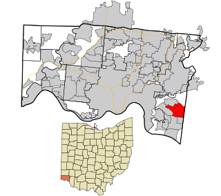
Dry Run is a census-designated place (CDP) in Anderson Township, Hamilton County, Ohio, United States. The population was 7,672 at the 2020 census.

Maplewood Park is an unincorporated community and census-designated place in southern Hubbard Township, Trumbull County, Ohio, United States. The population was 243 at the 2020 census. It is part of the Youngstown–Warren metropolitan area.

South Canal is an unincorporated community and census-designated place in western Newton Township, Trumbull County, Ohio, United States. The population was 1,101 at the 2020 census. It is part of the Youngstown–Warren metropolitan area.

Fairdale is a community and census-designated place (CDP) in Greene County, Pennsylvania, United States. The population was 2,059 at the 2010 census.
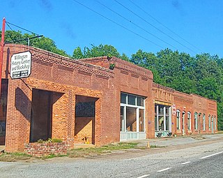
Willington is a census-designated place (CDP) in McCormick County, South Carolina, United States. The population was 177 at the 2000 census.

Loveland Park is a census-designated place (CDP) located in Symmes Township, Hamilton County and Deerfield Township, Warren County, in the southwestern part of the U.S. state of Ohio. The CDP is named after the city of Loveland. The population was 1,737 at the 2020 census.

Fort Kent is a census-designated place (CDP) that comprises the main village in the town of Fort Kent in Aroostook County, Maine, United States. In 2010, Fort Kent's population was 2,488 of 4,097 for the entire town.

Madawaska is a census-designated place (CDP) comprising the main village within the town of Madawaska in Aroostook County, Maine, United States. The population of the CDP was 2,967 at the 2010 census, out of a population of 4,035 for the entire town.
East Millinocket is a census-designated place (CDP) consisting of the main settlement in the town of East Millinocket in Penobscot County, Maine, United States. The population was 1,567 at the 2010 census.
Hampden is a census-designated place (CDP) consisting of the eastern portion of the town of Hampden in Penobscot County, Maine, United States. The population of the CDP was 4,343 at the 2010 census.
Millinocket is a census-designated place (CDP) comprising most of the developed land within the town of Millinocket in Penobscot County, Maine, United States. The population of the CDP was 4,466 at the 2010 census.
Newport is a census-designated place (CDP) consisting of the main area of settlement within the town of Newport in Penobscot County, Maine, United States. The population of the CDP was 1,776 at the 2010 census.
Orono is a census-designated place (CDP) consisting of the eastern portion of the town of Orono in Penobscot County, Maine, United States. The population of the CDP was 9,474 at the 2010 census.

Milo is a census-designated place (CDP) in the town of Milo in Piscataquis County, Maine, United States. The population was 1,898 at the 2000 census.
Pittsfield is a census-designated place (CDP) in the town of Pittsfield in Somerset County, Maine, United States. The population was 3,217 at the 2000 census.

