Unity (CDP), Maine

Last updated

Unity, Maine
CDP
Waldo County Maine Incorporated Areas Unity CDP Highlighted.png
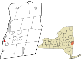
Location of Unity (in red) in Waldo County and the state of Maine
Coordinates: 44°37′8″N69°20′12″W / 44.61889°N 69.33667°W / 44.61889; -69.33667
CountryUnited States
State Maine
County Waldo
Area
[1]
  Total1.84 sq mi (4.76 km2)
  Land1.83 sq mi (4.75 km2)
  Water0.01 sq mi (0.01 km2)
Elevation
220 ft (67 m)
Population
 (2020)
  Total448
  Density244.41/sq mi (94.39/km2)
Time zone UTC-5 (Eastern (EST))
  Summer (DST) UTC-4 (EDT)
ZIP code
04988
Area code 207
FIPS code 23-78220
GNIS feature ID0577560

Unity is a census-designated place (CDP) in the town of Unity in Waldo County, Maine, United States. The population was 448 at the 2020 census.

Contents

Geography

Unity is located at 44°37′8″N69°20′12″W / 44.61889°N 69.33667°W / 44.61889; -69.33667 (44.619003, −69.336696). [2]

According to the United States Census Bureau, the CDP has a total area of 1.8 square miles (4.7 km2), all land.

Demographics

Historical population
CensusPop.Note
2020 448
U.S. Decennial Census [3]

As of the census [4] of 2000, there were 486 people, 244 households, and 112 families residing in the CDP. The population density was 267.3 inhabitants per square mile (103.2/km2). There were 319 housing units at an average density of 175.4 per square mile (67.7/km2). The racial makeup of the CDP was 96.91% White, 0.21% Black or African American, 0.82% Native American, and 2.06% from two or more races. Hispanic or Latino of any race were 1.03% of the population.

There were 244 households, out of which 23.8% had children under the age of 18 living with them, 29.9% were married couples living together, 13.1% had a female householder with no husband present, and 53.7% were non-families. 42.6% of all households were made up of individuals, and 23.4% had someone living alone who was 65 years of age or older. The average household size was 1.99 and the average family size was 2.74.

In the CDP, the population was spread out, with 21.6% under the age of 18, 15.0% from 18 to 24, 21.8% from 25 to 44, 18.9% from 45 to 64, and 22.6% who were 65 years of age or older. The median age was 36 years. For every 100 females, there were 77.4 males. For every 100 females age 18 and over, there were 78.0 males.

The median income for a household in the CDP was $18,333, and the median income for a family was $30,417. Males had a median income of $29,250 versus $23,182 for females. The per capita income for the CDP was $15,043. About 29.3% of families and 33.1% of the population were below the poverty line, including 32.4% of those under age 18 and 25.2% of those age 65 or over.

Related Research Articles

<span class="mw-page-title-main">Tsaile, Arizona</span> Census-designated place in Arizona, United States

Tsaile is a census-designated place (CDP) in Apache County, Arizona, United States, on the Navajo Nation. The population was 1,205 at the 2010 census.

<span class="mw-page-title-main">Littleton, Illinois</span> Village in Illinois, United States

Littleton is a village in Schuyler County, Illinois, United States. The population was 197 at the 2000 census.

<span class="mw-page-title-main">Ingalls Park, Illinois</span> Census-designated place in Illinois, United States

Ingalls Park is a census-designated place and suburb of Joliet in Will County, Illinois, United States. The population was 3,314 at the 2010 census. The town consists of a small neighborhood and a few businesses between Joliet's Pilcher Park and Interstate 80. It is the nearest town to Chicagoland Speedway, which hosted the NASCAR Cup Series from 2001 to 2019.

<span class="mw-page-title-main">West Chatham, Massachusetts</span> Census-designated place in Massachusetts, United States

West Chatham is a census-designated place (CDP) in the town of Chatham in Barnstable County, Massachusetts, United States. The population was 1,410 at the 2010 census.

<span class="mw-page-title-main">Hampton Manor, New York</span> CDP in New York, United States

Hampton Manor is a census-designated place in the town of East Greenbush in Rensselaer County, New York, United States. The population was 2,417 at the 2010 census.

<span class="mw-page-title-main">Drexel, Ohio</span> CDP in Ohio, United States

Drexel is a census-designated place (CDP) in Jefferson Township, Montgomery County, Ohio, United States. The population was 1,693 at the 2020 census. Informally, the Drexel designation also applies to the neighboring portion of Trotwood.

<span class="mw-page-title-main">Pleasant Grove, Ohio</span> CDP in Ohio, United States

Pleasant Grove is a census-designated place (CDP) in Muskingum County, Ohio, United States. The population was 2,016 at the 2000 census.

Newtown is a census-designated place (CDP) in Reilly Township, Schuylkill County in the U.S. state of Pennsylvania. The population was 244 at the 2000 census.

<span class="mw-page-title-main">Greenwater, Washington</span> CDP in Washington, United States

Greenwater is a census-designated place (CDP) in the northwest United States in Pierce County, Washington. Southeast of Seattle, the population was 67 at the 2010 census, down from 91 in 2000.

Alpine Northwest is a census-designated place (CDP) in Lincoln County, Wyoming, United States. The population was 244 at the 2010 census.

<span class="mw-page-title-main">Oakland (CDP), Maine</span> Census-designated place in Maine, United States

Oakland is a census-designated place (CDP) comprising the main population center in the town of Oakland in Kennebec County, Maine, United States. The population was 2,602 at the 2010 census, out of 6,240 in the entire town of Oakland.

Newport is a census-designated place (CDP) consisting of the main area of settlement within the town of Newport in Penobscot County, Maine, United States. The population of the CDP was 1,776 at the 2010 census.

<span class="mw-page-title-main">Greenville (CDP), Maine</span> CDP in Maine, United States

Greenville is a census-designated place (CDP) in the town of Greenville in Piscataquis County, Maine, United States. The population was 1,010 at the 2020 census.

<span class="mw-page-title-main">Milo (CDP), Maine</span> CDP in Maine, United States

Milo is a census-designated place (CDP) in the town of Milo in Piscataquis County, Maine, United States. The population was 1,898 at the 2000 census.

Anson is a census-designated place (CDP) in the town of Anson in Somerset County, Maine, United States. The population was 818 at the 2000 census.
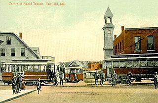
Hartland is a census-designated place (CDP) in the town of Hartland in Somerset County, Maine, United States. The population was 756 at the 2020 census.

Madison is a census-designated place (CDP) in the town of Madison in Somerset County, Maine, United States. The population was 2,533 at the 2020 census.

Norridgewock is a census-designated place (CDP) in the town of Norridgewock in Somerset County, Maine, United States. The population was 1,351 at the 2020 census.

Pittsfield is a census-designated place (CDP) in the town of Pittsfield in Somerset County, Maine, United States. The population was 3,217 at the 2000 census.

<span class="mw-page-title-main">Skowhegan (CDP), Maine</span> CDP in Maine, United States

Skowhegan is a census-designated place (CDP) in the town of Skowhegan in Somerset County, Maine, United States. The population was 6,404 at the 2020 census.

References

  1. "2020 U.S. Gazetteer Files". United States Census Bureau. Retrieved April 8, 2022.
  2. "US Gazetteer files: 2010, 2000, and 1990". United States Census Bureau. February 12, 2011. Retrieved April 23, 2011.
  3. "Census of Population and Housing". Census.gov. Retrieved June 4, 2016.
  4. "U.S. Census website". United States Census Bureau . Retrieved January 31, 2008.