The Great Dividing Range, also known as the East Australian Cordillera or the Eastern Highlands, is a cordillera system in eastern Australia consisting of an expansive collection of mountain ranges, plateaus and rolling hills. It runs roughly parallel to the east coast of Australia and forms the fifth-longest land-based mountain chain in the world, and the longest entirely within a single country. It is mainland Australia's most substantial topographic feature and serves as the definitive watershed for the river systems in eastern Australia, hence the name.
Barron Gorge National Park is a protected area in the Cairns Region, Queensland, Australia. It lies predominantly within the locality of Barron Gorge.

The Daintree National Park is located in Far North Queensland, Australia, 1,757 km (1,092 mi) northwest of Brisbane and 100 km (62 mi) northwest of Cairns. It was founded in 1981 and is part of the Wet Tropics of Queensland. In 1988, it became a World Heritage Site. The park consists of two sections—Mossman Gorge and Cape Tribulation, with a settled agricultural area between them which includes the towns of Mossman and Daintree Village.
Girramay is a national park in Queensland, Australia, 1269 km northwest of Brisbane. The national park is part of the Wet Tropics World Heritage Area.
Girringun National Park is a national park in Queensland, Australia, approximately 50 kilometres (31 mi) southwest of Ingham, 110 kilometres (68 mi) north of Townsville and 1,290 kilometres (800 mi) northwest of Brisbane. The park is one of the Wet Tropics World Heritage Area series of national parks, and is a gazetted World Heritage Site.
Moresby Range is a national park in the Cassowary Coast Region in Far North Queensland, Australia, 1,314 kilometres (816 mi) northwest of Brisbane. It is part of the Coastal Wet Tropics Important Bird Area, identified as such by BirdLife International because of its importance for the conservation of lowland tropical rainforest birds.
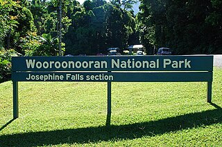
Wooroonooran National Park is a national park in Queensland, Australia, 1,367 km northwest of Brisbane, between Innisfail and Cairns.

The Burdekin River is a river in North and Far North Queensland, Australia. The river rises on the northern slopes of Boulder Mountain at Valley of Lagoons, part of the western slope of the Seaview Range, and flows into the Coral Sea at Upstart Bay over 200 kilometres (124 mi) to the southeast of the source, with a catchment area of approximately 130,000 square kilometres (50,000 sq mi). The Burdekin River is Australia's largest river by (peak) discharge volume.

The Wallaman Falls, a cascade and horsetail waterfall on the Stony Creek, is located in the UNESCO World Heritage–listed Wet Tropics in the locality of Wallaman, Shire of Hinchinbrook in the northern region of Queensland, Australia. The waterfall is notable for its main drop of 268 metres (879 ft), which makes it the country's tallest single-drop waterfall. The pool at the bottom of the waterfall is 20 metres (66 ft) deep. An estimated 100,000 people visit the waterfall annually.

The Wet Tropics of Queensland World Heritage Site consists of approximately 8,940 km2 of Australian wet tropical forests growing along the north-east Queensland portion of the Great Dividing Range. The Wet Tropics of Queensland meets all four of the criteria for natural heritage for selection as a World Heritage Site. World Heritage status was declared in 1988, and on 21 May 2007 the Wet Tropics were added to the Australian National Heritage List.

The Daintree Rainforest, also known as the Daintree, is a region on the northeastern coast of Queensland, Australia, about 105 km (65 mi), by road, north of the city of Cairns. Whilst the terms "Daintree Rainforest" and "the Daintree" are not officially defined, it is generally accepted and understood that they refer to the area from the Daintree River north to Cooktown, and from the coastline west to the Great Dividing Range. The popular tourist destination of Mossman Gorge, some 30 km (19 mi) south of the Daintree River, is often included in the definition.

The Herbert River is a river in Far North Queensland, Australia. The southernmost of Queensland's wet tropics river systems, it was named in 1864 by George Elphinstone Dalrymple explorer, after Robert George Wyndham Herbert, the first Premier of Queensland.

The Murray Falls, a cascade waterfall on the Murray River, is located in the UNESCO World Heritage–listed Wet Tropics in Murray Upper, Cassowary Coast Region in the Far North region of Queensland, Australia.

The Blencoe Falls is a segmented waterfall on the Blencoe Creek, located in Kirrama, Tablelands Region, in Far North Queensland, Australia.

The Burdekin Falls Dam, also known as the Burdekin Dam, is a concrete gravity dam with an uncontrolled spillway across the Burdekin River in the Whitsunday Region, Queensland, Australia. Built for the purpose of irrigation, the reservoir is called Lake Dalrymple, and is on the boundary of the Whitsunday Region and the Charters Towers Region. Burdekin Falls Dam is managed by SunWater. Water from the reservoir is also used to replenish downstream aquifers.
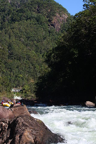
The Tully River is a river in Far North Queensland, Australia.

The Bloomfield Falls is a cascade waterfall on the Bloomfield River near Cape Tribulation, close to Wujal Wujal in Queensland, Australia. It is within the Wet Tropics of Queensland World Heritage Area.

The Tully Falls, a horsetail chute waterfall on the Tully River, is located in the UNESCO World Heritage–listed Wet Tropics in the Far North region of Queensland, Australia. It formed the eastern boundary of the Dyirbal.

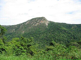
The Bellenden Ker Range, also known as the Wooroonooran Range is a coastal mountain range in Far North Queensland, Australia. Part of the Great Dividing Range it is located between Gordonvale and Babinda.

The geography of Queensland in the north-east of Australia, is varied. It includes tropical islands, sandy beaches, flat river plains that flood after monsoon rains, tracts of rough, elevated terrain, dry deserts, rich agricultural belts and densely populated urban areas.