Ben Wyvis is a mountain located in Easter Ross, north-west of Dingwall in northern Scotland. It lies in the council area of Highland, and the county of Ross and Cromarty. The mountain is prominent in views of the area, presenting a whale-back shape above the farmland of Strathconon. Geologically, the ridge is composed of Moine pelitic gneiss.
Creag Meagaidh is a mountain on the northern side of Glen Spean in the Highlands of Scotland. It is a complex mountain, taking the form of a flat summit plateau from which five ridges radiate, and is most famed for the cliffs surrounding the corrie of Coire Ardair on the north-eastern face. These crags are a renowned venue for winter and ice climbing, although being somewhat vegetated they are less suited to summer climbing.
Kampinos National Park is a National Park in east-central Poland, in Masovian Voivodeship, on the north-west outskirts of Warsaw. It has a sister park agreement with Indiana Dunes National Park, Indiana, United States.

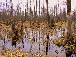
Dersingham Bog is a 159.1-hectare (393-acre) biological and geological Site of Special Scientific Interest Norfolk. It is a Nature Conservation Review site, Grade 2, a National Nature Reserve and a Ramsar site It is part of the Norfolk Coast Area of Outstanding Natural Beauty, and the Roydon Common & Dersingham Bog Special Area of Conservation Part of it is a Geological Conservation Review site.

Barnack Hills & Holes is a 23.3 hectare biological Site of Special Scientific Interest in Barnack in Cambridgeshire. It is also a national nature reserve. It is a Nature Conservation Review site, Grade I. In 2002 it was designated as a Special Area of Conservation, to protect the orchid rich grassland as part of the Natura 2000 network of sites throughout the European Union.

Park Corner Heath is a 2.9-hectare (7.2-acre) biological Site of Special Scientific Interest about 1.2 miles (2 km) south of East Hoathly, adjacent to the A22 main road between Uckfield and Eastbourne in East Sussex. It is managed by Butterfly Conservation.

Foxhole Heath is an 85.2 hectare biological Site of Special Scientific Interest east of Eriswell in Suffolk. It is a Nature Conservation Review site, Grade I, and part of Breckland Special Area of Conservation and Breckland Special Protection Area under the European Union Directive on the Conservation of Wild Birds.

The Südheide Nature Park is a large protected area of forest and heathland in the southern part of the Lüneburg Heath in North Germany. It has been designated as a protected nature park since 1964.
The Central Lüß Plateau Heathland are a nature reserve within the Südheide Nature Park with a total area of about 293 hectares. They were placed under protection in 1995 and consist of three physically separate areas of land: the Misselhorn Heath, the Schillohsberg Heath and the Weesener Weg Heathland. The region referred to as Heathland and Rough Pasture in the Südheide with an area of 278.3 hectares was also declared as Special Area of Conservation No. 277. The conservation agency responsible is the district of Celle.

North Warren RSPB reserve is a nature reserve run by the Royal Society for the Protection of Birds (RSPB) in Suffolk, England. It lies on the Suffolk coast on the north edge of the town of Aldeburgh and to the south of Thorpeness and includes the Aldringham Walks area of heathland to the north. It is within the Suffolk Coast and Heaths Area of Outstanding Natural Beauty (AONB) and the Suffolk Heritage Coast area. Noted for its populations of Eurasian bittern, European nightjar and other bird species, it covers a range of coastal habitats and is protected with SSSI, SPA conservation status.

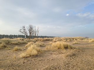
Roydon Common is a 194.9-hectare (482-acre) biological Site of Special Scientific Interest east of King's Lynn in Norfolk. It is also a Grade I Nature Conservation Review site, a National Nature Reserve and a Ramsar site. It is part of the Roydon Common and Dersingham Bog Special Area of Conservation and Roydon Common and Grimston Warren nature reserve, which is managed by the Norfolk Wildlife Trust,
Tentsmuir National Nature Reserve (NNR) is located southeast of Tayport in Fife, Scotland. The reserve is made up of three parts, encompassing Morton Lochs (56.428°N 2.873°W), Tentsmuir Point and Tayport Heath (56.439°N 2.850°W) and is managed by Scottish Natural Heritage (SNH). The adjoining Tentsmuir Forest is managed by the Forestry Commission Scotland.

Bixley Heath is a 5.1 hectare biological Site of Special Scientific Interest on the eastern outskirts of Ipswich in Suffolk. It is also a Local Nature Reserve owned and managed by Ipswich Borough Council.

The Karađorđevo hunting ground is located in the northwest Serbia, along the left Danube bank. It lies 10 km north-west of Bačka Palanka, near the village of Karađorđevo. It covers an area of 69.14 square kilometres (26.70 sq mi). The property is state-owned, and managed by an establishment of the Army of Serbia. Since its establishment as a state property of the Austro-Hungarian Empire in 1885, it has served as a representative hunting ground and resort for statesmen, high-ranking military officials and businessmen. A part of the property is protected as a special nature reserve, occupying the area of 25.53 square kilometres (9.86 sq mi).

Hertford Heath nature reserve is a 28 hectare biological Site of Special Scientific Interest in Hertford Heath in Hertfordshire. It is managed by the Herts and Middlesex Wildlife Trust and the local planning authority is East Hertfordshire District Council.

Barnham Heath is a 78.6 hectare biological Site of Special Scientific Interest near Barnham, a village south of Thetford in Suffolk. It is a Nature Conservation Review site, Grade 2, and part of the Breckland Special Protection Area under the European Union Directive on the Conservation of Wild Birds

Cavenham–Icklingham Heaths is a 419 hectare biological Site of Special Scientific Interest west of Icklingham in Suffolk. It is a Nature Conservation Review site, Grade I, and part of Breckland Special Area of Conservation and Breckland Special Protection Area under the European Union Directive on the Conservation of Wild Birds. Cavenham Heath is a 203.1 hectare National Nature Reserve.
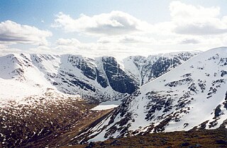
Invereshie and Inshriach is a national nature reserve on the western flank of the Cairngorms in the Highland council area, Scotland. The reserve covers habitats at a range of different altitudes, ranging from Caledonian Forest beside the River Feshie in the west, via bog and open moorland, to an arctic-alpine environment on the Cairngorm plateau. The Munro summit of Sgòr Gaoith (1118 m) lies on the eastern boundary of the reserve. The forested areas of the reserve form part of an expanse of Caledonian Forest that stretches from Glen Feshie to Abernethy, and which as a whole forms the largest single area of this habitat remaining in Scotland. The reserve is owned and managed jointly by Scottish Natural Heritage (SNH) and Forestry Commission Scotland (FCS): SNH own the Invereshie portion of the reserve and FCS the Inshriach area.