Selong | |
---|---|
Town/City | |
![]() Road sign at a market near Selong (1949) | |
Location in Indonesia | |
Coordinates: 8°39′S116°32′E / 8.650°S 116.533°E | |
Country | Indonesia |
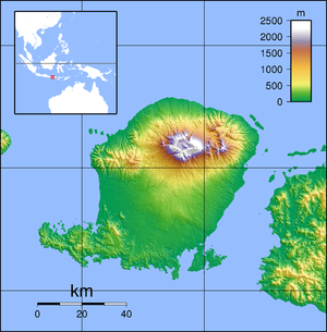
Region | Lesser Sunda Islands |
Province | West Nusa Tenggara |
Regency | East Lombok |
Area | |
• Total | 31.68 km2 (12.23 sq mi) |
Population (mid 2024 estimate) | |
• Total | 98,953 |
• Density | 3,100/km2 (8,100/sq mi) |
[1] | |
Time zone | UTC+08 |
Selong is a town and administrative district (kecamatan) on the island of Lombok which serves as the capital of the East Lombok Regency in the Indonesian province of West Nusa Tenggara. It is subdivided into the eleven urban villages (kelurahan) of Denggen, Jorong, Kelayu Selatan, Kelayu Utara, Kembang Sari, Majidi, Pancor, Rakam, Sandubaya, Sekarteja and Selong Kota, together with one rural village (desa) of Denggen Timur.
Selong has a tropical savanna climate (Aw) with little to no rainfall from April to November and heavy rainfall from December to March.
Climate data for Selong | |||||||||||||
---|---|---|---|---|---|---|---|---|---|---|---|---|---|
Month | Jan | Feb | Mar | Apr | May | Jun | Jul | Aug | Sep | Oct | Nov | Dec | Year |
Mean daily maximum °C (°F) | 29.6 (85.3) | 29.6 (85.3) | 29.9 (85.8) | 30.4 (86.7) | 30.0 (86.0) | 29.3 (84.7) | 28.9 (84.0) | 29.4 (84.9) | 30.1 (86.2) | 30.4 (86.7) | 30.1 (86.2) | 29.8 (85.6) | 29.8 (85.6) |
Daily mean °C (°F) | 25.6 (78.1) | 25.7 (78.3) | 25.7 (78.3) | 25.6 (78.1) | 25.0 (77.0) | 24.1 (75.4) | 23.6 (74.5) | 24.0 (75.2) | 24.9 (76.8) | 25.5 (77.9) | 25.8 (78.4) | 25.7 (78.3) | 25.1 (77.2) |
Mean daily minimum °C (°F) | 21.7 (71.1) | 21.8 (71.2) | 21.5 (70.7) | 20.8 (69.4) | 20.1 (68.2) | 19.0 (66.2) | 18.4 (65.1) | 18.7 (65.7) | 19.7 (67.5) | 20.6 (69.1) | 21.5 (70.7) | 21.6 (70.9) | 20.5 (68.8) |
Average rainfall mm (inches) | 254 (10.0) | 166 (6.5) | 146 (5.7) | 52 (2.0) | 36 (1.4) | 8 (0.3) | 38 (1.5) | 15 (0.6) | 5 (0.2) | 29 (1.1) | 84 (3.3) | 215 (8.5) | 1,048 (41.1) |
Source: Climate-Data.org [2] |