The French Broad River flows 218 miles (351 km) from near the town of Rosman in Transylvania County, North Carolina, into the state of Tennessee. Its confluence with the Holston River at Knoxville is the beginning of the Tennessee River. The river flows through the counties of Transylvania, Buncombe, Henderson, and Madison in North Carolina, and Cocke, Jefferson, Sevier, and Knox in Tennessee, and drains large portions of the Pisgah National Forest and the Cherokee National Forest.
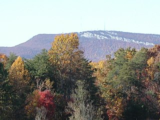
Mount Jefferson is a mountain located in Ashe County, North Carolina. The mountain is part of the Mount Jefferson State Natural Area. The mountain has an elevation of 4,665 feet (1,422 m) above sea level, and it sharply rises more than 1,600 feet above the towns of Jefferson, North Carolina and West Jefferson.

The Holston River is a 136-mile (219 km) river that flows from Kingsport, Tennessee, to Knoxville, Tennessee. Along with its three major forks, it comprises a major river system that drains much of northeastern Tennessee, southwestern Virginia, and northwestern North Carolina. The Holston's confluence with the French Broad River at Knoxville marks the beginning of the Tennessee River.

The Saluda River is a principal tributary of the Congaree River, about 200 mi (320 km) long, in northern and western South Carolina in the United States. Via the Congaree River, it is part of the watershed of the Santee River, which flows to the Atlantic Ocean.
The Pacolet River is a tributary of the Broad River, about 50 miles (80 km) long, in northwestern South Carolina in the United States. One of its principal headwaters tributaries also drains a small portion of western North Carolina. Via the Broad and Congaree Rivers, it is part of the watershed of the Santee River, which flows to the Atlantic Ocean. The stream's name has also been spelled historically as "Pacolate River". There is a Pacolet River in Polk County in Florida.
The Horsepasture River is an 18.1-mile-long (29.1 km) National Wild and Scenic river in the U.S. states of North Carolina and South Carolina. The river rises in Jackson County, North Carolina, and flows through the Jocassee Gorges area and ends at Lake Jocassee in South Carolina. Some of the land over which the river flows is part of the Pisgah National Forest, making it accessible to the public.

Waterrock Knob is a mountain peak in the U.S. state of North Carolina. It is the highest peak in the Plott Balsams and is the 16th-highest mountain in the Eastern United States.

The Sauratown Mountains,( Pronounced Sar-a -town like Laura not Sour) which are sometimes called "the mountains away from the mountains", are an isolated mountain range located within Stokes and Surry counties in the U.S. state of North Carolina. The vast majority of the range is located in Stokes County, and even though the range occupies only 5% of Stokes County's area, it dominates the county's scenery from almost every direction. The Sauras rise sharply 800 to 1,700 feet above the surrounding terrain. The Sauratown Mountains were named after the "Sauras", a Native American tribe that lived in the area before European settlers arrived in the early 1700s. The range consists of rugged, heavily forested ridges frequently broken by large quartzite rock cliffs that can be seen for miles. The Sauratown Mountains are known for offering some of the best rock climbing in North Carolina. The highest point in the Sauratown Mountains is Moore's Knob, which rises to 2,579 feet.
Feltonville is an unincorporated community in the U.S. state of North Carolina. It is located north of Holly Springs, near where North Carolina Highway 540 meets North Carolina Highway 55, south of Apex.
Ingleside is an unincorporated community in northern Franklin County, North Carolina, United States. It lies at the intersection of U.S. Route 401, and North Carolina Highway 39, north of Louisburg, at an elevation of 394 feet.

Gerton is an unincorporated community and census-designated place (CDP) in Henderson County, North Carolina, United States. As of the 2010 census it had a population of 254. It is part of the Asheville Metropolitan Statistical Area.

Monticello is an unincorporated community in Guilford County, North Carolina, United States. It is northeast of Browns Summit and east of U.S. Route 29, on North Carolina Highway 150. Its elevation is 855 feet (261 m) above sea level.

Bellemont is an unincorporated community in Alamance County, North Carolina, United States.

Linville Falls is an unincorporated community at the junction of Avery, Burke, and McDowell counties in the U.S. state of North Carolina. The community is named after Linville Falls, a nearby waterfall in the Linville Gorge Wilderness.

This is a list of the National Register of Historic Places listings in Aiken County, South Carolina.

Pleasant Grove is an unincorporated community in Alamance County, North Carolina, United States.

Sunbury is a census-designated place (CDP) and unincorporated community in Gates County, North Carolina, United States. As of the 2010 census it had a population of 289.

Snake Mountain is a mountain located along the border between North Carolina and Tennessee, east of the community of Zionville, in the southeastern United States. It is part of the Blue Ridge Mountains, and includes parts of Watauga County, North Carolina, and Johnson County, Tennessee. It has two peaks, the highest of which reaches an elevation of 5,564 feet (1,696 m). The lower peak, at 5,518 feet (1,682 m), is Johnson County's high point.
Big Butt Mountain or Big Butt are the names of five distinct mountains in Western North Carolina. Butt in this context is a corruption of butte.
Chambersburg Township is a township in Iredell County, North Carolina. The 2010 United States Census reported a total population of 11,344.


