Related Research Articles

North Korea is located in East Asia in the Northern half of Korea, partially on the Korean Peninsula. It borders three countries: China along the Yalu (Amnok) River, Russia along the Tumen River, and South Korea to the south.

Pyeongchang is a county in the province of Gangwon-do, South Korea, located in the Taebaek Mountains region. It is home to several Buddhist temples, including Woljeongsa. It is about 180 km (110 mi) east southeast of Seoul, the capital of South Korea, and connected by expressways and high-speed passenger railways. Pyeongchang's slogan, "Happy 700 Pyeongchang", is taken from its average elevation of approximately 700 metres (2,300 ft).

Mount Kumgang or the Kumgang Mountains is a mountain massif, with a 1,638-metre-high (5,374 ft) peak, in Kangwon-do, North Korea. It is located on the east coast of the country, in Mount Kumgang Tourist Region, formerly part of Kangwŏn Province, and is part of the Taebaek mountain range which runs along the east of the Korean Peninsula. The mountain is about 50 kilometres (31 mi) from the South Korean city of Sokcho in Gangwon-do.

Woraksan, or Worak Mountain, is a major mountain of the Sobaek mountain range in South Korea. Its highest peak is 1,094 m (3,589 ft) above sea level. It forms part of the boundary between North Chungcheong and North Gyeongsang provinces. Its slopes contain portions of Mungyeong city in North Gyeongsang, as well as Danyang County, Jecheon City, and Chungju City in North Chungcheong. Woraksan National Park takes up 28% of the land in Danyang County.

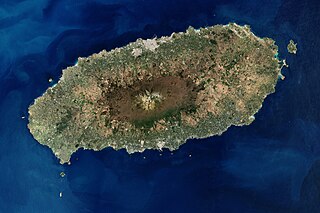
Jeju Island is South Korea's largest island, covering an area of 1,833.2 km2 (707.8 sq mi), which is 1.83% of the total area of the country. Alongside outlying islands, it is part of Jeju Province and makes up the majority of the province.

Baekdu-daegan is a traditional Korean conception of the mountains and consequently the watersheds of the Korean Peninsula. The mountain range stretches the length of the Korean Peninsula, around 1,500 km, from Baekdu Mountain in the north to Jirisan, or Hallasan on Jeju Island in the south. The mountain range is often associated with national identity and traditional Korean shamanism.

Deogyusan (Korean: 덕유산), formerly spelled Togyusan, is a mountain in South Korea. Its highest peak is 1,614 meters above sea level.

Taebaeksan, also known as Mount Taebaeksan or Mount Taebaek, is a South Korean mountain with several important peaks of the Taebaek mountain range, or the Taebaek Jeongmaek Range. It is an important mountain in the Baekdu-daegan mountain range, the point where it turns west after running along Korea's east coast for a long distance. Its territory stretches from the city of Taebaek in Yeongwol-gun County, Gangwon-do Province to Bonghwa-gun County, Gyeongsangbuk-do Province, and it was designated South Korea's 22nd national park on 22 August 2016. It has an elevation of 1,566.7 m (5,140 ft).
Hwaaksan (Korean: 화악산) is a mountain in South Korea whose area extends over Gapyeong County, Gyeonggi-do and Hwacheon County, Gangwon-do. It has an elevation of 1,468.3 m (4,817 ft).

Manisan (Korean: 마니산) is a mountain in Incheon, South Korea. It is situated in Ganghwa County and is the highest peak on Ganghwa Island. Manisan has an elevation of 469.4 m (1,540 ft). There is a popular hiking trail to the summit; at the summit is Chamseongsdan, an altar where Dangun performed ritual ceremonies.
Yongmunsan (Korean: 용문산) is a mountain in the county of Yangpyeong, Gyeonggi Province in South Korea. It has an elevation of 1,157.2 m (3,797 ft).
Ansan (Korean: 안산) is a mountain in the county of Inje, Gangwon-do in South Korea. It is in the north-western area of Seoraksan National Park. It has an elevation of 300 m (984 ft).
Balwangsan (Korean: 발왕산) is a mountain in the county of Pyeongchang, Gangwon-do in South Korea. It has an elevation of 1,458.1 m (4,784 ft).
Gariwangsan (Korean: 가리왕산) is a mountain between the counties of Jeongseon and Pyeongchang, Gangwon-do, in South Korea. It has an elevation of 1,560.6 m (5,120 ft).
Gyebangsan (Korean: 계방산) is a mountain between the counties of Hongcheon and Pyeongchang, Gangwon-do in South Korea. It has an elevation of 1,577 m (5,174 ft).
The Battle of Maehwa-San was fought for control of the hills and area around Maehwa mountain between the Hoengseong County and Wonju, between 7–12 March 1951, during the Korean War. The British Empire 27th British Commonwealth Brigade was tasked with eliminating the Chinese People's Volunteer Army (PVA) and Korean People's Army (KPA) forces occupying the area.

Chiaksan National Park is located in the province of Gangwon-do, South Korea. It was designated as the 16th national park in 1984. The park is named after the 1,288-metre (4,226 ft) mountain Chiaksan, which in turn had its name changed from Jeokakasan to Chiaksan, meaning "Pheasant Peak Mountain", based on a myth about a man who saved a pheasant from being eaten by a snake. The park is home to a total of 821 plant species and 2,364 animal species. Among the animals 34 are endangered, including the Flying squirrel and Hodgson's Bat.
The Chaplain–Medic massacre took place in the Korean War on July 16, 1950, on a mountain above the village of Tuman. South Korean local natives claim that it took place on a mountain above the village of Yongdam-ri, which is next to Duman-ri. Thirty unarmed, critically wounded United States Army (US) soldiers and an unarmed chaplain were murdered by members of the Korean People's Army (KPA) during the Battle of the Kum River.
The Hamgyong Mountains, officially known as the Gangbaekjeonggan and formerly known as the Pepi Shan or Tumen Mountains, is a North Korean mountain range. It lies in the northeast quarter of the country, extending for about 350 kilometers (220 mi) southwest and northeast parallel to the Sea of Japan. Its northern terminus is in the Tumen Valley. To its west are the Kaema Highlands.

The Mateni class (マテニ) locomotives were a class of steam tender locomotives of the Chosen Government Railway (Sentetsu) with 4-8-2 wheel arrangement. The "Mate" name came from the American naming system for steam locomotives, under which locomotives with 4-8-2 wheel arrangement were called "Mountain".
References
- An Gyeong-ho (2003). 신 한국 100 명산 ('The New' 100 Korean Mountains). Seoul: 깊은솔 (Gipeunsol). ISBN 89-89917-07-7.