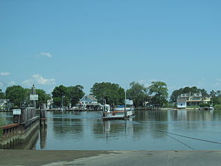
The Wicomico River is a 24.4-mile-long (39.3 km) tributary of the Chesapeake Bay on the eastern shore of Maryland. It drains an area of low marshlands and farming country in the middle Delmarva Peninsula.
Armdale is a neighbourhood of the community of Halifax, Nova Scotia, Canada.

Yafford is a hamlet on the Isle of Wight. It is located 6 miles (9.7 km) southwest from Newport in an area known as the Back of the Wight between Brighstone and Niton. It is in the civil parish of Shorwell. It has a non-operational water mill, which was working until 1970 and is now a listed building. The mill was a grist mill, working to grind corn to create animal feed; it did not have the machinery to produce fine flour for people. It has an overshot water wheel, powered by the flow of water from a millpond. The pond is fed by a stream from the nearby village of Shorwell, part of the Buddle Brook. The name Yafford derives from the Anglo-Saxon word "hæcc" meaning a hatch or sluice and the word "ford"; probably referring to grating used to stop animals being carried away by the current in a river.
Bedoń-Wieś is a village in the administrative district of Gmina Andrespol, within Łódź East County, Łódź Voivodeship, in central Poland. It lies approximately 3 kilometres (2 mi) north of Andrespol and 13 km (8 mi) east of the regional capital Łódź, and it is known for its rich history of wine making.
Aleksandrów is a village in the administrative district of Gmina Biała Rawska, within Rawa County, Łódź Voivodeship, in central Poland. It lies approximately 3 kilometres (2 mi) north-east of Biała Rawska, 19 km (12 mi) east of Rawa Mazowiecka, and 73 km (45 mi) east of the regional capital Łódź.
Zalesie is a village in the administrative district of Gmina Oksa, within Jędrzejów County, Świętokrzyskie Voivodeship, in south-central Poland. It lies approximately 12 kilometres (7 mi) south-east of Oksa, 10 km (6 mi) west of Jędrzejów, and 43 km (27 mi) south-west of the regional capital Kielce.
Skiby is a village in the administrative district of Gmina Chęciny, within Kielce County, Świętokrzyskie Voivodeship, in south-central Poland. It lies approximately 3 kilometres (2 mi) north-west of Chęciny and 15 km (9 mi) south-west of the regional capital Kielce.
Posada Jaśliska is a village in the administrative district of Gmina Jaśliska, within Krosno County, Subcarpathian Voivodeship, in south-eastern Poland, close to the border with Slovakia. It lies approximately 18 kilometres (11 mi) south-east of Dukla, 28 km (17 mi) south of Krosno, and 68 km (42 mi) south of the regional capital Rzeszów.
The Sydney International Shooting Centre in Cecil Park, New South Wales, Australia was built for the shooting events at the 2000 Summer Olympics. It has also been used for ISSF World Cup events in 2002, 2004, 2007 and the 2007 rifle and pistol events. It has hosted the Oceania Shooting Federation Championships since 1999 and is available for licensed shooters to use the facilities on a day-by-day basis.
Jurkowice is a village in the administrative district of Gmina Bogoria, within Staszów County, Świętokrzyskie Voivodeship, in south-central Poland. It lies approximately 8 kilometres (5 mi) east of Bogoria, 17 km (11 mi) north-east of Staszów, and 60 km (37 mi) south-east of the regional capital Kielce.
Kęsza is a village in the administrative district of Gmina Czersk, within Chojnice County, Pomeranian Voivodeship, in northern Poland. It lies approximately 9 kilometres (6 mi) east of Czersk, 39 km (24 mi) east of Chojnice, and 71 km (44 mi) south-west of the regional capital Gdańsk.
Nicponia is a village in the administrative district of Gmina Gniew, within Tczew County, Pomeranian Voivodeship, in northern Poland. It lies approximately 2 kilometres (1 mi) south-west of Gniew, 32 km (20 mi) south of Tczew, and 62 km (39 mi) south of the regional capital Gdańsk. It is located within the ethnocultural region of Kociewie.
Grabowo is a village in the administrative district of Gmina Lubawa, within Iława County, Warmian-Masurian Voivodeship, in northern Poland. It lies approximately 18 km (11 mi) east of Iława and 52 km (32 mi) south-west of the regional capital Olsztyn.
Matyszczyki is a village in the administrative district of Gmina Orzysz, within Pisz County, Warmian-Masurian Voivodeship, in northern Poland. It lies approximately 11 kilometres (7 mi) north-west of Orzysz, 27 km (17 mi) north of Pisz, and 88 km (55 mi) east of the regional capital Olsztyn.
Rzyszczewko is a village in the administrative district of Gmina Polanów, within Koszalin County, West Pomeranian Voivodeship, in north-western Poland. It lies approximately 10 kilometres (6 mi) north-west of Polanów, 30 km (19 mi) east of Koszalin, and 160 km (99 mi) north-east of the regional capital Szczecin.
Przyjezierze is a village in the administrative district of Gmina Borne Sulinowo, within Szczecinek County, West Pomeranian Voivodeship, in north-western Poland. It lies approximately 9 kilometres (6 mi) north-east of Borne Sulinowo, 11 km (7 mi) south-west of Szczecinek, and 137 km (85 mi) east of the regional capital Szczecin.
Valuste is a village in Lääneranna Parish, Pärnu County, in western Estonia.
Bogdanje is a village in the municipality of Trstenik, Serbia. According to the 2002 census, the village has a population of 1055 people.
Lockville is an unincorporated community in Fairfield County, in the U.S. state of Ohio.
