Ses Feixes Wetlands

Last updated
Ses Feixes Wetlands
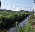
Ses Feixes Vistor Centre 2013.jpg
Plot Compuertas (Gateway)
Ses Feixes Wetlands
Location map Ibiza.png
Red pog.svg
Ses Feixes Wetlands
Location of Ses Feixes on Ibiza
Coordinates: 38°55′4″N1°27′5″E / 38.91778°N 1.45139°E / 38.91778; 1.45139
Location Ibiza, Spain

Ses Feixes is an area of wetland on the Spanish island of Ibiza. The area is on the northern side of the municipality of Ibiza town. [1]

Contents

Description

The wetland area known as Ses Feixes is situated between Ibiza Town and runs in a crescent around Ibiza bay to Talamanca. [2] These wet lowlands are an important wintering ground and resting place for many migratory birds and constitutes a key haven for wildlife. The wetlands support a great variety of fauna and flora and include rare bats, reptiles, and more than 140 species of birds. [3] The area is very important as wetlands such as these are rapidly disappearing in the Mediterranean region.

History

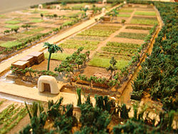
It was the Moors [2] who brought with them to Ibiza the expertise and knowledge to turn dry parched land into usable fertile agricultural land. They constructed a complicated network of cisterns, reservoirs, waterwheels and irrigation canals. These schemes which included Ses Feixes transformed the original wetland into extremely productive land, by moving vast amounts of water away. This in turn gave the moors the water supply to free up the potential of dryer tracts of land. These schemes turned both wetland and the parched ground into fertile agricultural land. At Ses Feixes . These ingenious irrigation systems transformed the original wetland into extremely productive land, farmed until the late 1950s. Once the loose marshes soil of these wetlands had been reclaimed from the sea, a mosaic of long narrow plots (feixa or field) were created by running narrow canals (séquies) [2] around the plots. These plots or strips were then crossed laterally by underground drainage culverts (Fibles). [2] These culverts kept the soil above well watered. At the entrance to each tract of land there was a distinctive gateway called a (Compuertas) [2] which also acted, in some cases, as a Hydraulic damper. The gateways were built from rendered stone and whitewashed and are reminiscent of similar structures seen in ancient Egypt and the Middle East. [2] In there prime the fields at Ses Feixes produced harvests of vegetables on a duel rotation system each year. Produce such as cabbages, potatoes, tomatoes, melons, beans and Sweet potato grew in the fields [2]

Threatened environment

In the time that this once-productive environment has lain dormant, it has become increasingly under threat from the construction and development around the northern shore line of Ibiza bay. [3] A new road was built in the 1970s, [4] which cut off some of the wetland's water outlets and fragmented the original wetland into two smaller sections of Prat de Vila and Prat de Ses Monges, and the area now has suffered from total abandonment. The island's authorities have now designated the area as a green belt and UNESCO [3] [4] has recognized the importance of the site. Despite this recognition, the area is facing a new threat from developers. The Spanish government has given the go-ahead for a new harbor development. As part of the plans, it has been suggested that a new road be built to carry the expected increase in traffic. The route of this road could put it right through the fragile wetland area.[ citation needed ]

Encouraging signs

The wetlands of Ses Feixes was made a Site of Cultural Interest (Bien de Interés Cultural) in 2006 and renewed in 2009, [4] which can be considered as a positive step for conservation, as a buffer zone of the UNESCO World Heritage property of Ibiza. [5] This will provide the area some protection but stronger measures are required to preserve the site perpetually. In November 2009 [4] the UNESCO World Heritage property of Ibiza, Biodiversity and Culture reported that the Ses Feixes areas of Prat de Vila and Prat de Ses Monges should be included in to the world heritage site as they have great value in their own right and are evidence of the ingenious Moorish system of land cultivation, but they represent the best evidence of the mixed cultural and natural values of the world heritage site. [4] The wetland system of the Ses Feixes has an important relationship with the off shore Posidonia oceanica meadows. [4]

The future

Recently some restoration work has been carried out on the ancient portals, [3] along with cleaning of the main drainage canals. [3] In the future it is hoped that an interpretation centre will be built, an event which would mark an important step in the area's preservation, if implemented. The Ibiza Preservation Fund [3] has furnish projects to raise awareness of the environmental and cultural significance of this ancient wetland.

Eight hectares of wetland were destroyed within two hours in an intentional fire on the 6th of March, 2017. [6] The current conditions of the Feixes and the future of this land are unclear

Related Research Articles

<span class="mw-page-title-main">Ibiza</span> Spanish island in the Mediterranean Sea

Ibiza is a Spanish island in the Mediterranean Sea off the eastern coast of the Iberian Peninsula. It is 150 kilometres from the city of Valencia. It is the third largest of the Balearic Islands. Its largest settlements are Ibiza Town, Santa Eulària des Riu, and Sant Antoni de Portmany. Its highest point, called Sa Talaiassa, is 475 metres above sea level.

<span class="mw-page-title-main">Douro</span> River in Spain and Portugal

The Douro is the highest-flow river of the Iberian Peninsula. It rises near Duruelo de la Sierra in the Spanish province of Soria, meanders south briefly then flows generally west through the northern part of the Meseta Central in Castile and León into northern Portugal. Its most plentiful tributary is the right-bank Esla river. At Douro's mouth at Porto, the second largest city of Portugal, the river meets the Atlantic Ocean.

<span class="mw-page-title-main">Valparaíso</span> Second largest city in Chile

Valparaíso is a major city, commune, seaport, naval base, and educational centre in the Valparaíso Region, Chile.

<span class="mw-page-title-main">Long Point, Ontario</span> Community of Norfolk County, Ontario, Canada

Long Point is a sand spit and medium-sized hamlet on the north shore of Lake Erie, part of Norfolk County in the province of Ontario, Canada.

<span class="mw-page-title-main">Ibiza (town)</span> Municipality in Balearic Islands, Spain

Ibiza is a city and municipality located on the southeast coast of the island of Ibiza in the Balearic Islands autonomous community.

<span class="mw-page-title-main">Buffer zone</span> Intermediate region, typically between belligerent entities

A buffer zone is a neutral zonal area that lies between two or more bodies of land, usually pertaining to countries. Depending on the type of buffer zone, it may serve to separate regions or conjoin them. Common types of buffer zones are demilitarized zones, border zones and certain restrictive easement zones and green belts. Such zones may be comprised by a sovereign state, forming a buffer state.

<span class="mw-page-title-main">Protected areas of New Zealand</span>

Protected areas of New Zealand are areas that are in some way protected to preserve their environmental, scientific, scenic, historical, cultural or recreational value. There are about 10,000 protected areas, covering about a third of the country. The method and aims of protection vary according to the importance of the resource and whether it is publicly or privately owned.

<span class="mw-page-title-main">Cordillera de Talamanca</span> Mountain range in Costa Rica and Panama

The Cordillera de Talamanca is a mountain range that lies in the southeast half of Costa Rica and the far west of Panama. Much of the range and the area around it is included in La Amistad International Park, which also is shared between the two countries.

<span class="mw-page-title-main">Palmeral of Elche</span>

The Palmeral or Palm Grove of Elche is the generic name for a system of date palm orchards in the city of Elche, Spain.

The Convention on the Protection of the Underwater Cultural Heritage is a treaty that was adopted on 2 November 2001 by the General Conference of the United Nations Educational, Scientific and Cultural Organization (UNESCO). The convention is intended to protect "all traces of human existence having a cultural, historical or archaeological character" which have been under water for over 100 years. This extends to the protection of shipwrecks, sunken cities, prehistoric art work, treasures that may be looted, sacrificial and burial sites, and old ports that cover the oceans' floors. The preservation of underwater cultural heritage is significant as it allows for the retelling of numerous historical events. As part of its duty to conduct scientific research and provide continuous education on the importance of underwater cultural heritage, UNESCO strives to maintain these sites for the enjoyment of current and future generations. The convention may provide a customary framework to help raise awareness and seek to combat the illegal looting and pirating occurring in waters worldwide. As an international body, member states of the convention agree to work towards the preservation of sunken cultural property within their jurisdiction and the high seas.

<span class="mw-page-title-main">Lake Letas</span> Crater lake in Gaua

Lake Letas is the largest lake in Vanuatu, located in the center of the volcanic island of Gaua of the Banks Islands in northern Vanuatu. The place submitted an application to be considered an UNESCO World Heritage Site in 2004.

<span class="mw-page-title-main">Gornje Podunavlje</span> Protected wetland area in the northwest of Serbia

Gornje Podunavlje Special Nature Reserve is a large protected area of wetland in the northwest of Serbia, on the Danube's left bank. It comprises two large marshes, Monoštorski Rit and Apatinski Rit and vast forests, meadows, ponds, swamps and the Danube's meanders, including 66 km (41 mi) of the Danube course. It is a part of the trans-boundary biosphere reserve "Mura-Drava-Danube", a five country project, dubbed the "Amazon of Europe".

<span class="mw-page-title-main">Protected areas of Albania</span>

Despite being a relatively small country, Albania is exceedingly rich in biodiversity. Its ecosystems and habitats support over 5,550 species of vascular and non-vascular plants and more than 15,600 species of coniferous and non-coniferous evergreens, most of which are threatened at global and European levels. The country has made recent efforts to expand its network of protected areas which now include: 11 national parks, 1 marine park, 718 nature monuments, 23 managed nature reserves, 11 protected landscapes, 4 World Heritage Sites, 4 Ramsar sites and other protected areas of various categories, that when combined, account for 21.36% of the territory. Furthermore, a biosphere reserve, 45 important plant areas and 16 important bird areas are found in the country.

<span class="mw-page-title-main">Jesús (Ibiza)</span> Village in Balearic Islands, Spain

Nostra Senyora de Jesús is a village on the northern side of Ibiza Bay, On the Spanish island of Ibiza, Spain. The village is in the municipality of Santa Eulària des Riu and is located on the designated road PMV 810. The village is 2.0 miles (3.2 km) North of Ibiza Town and 6.7 miles (10.8 km) of Ibiza Airport.

Biosphere reserves are established according to the UNESCO's Man and the Biosphere Programme (MAB) to promote sustainable development for conservation of biological and cultural diversity. As of 2016, the Lal Suhanra Biosphere Reserve and Ziarat Juniper Forest are the only two biosphere reserve in Pakistan, which were approved by UNESCO in 1977 and 2013 respectively. A number of initiatives and projects have been undertaken to promote and develop other biosphere reserves in Pakistan but due to weak implementation this has not yet been materialized. In July 2012, Pakistan Museum of Natural History and Beijing Museum of Natural History signed a MoU to work on trans-boundary biodiversity and to improve MAB related activities in the Karakoram, Himalaya, and Hindukush regions.

<span class="mw-page-title-main">Ría Lagartos Biosphere Reserve</span> UNESCO Biosphere Reserve in Yucatán, Mexico

Ría Lagartos Biosphere Reserve is a UNESCO Biosphere Reserve in the state of Yucatán, Mexico. The reserve is located at the eastern end of the coastal strip of the Yucatán Peninsula, with the Gulf of Mexico at its northern limit. The area encompasses coastal areas of the Gulf of Mexico and includes important wetlands designated under the Ramsar Wetlands Convention. The site presents a rich diversity of landscapes and ecosystems, such as mangroves, small estuaries, medium semi-evergreen forest, low deciduous forest, coastal dune vegetation, coastal lagoons, marshes (petenes) and savanna represented by tular vegetation, grasslands and reed beds that are the main nesting sites for marshland and sea birds.

The Museo Arqueológico de Ibiza y Formentera is an archaeological museum that preserves, researches and exhibits the remains belonging to the historical past of the islands of Ibiza and Formentera. The museum is housed on two campuses; the Archaeological museum of Dalt Vila and the Monographic museum of Puig Des Molins, both located within the Ibiza old town.
References

  1. Mapa Topografico Nacional de Espana, 798 Eivissa. 1:50.000. Published: IGN - CNIG (Spain Civilian Survey): 2006.
  2. 1 2 3 4 5 6 7 Ibiza & Formentera’s Heritage, A Non-clubber’s Guide. Author: Paul R Davis Pub:Barbary Press, 2009, ISBN   978-84-612-2908-6
  3. 1 2 3 4 5 6 Ibiza Preservation Fund Archived 2012-05-14 at the Wayback Machine
  4. 1 2 3 4 5 6 UNESCO World Heritage report Archived 2011-06-17 at the Wayback Machine
  5. World Heritage Ibiza
  6. Ibiza, Diario de. "El incendio de ses Feixes arrasó ocho hectáreas de humedal en sólo dos horas" . Retrieved 2017-03-23.