This article is about the Transport in Zambia.

The Zambezi Region is one of Namibia's fourteen regions, situated in the north-eastern part of the country along the Zambezi River where it gets its name from. The region's capital is the town of Katima Mulilo. The Katima Mulilo Airport is 18 kilometres south-west of the town, while the village of Bukalo is located 43 kilometres south-east of Katima Mulilo. Formerly known as the Caprivi Region until 2013, it has eight electoral constituencies and a population of 142,373 according to the 2023 census.
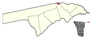
Katima Mulilo Urban is a constituency in Namibia's Zambezi Region. Its administrative centre is the region's capital, Katima Mulilo. The Katima Mulilo Airport is located 18 kilometres south-west of the town. The constituency has a population of 46,401 people, covers an area of 44.94 km², and has a population density of 1,033/km².

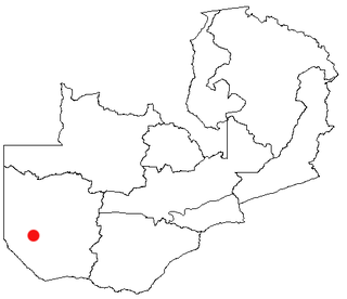
Western Province is one of the 10 provinces in Zambia and encompasses most of the area formerly known as Barotseland. The capital is Mongu, and together with the neighbouring town of Limulunga, Mongu is treated as the capital of Barotseland.

Livingstone is a city in Zambia. Until 1935, it served as the capital of Northern Rhodesia. Lying 10 km (6 mi) to the north of the Zambezi River, it is a tourism attraction center for the Victoria Falls and a border town with road and rail connections to Zimbabwe on the other side of the Victoria Falls. A historic British colonial city, its present population was enumerated at 177,393 inhabitants at the 2022 census. It is named after David Livingstone, the Scottish explorer and missionary who was the first European to explore the area. Until 2011, Livingstone was the provincial capital of Zambia's Southern Province.

Katima Mulilo or simply Katima is the capital of the Zambezi Region in Namibia. It had 46,401 inhabitants in 2023, and comprises two electoral constituencies, Katima Mulilo Rural and Katima Mulilo Urban. It is located on the B8 national road on the banks of the Zambezi River in the Caprivi Strip in lush riverine vegetation with tropical birds and monkeys. The town receives annual average rainfall of 654 millimetres (25.7 in).
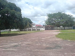
Mongu is the capital of Western Province in Zambia and was the capital of the formerly-named province and historic state of Barotseland. Its population is 179,585, and it is also the headquarters of Mongu District. Mongu is the home of the Litunga, King of the Lozi people.

Sesheke is a border town in the Western Province of Zambia, in a district of the same name. It lies on the northern bank of the Zambezi River which forms the border with Namibia's Caprivi Strip at that point.

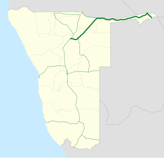
The Walvis Bay-Ndola-Lubumbashi Development Road, formerly known as the Trans-Caprivi Corridor and until 2004 the Trans-Caprivi Highway, begins in Walvis Bay. It runs through Rundu in northeastern Namibia and along the Caprivi Strip to Katima Mulilo on the Zambezi River, which forms the border between Namibia and Zambia. The Katima Mulilo Bridge spans the river to the Zambian town of Sesheke. From there, the road continues as the M10 Road to Livingstone, where it connects to the main north–south highway to Lusaka and extends to the Copperbelt.
Senanga is the capital of the Senanga District, which is located in the Western Province of Zambia. The town is situated on the eastern bank of the Zambezi River, at the southern end of the Barotse Floodplain. It lies on the main road running parallel to the river from Livingstone and Sesheke to Mongu. Recently the Kaunga Lyeti Bridge was completed to cross the Kaunga Lyeti River near the junction to Sioma, traveling from Sesheke and Katima Mulilo. On top of the bridgework, recent road projects have improved travel conditions and inspired economic confidence and growth.
The Katima Mulilo Bridge carries the TransCaprivi Highway over the Zambezi River between Katima Mulilo, Namibia and Sesheke, Zambia. It is a road bridge, completed in 2004, 900 metres long and with 19 spans. It links Namibia's Trans–Caprivi Highway to the Zambian road network, forming a section of the trade route from south-central Africa to the Atlantic known as the Walvis Bay Corridor. It also carries tourist traffic.

Luhonono, until 2013 Schuckmannsburg, is a settlement in the Caprivi Strip in northeastern Namibia with a population of about 800. It belongs to the Kabbe North electoral constituency of the Zambezi Region. During the time of German colonialism, it was the capital of the Caprivi Strip.
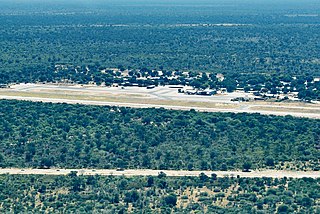
Katima Mulilo Airport, also known as Mpacha Airport, serves Katima Mulilo, the capital of the Zambezi Region in Namibia. The airport is on the B8 road, about 18 km (11 mi) southwest of Katima Mulilo. The Katima Mulilo non-directional beacon is located on the field.

The Kazungula Ferry was a pontoon ferry across the 400-metre-wide (1,300 ft) Zambezi River between Botswana and Zambia. It was one of the largest ferries in south-central Africa, having a capacity of 70 tonnes. The service was provided by two motorised pontoons and operated between border posts at Kazungula, Zambia and Kazungula, Botswana.
B8 road often known as the Golden Highway is one of the national highways of Namibia. It leads from the B1 at Otavi via Grootfontein and Rundu through the Caprivi Strip to the border town of Katima Mulilo and further on to the Botswana border at Ngoma. The section from Otavi to Katima Mulilo forms part of the Walvis Bay-Ndola-Lubumbashi Development Road.

Shangombo District with headquarters at Shangombo is located in Zambia. As of the 2022 Zambian Census, the district had a population of 73,822 people.

Namibia–Zambia relations refers to the bilateral relations of Namibia and Zambia. Namibia and Zambia are separated by the Zambezi River. The Katima Mulilo Bridge connects Katima Mulilo on the Namibia side with Sesheke, Zambia. Both countries are members of the African Union and Non-Aligned Movement.
Tobias Hainyeko (1932–1967) was a Namibian guerrilla fighter who served as the first commander of the People's Liberation Army of Namibia (PLAN) during the Namibian War of Independence from the 1960s through to the 1980s.
The M10 road is a road in Zambia. It goes from Livingstone, through Sesheke and Senanga, to Mongu. The road is approximately 508 kilometres and follows the Zambezi River for its entire length.
Choto is an informal settlement in Katima Mulilo in northern Namibia. As of the 2010 census, it has a population of about 11,200.
