Hurricane Juan was a significant tropical cyclone that heavily damaged parts of Atlantic Canada in late September 2003. Juan is also the first hurricane name and one of two to be requested to be retired by the Meteorological Service of Canada. It was the tenth named storm and the sixth hurricane of the 2003 Atlantic hurricane season. Juan formed southeast of Bermuda on September 24 from a tropical wave that had tracked across the subtropical Atlantic Ocean. It tracked northward and strengthened over the warm waters of the Gulf Stream, reaching Category 2 strength on the Saffir-Simpson hurricane scale on September 27. The hurricane peaked in intensity with sustained winds of 105 mph (165 km/h) that same day, losing some strength as it raced over cooler waters toward the coast of Nova Scotia. Juan made landfall between Shad Bay and Prospect in the Halifax Regional Municipality early on September 29 as a Category 2 hurricane with winds of 100 mph (160 km/h). Juan retained hurricane strength while crossing Nova Scotia from south to north, though it weakened to a Category 1 storm over Prince Edward Island. It was absorbed by another extratropical low later on September 29 near Anticosti Island in the northern Gulf of Saint Lawrence.

Halifax is the capital and largest municipality of the Canadian province of Nova Scotia, and the largest municipality in Atlantic Canada. Halifax is one of Canada's fastest growing municipalities, and as of 2022, it is estimated that the CMA population of Halifax was 480,582,with 348,634 people in its urban area. The regional municipality consists of four former municipalities that were amalgamated in 1996: Halifax, Dartmouth, Bedford, and Halifax County.

The Bedford Institute of Oceanography (BIO) is a major Government of Canada ocean research facility located in Dartmouth, Nova Scotia. BIO is the largest ocean research station in Canada. Established in 1962 as Canada's first, and currently largest, federal centre for oceanographic research, BIO derives its name from the Bedford Basin, an inland bay comprising the northern part of Halifax Harbour, upon which it is located.

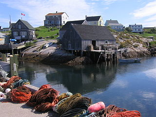
Peggy's Cove is a small rural community located on the eastern shore of St. Margarets Bay in the Halifax Regional Municipality, which is the site of Peggys Cove Lighthouse.

South Shore—St. Margarets is a federal electoral district in Nova Scotia, Canada, that has been represented in the House of Commons of Canada since 1968. It covers the South Shore region of Nova Scotia.

The American shad is a species of anadromous clupeid fish naturally distributed on the North American coast of the North Atlantic, from Newfoundland to Florida, and as an introduced species on the North Pacific coast. The American shad is not closely related to the other North American shads. Rather, it seems to form a lineage that diverged from a common ancestor of the European taxa before these diversified.

SS Atlantic was a transatlantic ocean liner of the White Star Line that operated between Liverpool, United Kingdom, and New York City, United States. During the ship's 19th voyage, on 1 April 1873, she struck rocks and sank off the coast of Nova Scotia, Canada, killing at least 535 people. It remained the deadliest civilian maritime disaster in the North Atlantic Ocean until the sinking of SS La Bourgogne on 2 July 1898 and the greatest disaster for the White Star Line prior to the loss of Titanic in April 1912.

The Ocean, previously known as the Ocean Limited, is a passenger train operated by Via Rail in Canada between Montreal, Quebec, and Halifax, Nova Scotia. It is the oldest continuously operated named passenger train in North America. The Ocean's schedule takes approximately 22 hours, running overnight in both directions. Together with The Canadian and Via's corridor trains, the Ocean provides a transcontinental service across Canada.

The Marblehead to Halifax Ocean Race (MHOR) is a biennial sailing race which celebrated its 100th anniversary in 2005. It runs between Marblehead, Massachusetts and Halifax, Nova Scotia. It is believed to be the longest running offshore ocean race in the world and is considered one of the pre-eminent ocean races of the North Atlantic.

The Chebucto Peninsula is a peninsula located in central Nova Scotia, Canada, entirely within the Halifax Regional Municipality on the Atlantic coast.

The Eastern Shore is a region of the Canadian province of Nova Scotia. It is the Atlantic coast running northeast from Halifax Harbour to the eastern end of the peninsula at the Strait of Canso.
The Halifax Regional Municipality (HRM) in Nova Scotia, Canada has a widely varied geography.

Route 333 is a collector road in the Canadian province of Nova Scotia.
The Lighthouse Route is a scenic roadway in the Canadian province of Nova Scotia. It follows the province's South Shore for 585 km (364 mi) from Halifax to Yarmouth.

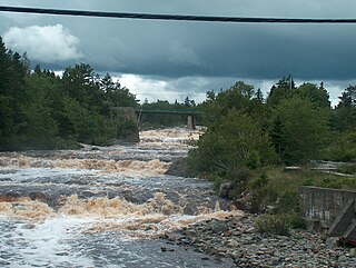
Moser River is a rural community on the Eastern Shore of Nova Scotia, Canada, in the Halifax Regional Municipality. The community lies along the Marine Drive on Trunk 7, 32 km (20 mi) east of Sheet Harbour and 51 km (32 mi) southwest of Sherbrooke. The community is located along the shores of Necum Teuch Harbour, an inlet of the Atlantic Ocean, and is at the mouth of Moser River. The area was called Noogoomkeak in the mi'kmaq language, translating to "soft sand place". The community is named for Henry Moser, who was the son of Jacob Moser, who settled the area in the early 1800s. The first school in the community was built in 1905, and another school, Moser River Consolidated School, was built in 1957. The school closed in 2015, due to its very low student population. Marine Drive Academy in Sheet Harbour serves the community and its surroundings at all grade levels. There is a small seaside park in the community near the former school, as well as a post office and convenience store.
Terence Bay is a rural fishing community on the Chebucto Peninsula in the Halifax Regional Municipality, Nova Scotia. It is located on the shore of the Atlantic Ocean, 10 km off the Prospect Road, off Route 333, 21.2 kilometers from Halifax.

Bayside is a small coastal rural community in the Halifax Regional Municipality Nova Scotia, Canada. It is about 19 kilometres (12 mi) from Halifax. Bayside is situated on the shore of Shad Bay on the Atlantic Ocean. The community is on the Prospect Road which runs on the Chebucto Peninsula.

Prospect is a Canadian coastal community on the Chebucto Peninsula in Nova Scotia, Canada within the Halifax Regional Municipality.

In the Canadian Forces, Maritime Forces Atlantic (MARLANT) is responsible for the fleet training and operational readiness of the Royal Canadian Navy in the Atlantic Ocean and Arctic Ocean. It was once referred to as Canadian Atlantic Station.

CSS Acadia is a former hydrographic surveying and oceanographic research ship of the Hydrographic Survey of Canada and its successor the Canadian Hydrographic Service.


