Related Research Articles

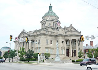
Somerset County is a county located in the U.S. state of Pennsylvania. As of the 2010 census, the population was 77,742. Its county seat is Somerset. The county was created from part of Bedford County on April 17, 1795, and named after the county of Somerset in England.

Stonycreek Township is a township in Cambria County, Pennsylvania, United States. The population was 2,844 at the 2010 census, down from 3,204 at the 2000 census. It is part of the Johnstown, Pennsylvania Metropolitan Statistical Area.

Quemahoning Township is a township in Somerset County, Pennsylvania, United States. The population was 2,180 at the 2000 census. It is part of the Johnstown, Pennsylvania, Metropolitan Statistical Area.

Shade Township is a township in Somerset County, Pennsylvania, United States. The population was 2,886 at the 2000 census. It is part of the Johnstown, Pennsylvania, Metropolitan Statistical Area.

Stonycreek Township is a township in Somerset County, Pennsylvania, United States. The township takes its name from the stony creek which for a part of its course flows through it and then becomes its western boundary. As a stream it takes its name from the rocky bed over which it flows in a great part of its course. Its Indian name was Sinne-Hanne or Achsin-Hanne. "Hanne" means a stream and especially a swift mountain stream." The population was 2,221 at the 2000 census. It is part of the Johnstown, Pennsylvania, Metropolitan Statistical Area.

The Little Juniata River, sometimes called the "Little J," is a 32.1-mile-long (51.7 km) tributary of the Juniata River in the Susquehanna River watershed of Pennsylvania. It is formed at Altoona by the confluence of several short streams. It flows northeast in the Logan Valley at the foot of Brush Mountain.
Blacklog Creek is a 28.5-mile-long (45.9 km) tributary of Aughwick Creek in Huntingdon County, Pennsylvania, in the United States.

Perkiomen Creek is a 37.7-mile-long (60.7 km) tributary of the Schuylkill River in Berks, Lehigh and Montgomery counties, Pennsylvania in the United States. The water course was also named Perquaminck Creek, on Thomas Holme's 1687 map.
Buckwha Creek is a 12.6-mile-long (20.3 km) tributary of Aquashicola Creek in the Poconos of eastern Pennsylvania in the United States.

Black Moshannon Creek is a 22.9-mile-long (36.9 km) tributary of Moshannon Creek in Centre County, Pennsylvania in the United States.
Little Clearfield Creek is a 14.5-mile-long (23.3 km) tributary of Clearfield Creek in Clearfield County, Pennsylvania in the United States.

Potato Creek is a tributary of the Allegheny River in McKean County, Pennsylvania in the United States.
Mill Creek is an 18.7-mile-long (30.1 km) tributary of the Tioga River in Tioga County, Pennsylvania in the United States.
Wallenpaupack Creek is a 30.0-mile-long (48.3 km) tributary of the Lackawaxen River in the Pocono Mountains of eastern Pennsylvania in the United States.
Cocolamus Creek is a 22.1-mile-long (35.6 km) tributary of the Juniata River in Juniata and Perry counties, Pennsylvania in the United States.
Honey Creek is a 20.3-mile-long (32.7 km) tributary of Kishacoquillas Creek in Mifflin County, Pennsylvania in the United States.
Chest Creek is a tributary of the West Branch Susquehanna River in Cambria County and Clearfield County, in Pennsylvania, in the United States. It is approximately 40.4 miles (65.0 km) long and flows through Allegheny Township, East Carroll Township, Clearfield Township, Patton, Chest Township, and Elder Township in Cambria County and Westover Township, Chest Township, Newburg, Bell Township, and Mahaffey in Clearfield County. Although it is considered by the Pennsylvania Department of Environmental Protection to be impaired by situation, it is a coldwater fishery or a high-quality coldwater fishery throughout its length. The watershed of the creek has an area of 129.22 square miles (334.7 km2).
Shade Junior/Senior High School is a public secondary school serving nearly 300 students in grades 7-12 in the Shade Township coal patch of Cairnbrook.
Bennett Branch Sinnemahoning Creek is a tributary of Sinnemahoning Creek in the U.S. state of Pennsylvania.
Driftwood Branch Sinnemahoning Creek is a tributary of Sinnemahoning Creek in the U.S. state of Pennsylvania. This stream once called simply "Driftwood Creek" was so named for the driftwood which accumulated there.
References
Coordinates: 40°11′10″N78°51′37″W / 40.186226°N 78.860286°W