
An aerodrome is a location from which aircraft flight operations take place, regardless of whether they involve air cargo, passengers, or neither, and regardless of whether it is for public or private use. Aerodromes include small general aviation airfields, large commercial airports, and military air bases.

The ICAOairport code or location indicator is a four-letter code designating aerodromes around the world. These codes, as defined by the International Civil Aviation Organization and published quarterly in ICAO Document 7910: Location Indicators, are used by air traffic control and airline operations such as flight planning. ICAO codes are also used to identify other aviation facilities such as weather stations, international flight service stations or area control centers, whether or not they are located at airports. Flight information regions are also identified by a unique ICAO-code.

Juhu Aerodrome is located in Juhu, an upmarket residential suburb of Mumbai, Maharashtra, India. It is served primarliy by general aviation aircraft and helicopters. It was founded in 1928 as India's first civil aviation airport.

Nottingham Airport, also known as Nottingham City Airport, is located in Tollerton, Nottinghamshire, England. It is situated 3 nautical miles south east of Nottingham City Centre, and signposted on the A52 at Trent Bridge and on the A606—this makes it one of the closest airports to a city centre in the UK. The aerodrome is equipped for private aviation, business aviation and flight instruction.

Eros Airport or Windhoek Eros Airport is an airport serving Windhoek, the capital and largest city of Namibia. It is located in the Khomas Region, about 5 km (3 mi) south of Windhoek's central business district, and has been a secondary hub for Air Namibia.

Sir Seretse Khama International Airport, located 15 kilometres (9 mi) north of downtown Gaborone, is the main international airport of the capital city of Botswana. The airport is named after Sir Seretse Khama, the first president of Botswana. It was opened in 1984 to handle regional and international traffic. It has the largest passenger movement in the country. In 2017 the airport got its first special economic zone which would house in the following departments: CAAB, Botswana Innovation Hub, ITPA and diamond hub for diamond sector.
Goa is a small town in Botswana. It lies near the Namibian border, near the Caprivi Strip, and about 11 kilometres from Shakawe which is also the nearest airport.

Shakawe is a village located in the northwest corner of Botswana at the beginning of the Okavango Delta, close to Namibia and Angola. Shakawe is awakening from its former status as a sleepy little outpost on the Okavango. For travellers, Shakawe means a Botswana entry or exit stamp or a staging post for a visit to the Tsodilo Hills, 40 km away. For Southern African holiday-makers, it is most often the start of a fishing trip in the Okavango Panhandle. It also provides access to the Caprivi Strip. The record high temperature ever registered in Shakawe was 39.6 °C (103.3 °F). The lowest temperature registered in Shakawe was −6.1 °C (21.0 °F).
Mudgee Airport is a regional airport located 3 nautical miles north northeast of Mudgee, New South Wales, Australia. The airport is frequently used for technical training. FlyPelican operates a flight to Sydney, making it the only commercial airline serving Mudgee.
Scone Memorial Airport, is a public airport in the Upper Hunter Valley, 4 km (2.5 mi) northwest of Scone, New South Wales, Australia. It was built to provide a public aerodrome replacing Nandowra aerodrome on located on "Nandowra", approx. 9 km south of Scone.
Cessnock Airport is a civil airport located 6 km (4 mi) North of Cessnock, New South Wales, Australia.

Quilon Aerodrome or Kollam Airport was an aerodrome in the city of Kollam in the former state of Travancore, now in Kerala, India. During the 1920s, there were no other civil aerodromes in the kingdoms of Cochin, Travancore and the Malabar District at the time of the British ruled Madras Presidency. With the commissioning of Trivandrum International Airport in 1932 at state capital 57 kilometres (35 mi) to the south, the aerodrome fell into disuse and came to be known as the Asramam Maidan.


 Aerial view of airport Shakawe (2019)
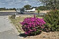 Apron
Apron
