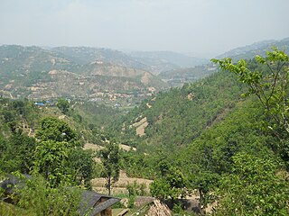
Arghakhanchi is one of the districts of Lumbini Province in Nepal. The district headquarter is Sandhikharka. The district covers an area of 1,193 km2 (461 sq mi) and has a population (2011) of 197,632. Its neighboring districts are Palpa in the east, Gulmi in the north, Kapilvastu District in the south and Pyuthan in the west. The district also covers 4.18km of daily busy road connecting Kapilvastu and Bhalubang, Lalmatiya, Dang with Rapti River as Mahendra Highway or Easy-West Highway.

Gulmi District, a part of Lumbini Province, is one of the seventy-seven districts of Nepal. The district, with Tamghas as its headquarters, covers an area of 1,149 km2 (444 sq mi), had a population of 296,654 in 2001, 280,160 in 2011 and 268,597 in 2016.

Tamghas, also Gulmi Tamghas or Tamghas Bazaar is the center of Resunga Municipality, and the district headquarter of Gulmi district.
Aslewa is a village development committee (VDC) in Gulmi District in the Lumbini Zone of central Nepal. At the time of the 1991 Nepal census it had a population of 8088 persons living in 992 individual households. The village has a temple called Rudra Beni Dhaam and a school for higher level study, the Shree Janata Higher Secondary School.
Limgha is a rural municipality ward no 4 and (सत्यवती) village council ward no 4 in Gulmi District in the Lumbini Zone of central Nepal. At the time of the 1991 Nepal census it had a population of 3285 persons living in 665 individual households.
Nayagaun is a Village and Ward Number one of Dhurkot rural municipality in Gulmi District in the Lumbini Zone of central Nepal. At the time of the 1991 Nepal census it had a population of 4070 persons living in 818 individual households.
Purkot Daha is the administrative headquarter of Madane Rural Municipality which is in Lumbini province of Nepal. As of the 2001 Nepal Census, it had a population of 9,918, including 1,765 individual households.
Turang is 8 number ward of Chandrakot Rural Municipality in Gulmi District in the Province No. 5 of Nepal. At the time of the 1991 Nepal census it had a population of 4383 persons living in 1044 individual households. Majuwa Bazer is the economic and educational center of this place where people from Jubhung, Balithum, Rupakot and Aanpchour visit for shopping, education and other official works. Manaka Tikaram Multiple College, Gyanodaya Higher Secondary School and Polaris Secondary Boarding School are the famous educational institutions of this place. Notable person are Sompal Kami
Galkot is a municipality in Baglung district of Gandaki province of Nepal. It consists of several VDCs. Nearby cities include Gulmi and Pokhara. Its geographic coordinates are 28°13'24"N 83°25'29"E.
Rong is a rural municipality out of six rural municipalities located in Ilam District of Province No. 1 of Nepal. There are a total of 10 municipalities in Ilam in which 4 are urban and 6 are rural.
Jaimini is a municipality in Baglung district of Gandaki province of Nepal. Nearby cities include Kusma and Baglung. Its geographic coordinates are 28.182101" N 83.613602" E. Jaimini Municipality is surrounded by Parbat district on the east, Galkot Municipality and Bareng Rural Municipality on the west, Khathekhola Rural Municipality and Baglung Municipality on the north and Gulmi and Parbat districts on the south. The population of the municipality declined to 24,628 at the 2021 Nepal census. 100% of the residents were Nepali citizens and 78.9% were literate in 2021.

Gulmi 1 one of two parliamentary constituencies of Gulmi District in Nepal. This constituency came into existence on the Constituency Delimitation Commission (CDC) report submitted on 31 August 2017.

Gulmi 2 one of two parliamentary constituencies of Gulmi District in Nepal. This constituency came into existence on the Constituency Delimitation Commission (CDC) report submitted on 31 August 2017.
Ishma is a Rural municipality located within the Gulmi District of the Lumbini Province of Nepal. The rural municipality spans 81.88 square kilometres (31.61 sq mi) of area, with a total population of 20,964 according to a 2011 Nepal census.
Gulmi Darbar is a Rural municipality located within the Gulmi District of the Lumbini Province of Nepal. The rural municipality spans 79.99 square kilometres (30.88 sq mi) of area, with a total population of 22,037 according to a 2011 Nepal census.
Satyawati is a Rural municipality located within the Gulmi District of the Lumbini Province of Nepal. The rural municipality spans 115.92 square kilometres (44.76 sq mi) of area, with a total population of 23,807 according to a 2011 Nepal census.
Chandrakot is a Rural municipality located within the Gulmi District of the Lumbini Province of Nepal. The rural municipality spans 105.73 square kilometres (40.82 sq mi) of area, with a total population of 21,827 according to a 2011 Nepal census.
Dhurkot is a Rural municipality located within the Gulmi District of the Lumbini Province of Nepal. The rural municipality spans 86.32 square kilometres (33.33 sq mi) of area, with a total population of 22,454 according to a 2011 Nepal census.
Madane is a Rural municipality located within the Gulmi District of the Lumbini Province of Nepal. The rural municipality spans 94.52 square kilometres (36.49 sq mi) of area, with a total population of 21,899 according to a 2011 Nepal census.


