Shawmere River

Last updated
Shawmere River
Canada Ontario relief location map.jpg
Red pog.svg
Location of the mouth of the Shawmere River in Ontario
Location
Country Canada
Province Ontario
Region Northeastern Ontario
District Sudbury
Physical characteristics
Source Unnamed lake
  locationGamey Township
  coordinates 47°53′29″N82°59′44″W / 47.89139°N 82.99556°W / 47.89139; -82.99556
  elevation440 m (1,440 ft)
Mouth Ivanhoe River
  location
Oates Township
  coordinates
48°20′23″N82°28′38″W / 48.33972°N 82.47722°W / 48.33972; -82.47722 Coordinates: 48°20′23″N82°28′38″W / 48.33972°N 82.47722°W / 48.33972; -82.47722
  elevation
294 m (965 ft)
Basin features
River system James Bay drainage basin
Tributaries 
  left Little Shawmere River

The Shawmere River is a river in Sudbury District in northeastern Ontario, Canada. [1] It is in the James Bay drainage basin, and is a left tributary of the Ivanhoe River.

River Natural flowing watercourse

A river is a natural flowing watercourse, usually freshwater, flowing towards an ocean, sea, lake or another river. In some cases a river flows into the ground and becomes dry at the end of its course without reaching another body of water. Small rivers can be referred to using names such as stream, creek, brook, rivulet, and rill. There are no official definitions for the generic term river as applied to geographic features, although in some countries or communities a stream is defined by its size. Many names for small rivers are specific to geographic location; examples are "run" in some parts of the United States, "burn" in Scotland and northeast England, and "beck" in northern England. Sometimes a river is defined as being larger than a creek, but not always: the language is vague.

Sudbury District District in Ontario, Canada

The Sudbury District is a district in Northeastern Ontario in the Canadian province of Ontario. It was created in 1894 from townships of eastern Algoma District and west Nipissing District.

Northeastern Ontario Secondary region in Ontario, Canada

Northeastern Ontario is a secondary region of Northern Ontario which lies north of Lake Huron and east of Lake Superior.

Contents

Course

The river begins at a small, unnamed lake in geographic Gamey Township, [2] and flows north to Yohannson Lake, where it enters geographic Crockett Township. [3] It flows briefly through the northwest corner of the township and enters geographic Sandy Township, [4] continuing its northeast course under Ontario Highway 101. It heads north into geographic Murdock Township [5] into Renée Lake, on the border of geographic Paul Township [6] to the west and geographic Warren Township [7] to the east. The river heads north out the lake on the Paul Township side, takes in the left tributary Little Shawmere River, then turns northeast back into Warren Township and continues northeast into geographic Lemoine Township. It flows into Lemoine Lake where it takes in the right tributary Carty Creek, then into Shawmere Lake where it takes in the left tributaries Lincoln Creek and Mishionga Creek. It passes northeast through the northwestern tip of geographic Folyet Township, [8] and enters geographic Oates Township. [9] It passes under the Canadian National Railway transcontinental railway main line, at that point passed but not served by Via Rail transcontinental Canadian trains, at the railway point of Shawmere, and reaches its mouth at the Ivanhoe River. The Ivanhoe River flows via the Groundhog River, the Mattagami River and the Moose River to James Bay.

King's Highway 101, commonly referred to as Highway 101, is a provincially maintained highway in the Canadian province of Ontario. The 473.3-kilometre (294.1 mi) highway connects Highway 17 west of Wawa with Highway 11 in Matheson before continuing east to the Ontario–Quebec border where it becomes Route 388. The highway forms one of the only connections between the two routes of the Trans-Canada Highway between Nipigon and Temagami, and crosses some of the most remote regions of Northern Ontario. Major junctions are located with Highway 129 near Chapleau and Highway 144 southwest of Timmins, though the distance between these junctions is significant.

Little Shawmere River river in Sudbury District, Ontario, Canada

The Little Shawmere River is a river in Sudbury District in northeastern Ontario, Canada. It is in the James Bay drainage basin, and is a left tributary of the Shawmere River.

Canadian National Railway railway company

Canadian National is a Canadian Class I freight railway headquartered in Montreal, Quebec that serves Canada and the Midwestern and Southern United States.

Tributaries

Related Research Articles

Sarsfield Creek watercourse in Canada

Sarsfield Creek is a creek in Timiskaming District in northeastern Ontario, Canada. It is in the James Bay drainage basin and is a right tributary of Woollings Creek.
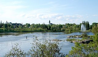
Kapuskasing River river in Northeastern Ontario, Canada

The Kapuskasing River is a river in the James Bay drainage basin in Cochrane District and Algoma District in northeastern Ontario, Canada. The river is a left tributary of the Mattagami River.

Ivanhoe River river in Cochrane and Sudbury Districts, Ontario, Canada

The Ivanhoe River is a river in Cochrane District and Sudbury District in Northeastern Ontario, Canada. The river is in the James Bay drainage basin and is a left tributary of the Groundhog River.

Groundhog River river in Canada

The Groundhog River is a river in Cochrane District and Sudbury District in Northeastern Ontario, Canada. The river is in the James Bay drainage basin and is a left tributary of the Mattagami River.

Bobs Lake (Sudbury District)

Bobs Lake is a lake in geographic Gamey Township in the Unorganized North Part of Sudbury District in Northeastern Ontario, Canada. It is in the James Bay drainage basin and is part of the Moose River system. The lake is 2 kilometres (1.2 mi) south of Ontario Highway 101.

Carp River (Algoma District) river in Ontario, Canada

The Carp River is a river in the Unorganized North Part of Algoma District in Northeastern Ontario, Canada. The river is in the Great Lakes Basin and is a tributary of Lake Superior.
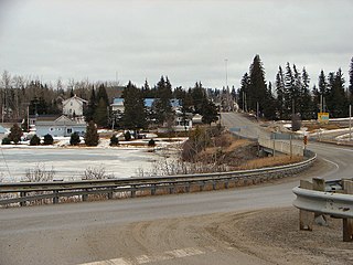
Black River (Abitibi River tributary) tributary of the Abitibi River in Canada

The Black River is a river in Cochrane District and Timiskaming District in Northeastern Ontario, Canada. It is part of the James Bay drainage basin, and is a right tributary of the Abitibi River. The municipality of Black River-Matheson is named after the river.

Carhess Creek river in Canada

Carhess Creek is a river in Greater Sudbury and Sudbury District in Northeastern Ontario, Canada. It is in the Great Lakes Basin and is a right tributary of the Onaping River. The name is a portmanteau of the names of two geographic townships through which it flows, Hess Township and Cartier Township.

Dunrankin River river in Northeastern Ontario, Canada

The Dunrankin River is a river in Algoma District and Sudbury District in northeastern Ontario, Canada. It is in the James Bay drainage basin, begins at Upper Dunrankin Lake and is a left tributary of the Kapuskasing River.

Makonie River watercourse in Canada

The Makonie River is a river in Sudbury District in northeastern Ontario, Canada. It is in the James Bay drainage basin, and is a left tributary of the Chapleau River.

Nemegosenda River watercourse in Canada

The Nemegosenda River is a river in Algoma District and Sudbury District in northeastern Ontario, Canada. It is in the James Bay drainage basin, and is a right tributary of the Kapuskasing River.

Borden River (Ontario) watercourse in Ontario, Canada

The Borden River is a river in Sudbury District in northeastern Ontario, Canada. It is in the James Bay drainage basin, and is a left tributary of the Nemegosenda River.

Saganash River watercourse in Canada

The Saganash River is a river in Cochrane District in northeastern Ontario, Canada. It is in the James Bay drainage basin, and is a right tributary of the Kapuskasing River.

Greenhill River river in Canada

The Greenhill River is a river in Algoma District in northeastern Ontario, Canada. It is in the James Bay drainage basin, and is a left tributary of the Missinaibi River.

Valentine River river in Ontario, Canada

The Valentine River is a river in Cochrane District in northeastern Ontario, Canada. It is in the James Bay drainage basin, and is a tributary of Lac Pivabiska, the source of the Pivabiska River.

South Greenhill River watercourse in Canada

The South Greenhill River is a river in Algoma District and Sudbury District in northeastern Ontario, Canada. It is in the James Bay drainage basin, and is a right tributary of the Greenhill River.

Fire River (Ontario) watercourse in Canada

The Fire River is a river in Algoma District in northeastern Ontario, Canada. It is in the James Bay drainage basin, and is a left tributary of the Missinaibi River.

Woollings Creek

Woollings Creek is a creek in Timiskaming District and Cochrane District in northeastern Ontario, Canada. It is in the James Bay drainage basin and is a tributary of the Whiteclay River.

Jocko River (Ontario) watercourse in Canada

The Jocko River is a river in Nipissing District in Northeastern Ontario, Canada. It is in the Saint Lawrence River drainage basin, is a right tributary of the Ottawa River, and lies entirely within Jocko Rivers Provincial Park.

References

  1. "Shawmere River". Geographical Names Data Base. Natural Resources Canada . Retrieved 2016-11-12.
  2. "Gamey" (PDF). Geology Ontario - Historic Claim Maps. Ontario Ministry of Northern Development, Mines and Forestry. Archived from the original (PDF) on 2016-03-04. Retrieved 2016-11-12.
  3. "Crockett" (PDF). Geology Ontario - Historic Claim Maps. Ontario Ministry of Northern Development, Mines and Forestry . Retrieved 2016-11-12.
  4. "Sandy" (PDF). Geology Ontario - Historic Claim Maps. Ontario Ministry of Northern Development, Mines and Forestry . Retrieved 2016-11-12.
  5. "Murdock" (PDF). Geology Ontario - Historic Claim Maps. Ontario Ministry of Northern Development, Mines and Forestry . Retrieved 2016-11-12.
  6. "Paul" (PDF). Geology Ontario - Historic Claim Maps. Ontario Ministry of Northern Development, Mines and Forestry. Archived from the original (PDF) on 2016-09-11. Retrieved 2016-11-12.
  7. "Warren" (PDF). Geology Ontario - Historic Claim Maps. Ontario Ministry of Northern Development, Mines and Forestry . Retrieved 2016-11-12.
  8. "Folyet" (PDF). Geology Ontario - Historic Claim Maps. Ontario Ministry of Northern Development, Mines and Forestry. Archived from the original (PDF) on 2014-07-14. Retrieved 2016-11-12.
  9. "Oates" (PDF). Geology Ontario - Historic Claim Maps. Ontario Ministry of Northern Development, Mines and Forestry . Retrieved 2016-11-12.

Sources

Ministry of Transportation of Ontario government ministry in Ontario

The Ministry of Transportation of Ontario (MTO) is the provincial ministry of the Government of Ontario that is responsible for transport infrastructure and related law in Ontario. The ministry traces its roots back over a century to the 1890s, when the province began training Provincial Road Building Instructors. In 1916, the Department of Public Highways of Ontario (DPHO) was formed and tasked with establishing a network of provincial highways. The first was designated in 1918, and by the summer of 1925, sixteen highways were numbered. In the mid-1920s, a new Department of Northern Development (DND) was created to manage infrastructure improvements in northern Ontario; it merged with the Department of Highways of Ontario (DHO) on April 1, 1937. In 1971, the Department of Highways took on responsibility for Communications and in 1972 was reorganized as the Ministry of Transportation and Communications (MTC), which then became the Ministry of Transportation in 1987.

The Ministry of Municipal Affairs and Housing is the department of the Government of Ontario that is responsible for municipal affairs and housing in the Canadian province of Ontario.