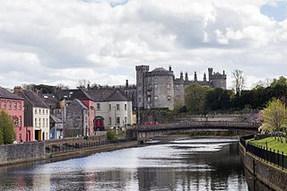
Kilkenny is a city in County Kilkenny, Ireland. It is located in the South-East Region and in the province of Leinster. It is built on both banks of the River Nore. The 2016 census gave the total population of Kilkenny as 26,512.

Ennis is the county town of County Clare, Ireland. The Irish name is short for Inis Cluana Rámhfhada. The town is on the River Fergus, north of where it enters the Shannon Estuary, 19 km (12 mi) from Shannon Airport. In 2016, Ennis had a population of 25,276, making it the largest town in Clare and the 12th largest in Ireland.

Youghal is a seaside resort town in County Cork, Ireland. Located on the estuary of the River Blackwater, the town is a former military and economic centre. Located on the edge of a steep riverbank, the town has a long and narrow layout. As of the 2016 census, the population was 7,963.
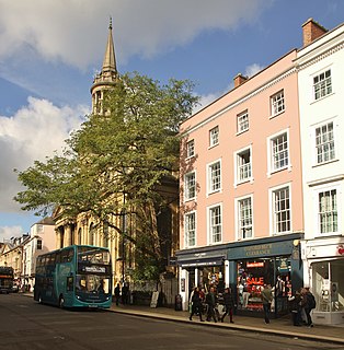
High Street is a common street name for the primary business street of a city, town, or other population center, especially in the United Kingdom and Commonwealth. It implies that it is the focal point for business, especially shopping. It is also a metonym for the retail sector.
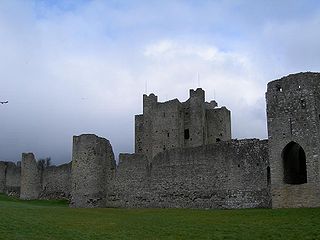
Trim is a town in County Meath, Ireland. It is situated on the River Boyne and has a population of 9,194. The town is noted for Trim Castle – the largest Cambro-Norman castle in Ireland. One of the two cathedrals of the United Dioceses of Meath and Kildare — St Patrick's cathedral — is located north of the river. Trim won the Irish Tidy Towns Competition in 1972, 1984, and 2014 and was the "joint" winner with Ballyconnell in 1974. Traditionally Trim was the county town of Meath, but this title was passed on over time onto larger, neighbouring town Navan.

Trim Castle is a castle on the south bank of the River Boyne in Trim, County Meath, Ireland, with an area of 30,000 m². Over a period of 30 years, it was built by Hugh de Lacy and his son Walter as the caput of the Lordship of Meath. The Irish Government currently own and are in charge of the care of the castle, through the state agency The Office of Public Works (OPW).

Builth Wells is a market town and community in the county of Powys and historic county of Brecknockshire (Breconshire), mid Wales, lying at the confluence of rivers Wye and Irfon, in the Welsh part of the Wye Valley. In 2011 it had a population of 2,568.

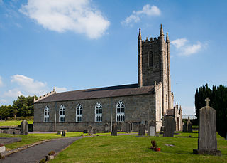
Castlepollard is a village in north County Westmeath, Republic of Ireland. It lies west of Lough Lene and northeast of Lough Derravaragh and Mullingar.

Oranmore is a town near the city of Galway in County Galway on the west coast of Ireland. It is also the name of the civil parish and Roman Catholic parish in which the town lies.

Bantry is a town in the civil parish of Kilmocomoge in the barony of Bantry on the southwest coast of County Cork, Ireland. It lies in West Cork at the head of Bantry Bay, a deep-water gulf extending for 30 km (19 mi) to the west. The Beara Peninsula is to the northwest, with Sheep's Head peninsula to the southwest.

Kilrush is a coastal town in County Clare, Ireland. It is also the name of a civil parish and an ecclesiastical parish in Roman Catholic Diocese of Killaloe. It is located near the mouth of the River Shannon in the south-west of the county. Kilrush is one of the listed Heritage Towns of Ireland. The area was officially classified as part of the West Clare Gaeltacht, an Irish-speaking community, until 1956.

Buttevant is a medieval market town, incorporated by charter of Edward III, situated in North County Cork, Ireland.

Loughrea is a town in County Galway, Ireland. The town lies to the north of a range of wooded hills, the Slieve Aughty Mountains, and the lake from which it takes its name. The town's cathedral, St Brendan's, dominates the town's skyline. The town has increased in population in the late 20th and early 21st centuries. Although the town also serves as a commuter town for the city of Galway, it also remains an independent market town. Loughrea is the fourth most populous settlement in County Galway, with a population of 5,556 as of 2016.

Fethard is a small town in County Tipperary, Ireland. Dating to the Norman invasion of Ireland, the town's walls were first laid-out in the 13th century, with some sections of these defensive fortifications surviving today.
Clogher is a village and civil parish in County Tyrone, Northern Ireland. It lies on the River Blackwater, 18 miles (29 km) south of Omagh. It stands on the townlands of Clogher Demesne and Clogher Tenements. The 2011 Census recorded a population of 717. The civil parish of Clogher covers areas of County Fermanagh as well as County Tyrone.

The Pool of Bethesda is a pool in Jerusalem known from the New Testament account of Jesus miraculously healing a paralysed man, from the fifth chapter of the Gospel of John, where it is described as being near the Sheep Gate, surrounded by five covered colonnades or porticoes. It is now associated with the site of a pool in the current Muslim Quarter of the city, near the gate now called the Lions' Gate or St. Stephen's Gate and the Church of St. Anne, that was excavated in the late 19th century.

Saint Laurence's Gate is a barbican which was built in the 13th century as part of the walled fortifications of the medieval town of Drogheda in Ireland. It is a barbican or defended fore-work which stood directly outside the original gate of which no surface trace survives. It has been described as one of the finest of its kind, and is designated as a national monument. The original names for Laurence Street and Saint Laurence Gate were Great East Street and Great East Gate, respectively. In the 14th century, the street and gate were renamed because they led to the hospital of Saint Laurence, which stood close to the Cord church.

Athboy is a small agricultural town located in County Meath. The town is located on the Yellow Ford River, in wooded country near the County Westmeath border.

The Porch Fields is an area of medieval farmland outside Trim, Ireland with a medieval roadway that forms a National Monument.
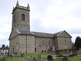
St. Cronan's Church is a 19th-century Church of Ireland church in Roscrea, County Tipperary, Ireland. The church was constructed in 1812 on the site of the original 12th century Romanesque church. The grounds include a graveyard and a replica high cross, enclosed by a rubble stone wall, cast iron gate and railings.


