Sheep Lake | |
---|---|
Location | Custer County, Idaho |
Coordinates | 44°06′49″N114°36′35″W / 44.113590°N 114.609613°W Coordinates: 44°06′49″N114°36′35″W / 44.113590°N 114.609613°W |
Type | Glacial |
Primary outflows | Bighorn Creek to Big Boulder Creek to East Fork Salmon River |
Basin countries | United States |
Max. length | 290 m (950 ft) |
Max. width | 200 m (660 ft) |
Surface elevation | 3,015 m (9,892 ft) |
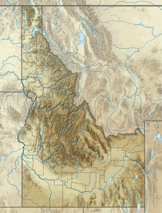
Sheep Lake is an alpine lake in Custer County, Idaho, United States, located in the White Cloud Mountains in the Sawtooth National Recreation Area. The lake can be accessed from Sawtooth National Forest trail 601. [1]
Sheep Lake is just south of Calkins Peak, northeast of D. O. Lee Peak, and downstream of Slide and Neck Lakes.
The White Cloud Mountains are part of the Rocky Mountains of the western United States, located in central Idaho, southeast of Stanley in Custer County. The range is located within the Sawtooth National Recreation Area (SNRA) and partially within the Cecil D. Andrus–White Clouds Wilderness.
Castle Peak is a mountain in the western United States, the highest peak in the White Cloud Mountains of central Idaho. Located in Custer County, it is the 25th highest peak in the state, and the ninth most prominent.
Castle Lake is an alpine lake in Custer County, Idaho, United States, located in the White Cloud Mountains in the Sawtooth National Recreation Area. The lake is accessed from Sawtooth National Forest trail 047.
Cirque Lake is an alpine lake in Custer County, Idaho, United States, located in the White Cloud Mountains in the Sawtooth National Recreation Area. The lake is accessed from Sawtooth National Forest trail 601.
Cornice Lake is an alpine lake in Custer County, Idaho, United States, located in the White Cloud Mountains in the Sawtooth National Recreation Area. The lake is in the Four Lakes Basin and is most easily accessed from Sawtooth National Forest trail 683.
Fourth of July Lake is an alpine lake in Custer County, Idaho, United States, located in the White Cloud Mountains in the Sawtooth National Recreation Area. The lake is accessed from Sawtooth National Forest trail 109.
Tin Cup Lake is an alpine lake in Custer County, Idaho, United States, located in the White Cloud Mountains in the Sawtooth National Recreation Area. No trails lead to lake but it can be accessed from Sawtooth National Forest trail 680.
Neck Lake is an alpine lake in Custer County, Idaho, United States, located in the White Cloud Mountains in the Sawtooth National Recreation Area. The lake can be accessed from Sawtooth National Forest trail 601.
Slide Lake is an alpine lake in Custer County, Idaho, United States, located in the White Cloud Mountains in the Sawtooth National Recreation Area. The lake can be accessed from Sawtooth National Forest trail 601.
Walker Lake is an alpine lake in Custer County, Idaho, United States, located in the White Cloud Mountains in the Sawtooth National Recreation Area. The lake is accessed from Sawtooth National Forest trail 601.
Sapphire Lake is an alpine lake in Custer County, Idaho, United States, located in the White Cloud Mountains in the Sawtooth National Recreation Area. No trails lead to the lake, but it can be most easily accessed from Sawtooth National Forest trail 601.
Shelf Lake is an alpine lake in Custer County, Idaho, United States, located in the White Cloud Mountains in the Sawtooth National Recreation Area. The lake is named for a distinct rock shelf extending around the south and west shores of the lake.
Lonesome Lake is an alpine lake in Custer County, Idaho, United States, located in the White Cloud Mountains in the Sawtooth National Recreation Area. The lake is accessed from Sawtooth National Forest trail 683.
Noisy Lake is an alpine lake in Custer County, Idaho, United States, located in the White Cloud Mountains in the Sawtooth National Recreation Area. While no trails lead to the lake, it can be accessed from Sawtooth National Forest trail 047.
Emerald Lake is an alpine lake in Custer County, Idaho, United States, located in the White Cloud Mountains in the Sawtooth National Recreation Area. While no trails lead to the lake, it can be accessed from Sawtooth National Forest trail 047.
Glacier Lake is an alpine lake in Custer County, Idaho, United States, located in the White Cloud Mountains in the Sawtooth National Recreation Area. While no trails lead to the lake, it can be accessed from Sawtooth National Forest trail 047.
The Boulder Chain Lakes are a chain of thirteen alpine and glacial Paternoster lakes in Custer County, Idaho, United States, located in the White Cloud Mountains in the Sawtooth National Recreation Area. The lakes are located in the upper portion of the Little Boulder Creek watershed north of Merriam Peak. Sawtooth National Forest trail 683 along leads to the Boulder Chain Lakes.
Merriam Peak, at 10,920 feet (3,330 m) is one of the peaks of the White Cloud Mountains of Custer County, Idaho. It was named for John H. Merriam who played an instrumental role in protecting the area from being mined for molybdenum. Merriam Peak is located in the middle of the range just north of Castle Peak, the highest point in the range. The peak is located in the White Clouds roadless area of Sawtooth National Recreation Area.
White Cloud Peak 10, also known as WCP 10, at 11,102 feet (3,384 m) above sea level is an unofficially named peak in the White Cloud Mountains of Idaho. The peak is located in Sawtooth National Recreation Area in Custer County 0.53 mi (0.85 km) south of Calkins Peak, its line parent. It is the 89th highest peak in Idaho. Sheep Lake is directly south of the peak, and Tin Cup Lake is directly north of the peak.
Calkins Peak, is a peak also known as Calkens, O'Calkens Peak, Caulkens Peak, and O'Caulkens Peak. At an elevation of 11,487 feet (3,501 m) above sea level it is the second highest peak in the White Cloud Mountains of Idaho. The peak is located in Sawtooth National Recreation Area in Custer County about 5.75 mi (9.25 km) north-northwest of Castle Peak, its line parent. It is the 46th highest peak in Idaho, and it is located about 0.5 mi (0.80 km) north-northeast of White Cloud Peak 9 and 1 mi (1.6 km) north-northwest of D. O. Lee Peak. Calkins Peak is directly north of Slide Lake, northwest of Sheep Lake, and southwest of Tin Cup Lake. Calkins Peak is named for Stephen Calkins (1842–1922), a prospector who established lode claims in the area.
This Custer County, Idaho state location article is a stub. You can help Wikipedia by expanding it. |