
Milwaukee is the most populous city in the U.S. state of Wisconsin and the county seat of Milwaukee County. With a population of 577,222 at the 2020 census, Milwaukee also is the 31st-most populous city in the United States, and the fifth-most populous city in the Midwest. It is the central city of the Milwaukee metropolitan area, the 40th-most populous metro area in the U.S. Milwaukee is categorized as a "Gamma minus" city by the Globalization and World Cities Research Network, with a regional GDP of over $102 billion in 2020.

Sherman Oaks is a neighborhood in the city of Los Angeles, California located in the San Fernando Valley, founded in 1927. The neighborhood includes a portion of the Santa Monica Mountains, which gives Sherman Oaks a lower population density than some other areas in Los Angeles.

Jefferson Park is one of the 77 community areas of Chicago, located on the Northwest Side of the city. The neighborhood of Jefferson Park occupies a larger swath of territory.

West Hills is a suburban/residential community in the western San Fernando Valley region of the City of Los Angeles, California. The percentage of residents aged 35 and older is among the highest in Los Angeles County.
Albany Park is one of 77 well-defined community areas of Chicago. Located on the Northwest Side of the City of Chicago with the North Branch of the Chicago River forming its east and north boundaries, it includes the ethnically diverse Albany Park neighborhood, with one of the highest percentages of foreign-born residents of any Chicago neighborhood.
The city of Atlanta, Georgia is made up of 243 neighborhoods officially defined by the city. These neighborhoods are a mix of traditional neighborhoods, subdivisions, or groups of subdivisions. The neighborhoods are grouped by the city planning department into 25 neighborhood planning units (NPUs). These NPUs are "citizen advisory councils that make recommendations to the Mayor and City Council on zoning, land use, and other planning issues". There are a variety of other widely recognized named areas within the city. Some are officially designated, while others are more informal.

Austin is one of 77 community areas in Chicago. Located on the city's West Side, it is the third largest community area by population and the second-largest geographically. Austin's eastern boundary is the Belt Railway located just east of Cicero Avenue. Its northernmost border is the Milwaukee District / West Line. Its southernmost border is at Roosevelt Road from the Belt Railway west to Austin Boulevard. The northernmost portion, north of North Avenue, extends west to Harlem Avenue, abutting Elmwood Park. In addition to Elmwood Park, Austin also borders the suburbs of Cicero and Oak Park.

West Town, northwest of the Loop on Chicago's West Side, is one of the city's officially designated community areas. Much of this area was historically part of Polish Downtown, along Western Avenue, which was then the city's western boundary. West Town was a collection of several distinct neighborhoods and the most populous community area until it was surpassed by Near West Side in the 1960s. The boundaries of the community area are the Chicago River to the east, the Union Pacific railroad tracks to the south, the former railroad tracks on Bloomingdale Avenue to the North, and an irregular western border to the west that includes the city park called Humboldt Park. Humboldt Park is also the name of the community area to West Town's west, Logan Square is to the north, Near North Side to the east, and Near West Side to the south. The collection of neighborhoods in West Town along with the neighborhoods of Bucktown and the eastern portion of Logan Square have been referred to by some media as the "Near Northwest Side".

South Deering, located on Chicago's far South Side, is the largest of the 77 official community areas of that city. Primarily an industrial area, a small residential neighborhood exists in the northeast corner and Lake Calumet takes up a large portion of the area. 80% of the community area is zoned as industrial, natural wetlands, or parks. The remaining 20% is zoned for residential and small-scale commercial uses. It is part of the 10th Ward, once under the control of former Richard J. Daley ally Alderman Edward Vrdolyak.
The Almighty Gaylords Nation is a Chicago street gang that was founded in the early 1950s. The original president of the Gaylords selected the name after reading about the Gaylords in the public library; the Gaillards, later anglicized to Gaylord, were people from Normandy who lived near the Château Gaillard, constructed by Richard I. The gang is part of the People Nation alliance and are known for disrupting rival gangs near Kilbourn Park.

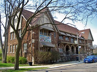
The neighborhoods of Milwaukee include a number of areas in southeastern Wisconsin within the state's largest city at nearly 600,000 residents.
Near Northside is a historic neighborhood located in Northside, Houston, Texas. Near Northside is primarily occupied by people of Hispanic descent.

Golden Oak at Walt Disney World Resort is a residential community within the Walt Disney World Resort in Lake Buena Vista, Florida. It was designed by Walt Disney Imagineering and is owned and operated by a newly formed Disney subsidiary, Golden Oak Realty within Disney Signature Experiences. The first phase of development is located southeast of the Magic Kingdom Park in Bay Lake. The area was named to pay homage to Walt Disney's Golden Oak Ranch in California. The first few home sites were available for purchase in late 2010 and completed in late 2011. Later on, a Four Seasons resort opened north of the property with the company purchasing several properties to serve in its "private residences" initiative on the WDW property.
Magic Grove is a public art work by artist Nancy Metz White. It is located in Enderis Playfield, which is northwest of downtown Milwaukee, Wisconsin. It was installed in November 2006 and dedicated in May 2007.

Stone Bracelet is a public art work by artist Zoran Mojsilov, located on the south side of Milwaukee, Wisconsin. The work is a large chiseled stone fitted with a stainless steel loop near its top from which smaller rocks are suspended on four sides of the sculpture. The artwork is located in a small park near Third and Walker Streets in the Walker's Point neighborhood. Stone Bracelet was commissioned through the Spirit of Milwaukee Neighborhood Millennium Art Initiative.
Colectivo Coffee Roasters is a specialty coffee roaster based in Milwaukee, Wisconsin. Until July 2013, the company was known as Alterra Coffee Roasters. Colectivo roasts its coffee and makes all its food products in Milwaukee and is known nationwide as a wholesale coffee supplier.
On August 13, 2016, a riot began in the Sherman Park neighborhood in Milwaukee, Wisconsin, sparked by the fatal police shooting of 23-year-old Sylville Smith. During the three-day turmoil, several people, including police officers, were injured and dozens of protesters arrested. A nightly curfew was set up for teenagers in the area.

In Milwaukee, freeways were constructed in response to an 8.5% increase in population during the 1940s. Road plans were drawn up in the 1950s through the 1970s and several freeways were built. A lack of foresight resulted in several communities experiencing sharp increases in property taxes such as in West Milwaukee, or the complete destruction of vibrant, African-American neighborhoods such as Bronzeville. After a decade of aggressive highway building in the 1960s, support for freeway construction began to wane as neighborhoods started to oppose construction. With the election of John Norquist as mayor in 1988, Milwaukee began to undo some of the damage of its highway construction. The dismantling of the Park East Freeway north of downtown led to a housing and entertainment construction boom and is the location of Fiserv Forum.

The 18th Assembly District of Wisconsin is one of 99 districts in the Wisconsin State Assembly. Located in southeast Wisconsin, the district is entirely contained within the boundaries of the city of Milwaukee in central Milwaukee County. It comprises neighborhoods of Milwaukee's west side, including Washington Heights and Sherman Park. It includes landmarks such as the Miller Brewing Company and Washington Park. The district is represented by Democrat Evan Goyke, since January 2013.
