Related Research Articles
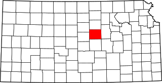
Saline County is located in the U.S. state of Kansas. Its county seat and largest city is Salina. As of the 2020 census, the county population was 54,303. The county was named after the Saline River.

Mentor is a census-designated place (CDP) in Saline County, Kansas, United States. As of the 2020 census, the population was 101. It is located south of Salina on Mentor Road.

Falun is a census-designated place (CDP) in southwestern Saline County, Kansas, United States. As of the 2020 census, the population was 83. It lies southwest of Salina and northwest of Lindsborg at the intersection of Forsse and Hedberg roads, approximately 7.5 miles west of Interstate 135, or about eight miles west of Assaria. It lies next to an abandoned railroad.

Bridgeport is a census-designated place (CDP) in Smoky View Township, Saline County, Kansas, United States. As of the 2020 census, the population was 64. It is located south of Salina, along K-4 near Interstate 135.

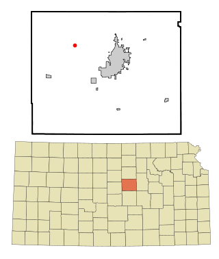
Kipp is a census-designated place (CDP) in Eureka and Solomon townships in Saline County, Kansas, United States. As of the 2020 census, the population was 60. It is located southeast of Salina, along Schilling Road between Whitmore Road and Kipp Road, next to an abandoned railroad.
Hedville is an unincorporated community in Ohio Township, Saline County, Kansas, United States. It lies along Hedville Road and a Kansas and Oklahoma Railroad line, 1.0 mile (1.6 km) south of Interstate 70, northwest of Salina. The Rolling Hills Zoo is located approximately 1.0 mile (1.6 km) south of the community.
Cambria Township is a township in Saline County, Kansas, United States.
Dayton Township is a township in Saline County, Kansas, United States.
Eureka Township is a township in Saline County, Kansas, United States.
Falun Township is a township in Saline County, Kansas, United States.
Glendale Township is a township in Saline County, Kansas, United States. The unincorporated community of Glendale is located within its boundaries.
Greeley Township is a township in Saline County, Kansas, United States.
Gypsum Township is a township in Saline County, Kansas, United States.
Liberty Township is a township in Saline County, Kansas, United States.
Ohio Township is a township in Saline County, Kansas, United States.
Pleasant Valley Township is a township in Saline County, Kansas, United States.
Smoky Hill Township is a township in Saline County, Kansas, United States.
Smoky View Township is a township in Saline County, Kansas, United States.
Smolan Township is a township in Saline County, Kansas, United States.
Washington Township is a township in Saline County, Kansas, United States.
References
- ↑ "Shipton, Kansas", Geographic Names Information System , United States Geological Survey, United States Department of the Interior
- ↑ "Kansas Post Offices, 1828-1961". Kansas Historical Society. Archived from the original on October 9, 2013. Retrieved June 23, 2014.
