Hariana is a town and a municipal council in Hoshiarpur district in the Indian state of Punjab. Hariana is named after Guru Hari Sen; the guru of the singer Tansen. It was a famous music gharana once. Gujjar Mal Vasudev raagi & Pandit Telu Ram were singers & residents of hariana.

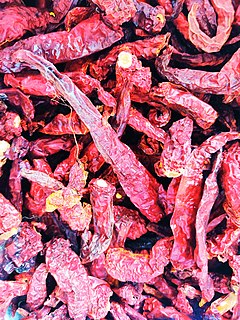
Haveri is a city in Karnataka, India. It is the administrative headquarters of Haveri district. Haveri is famous for its cardamom garlands and Byadagi red chillies. Around 25 km away, there is a place called Bada, which is the birthplace of the poet Kanakadasa.
Bhongir, officially known as, Bhuvanagiri is a district headquarters of the Yadadri Bhuvanagiri district and part of the Hyderabad Metropolitan Region of the Indian state of Telangana. Falling under Hyderabad Metropolitan Development Authority, the town is located on National Highway 163 & National Highway 161AA (India), about 47 km from state capital Hyderabad Central Point
Bhogpur is a town and a nagar panchayat in Jalandhar district in the state of Punjab, India. Bhogpur is the first city from the overall india who created its own website on city name. Bhogpur sugar mill is first Co-operative sugar mill and still running successfully.

Byadagi is a popular town in Haveri district, in the state of Karnataka, it is agricultural business centre.
Chikkanayakanahalli is a town in Tiptur sub-division of Tumakuru district, in the state of Karnataka, India. It is 30 km away from Tiptur and 132 km from Bangalore.
Chinchani is a Census Town in the Dahanu Taluka of Palghar District of Maharashtra, India.
Dhilwan is a town and a nagar panchayat in Kapurthala district in the state of Punjab, India.
Honnāli is a panchayat town in Davanagere district in the Indian state of Karnataka. Its name is derived from honnu alli, which means "gold".
Jobner is a tehsil headquarter and one of the oldest municipalities in Jaipur district in the Indian state of Rajasthan.
Kachhwa is a town and a nagar panchayat in Mirzapur district in the Indian state of Uttar Pradesh.

Kadipur is a town, tehsil and a nagar panchayat in Sultanpur district in the Indian state of Uttar Pradesh. It is located a short distance from the bank of the Gomti River, at a crossroads between two roads heading from Sultanpur to Surapur and from Pratapgarh to Dostpur and then on to Akbarpur. On the north side of town is a stream with a steep ravine that drains the surrounding area. The road to Sultanpur crosses over this stream on a bridge. The lands surrounding Kadipur are average quality for agricultural purposes. As of 2011, Kadipur has a population of 8,010 people, in 1,216 households.
Kiraoli is a town and a nagar panchayat in Agra district in the Indian state of Uttar Pradesh.
Kudligi is a panchayat town in Vijayanagara district in the India state of Karnataka. Kudligi is famous for its local Tamarind. Once upon a time Kudligi was called as "The Land of rich spices" for foreign tourists who came to Hampi. Now it is called as "The Tamarind Nadu". Here Kotthala Anjaneya festival is popular during Ugadhi Festival. Kudligi was ruled by few kings from Jarmali and Madakari kingdom. Gandhiji Chithabasma was carried by Bindu Madava and his friend Guddada Karnam Venkoba Rao.
Mairang is the headquarters of Eastern West Khasi Hills district of Meghalaya, India. It is located at about 40 km from the state capital Shillong, and 45 km (approx.) from Nongstoin along National Highway 106.
Pipraich is a town and a nagar panchayat in Gorakhpur district in the Indian state of Uttar Pradesh. The Pipraich block comes under the tehsil Sadar. It was declared a town on 25 November 1871, under the Bengal Chaukidari Act, of 1856 and is now administered as a town area under the U.P. Town Areas Act of 1914.
Sadasivpet is a town in Sangareddy district of the Indian state of Telangana.
Fatehabad is a town in Agra district in the state of Uttar Pradesh, India. It is nearly 35 km south-east of Agra in the direction of Etawah. The historical name of the town is Samugarh.
Hata is a town located at NH-28 having 25 wards and a Nagarpalika in Kushinagar district in the Indian state of Uttar Pradesh. It is situated 36 km away from Gorakhpur in east. It is a major town of Kushinagar district situated on NH -28. Nearest railway station is Gauri Bajar, which is 17 km away from the town and the next major market of Kaptanganj is located 23 km away from it. The gram panchayat of Dhadha Bujurg is located 3 km west from the town. Hata is the main market for wholesaler, local vendors & retailers.
Shirahatti is a panchayat town in Gadag district in the Indian state of Karnataka.


