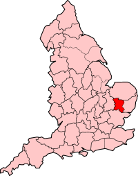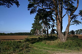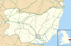
Suffolk is a ceremonial county of England in East Anglia. It borders Norfolk to the north, Cambridgeshire to the west and Essex to the south; the North Sea lies to the east. The county town is Ipswich; other important towns include Lowestoft, Bury St Edmunds, Newmarket, and Felixstowe which has one of the largest container ports in Europe.

Hadleigh is an ancient market town and civil parish in South Suffolk, East Anglia, situated, next to the River Brett, between the larger towns of Sudbury and Ipswich. It had a population of 8,253 at the 2011 census. The headquarters of Babergh District Council were located in the town until 2017.

Bury St Edmunds, commonly referred to locally as Bury, is a historic market, cathedral town and civil parish in Suffolk, England. Bury St Edmunds Abbey is near the town centre. Bury is the seat of the Diocese of St Edmundsbury and Ipswich of the Church of England, with the episcopal see at St Edmundsbury Cathedral.

West Suffolk was an administrative county of England created in 1889 from part of the county of Suffolk. It survived until 1974 when it was rejoined with East Suffolk. Its county town was Bury St Edmunds.

St Edmundsbury was a local government district and borough in Suffolk, England. It was named after its main town, Bury St Edmunds. The second town in the district was Haverhill. The population of the district was 111,008 at the 2011 Census.

Brantham is a village and civil parish in the Babergh district of Suffolk, England. It is located close to the River Stour and the border with Essex, around 2 miles (3 km) north of Manningtree, and around 9 miles (14 km) southwest of Ipswich.

Long Melford, colloquially and historically also referred to as Melford, is a large village and civil parish in the Babergh district, in the county of Suffolk, England. It is on Suffolk's border with Essex, which is marked by the River Stour, 3 miles (4.8 km) from Sudbury, approximately 16 miles (26 km) from Colchester and 14 miles (23 km) from Bury St Edmunds. It is one of Suffolk's "wool towns" and is a former market town. The parish also includes the hamlets of Bridge Street and Cuckoo Tye.

Alpheton is a village and civil parish in the Babergh district of Suffolk, England. Located on the A134 road about six miles north of Sudbury, in 2005 it had a population of 260, reducing to 256 at the 2011 Census. According to Eilert Ekwall the meaning of the village name is the homestead of Aelfled.

Donald Hanks McMorran RA FRIBA FSA was an English architect who is known today for his sensitive continuation of the neo-Georgian and classical tradition in the period after the Second World War. His buildings include halls of residence at the University of Nottingham, Wood Street Police Station in the City of London, public housing schemes around London, the South Block extension to the Old Bailey and civic buildings in Exeter and Bury St Edmunds.
Haughley is a village and civil parish in the English county of Suffolk, about two miles from Stowmarket in the Mid Suffolk District. The village is located 2 miles (3.2 km) miles northwest of the town of Stowmarket, overlooking the Gipping valley, next to the A14 corridor. The population recorded in 2011 was 1,638. Mentioned in the Domesday Book, it was the site of a castle, a church on the pilgrim's route to Bury St Edmunds Abbey, and a market. Adjacent farms on the north side of the village were also home to one of the first studies of organic farming and the first headquarters of the Soil Association.

Stanningfield is a village and former civil parish, since 1988 in the parish of Bradfield Combust with Stanningfield, in the West Suffolk district of the county of Suffolk, England. The village lies just off of the A134 road, about 5 miles (8 km) south-east of Bury St Edmunds, 5 miles/8 km north-west of Lavenham, and 10 miles/16 km north of Sudbury.

West Suffolk County Council was the county council of the non-metropolitan county of West Suffolk in east England. It came into its powers on 1 April 1889 and acted as the governing authority for the county until it was amalgamated with East Suffolk County Council to form Suffolk County Council in 1974. The county council was based at the Shire Hall Complex in Bury St Edmunds.

The Street is a linear settlement in the civil parish of Lawshall in the Babergh district in the county of Suffolk, England. It extends from Lawshall Hall in the west to Donkey Lane in the east. The settlement includes Swanfield, east of the Swan Public House and the small residential development of Hall Mead which is opposite All Saints Church.

East Suffolk County Hall is a historic building located in St Helen's Street in Ipswich. The building, which was the headquarters of East Suffolk County Council until 1974 and then of Suffolk County Council until 2004, is a Grade II listed building.

The Shire Hall is a municipal building in Fore Street, Hertford, the county town of Hertfordshire, England. The building, which currently serves as a Magistrates' Court, is a Grade I listed building.

The County Hall is a municipal building complex in Pegs Lane, Hertford, Hertfordshire. The building, which is the headquarters of Hertfordshire County Council, is a Grade II* listed building.

West Suffolk District is a local government district in Suffolk, England, which was established on 1 April 2019, following the merger of the existing Forest Heath district with the borough of St Edmundsbury. The two councils had already had a joint Chief Executive since 2011. At the 2011 census, the two districts had a combined population of 170,756. It is currently controlled by the Conservative Party.

The Shire Hall is a municipal building in St Paul's Square, Bedford, Bedfordshire. The shire hall, which was the headquarters of Bedfordshire County Council from 1888 to 1969, is a Grade II listed building.

Sudbury Town Hall is a municipal building in Gaol Lane in Sudbury, Suffolk, England. The building, which was the headquarters of Sudbury Borough Council, is a Grade II listed building.

The Shire Hall is a municipal building in Market Hill in Woodbridge, Suffolk, England. The structure, which is the meeting place of Woodbridge Town Council, is a Grade I listed building.


