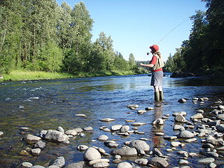
Shitepoke Creek

Last updated
Shitepoke Creek
Country United States
State Oregon
County Lane
Source Cascade Range
 - locationnear Dead Mountain, Willamette National Forest
 - elevation2,972 ft (906 m) [1]
 - coordinates 43°47′43″N122°22′02″W / 43.79528°N 122.36722°W / 43.79528; -122.36722   [2]
MouthSalmon Creek (Oregon)
 - locationeast of Oakridge
 - elevation1,611 ft (491 m) [2]
 - coordinates 43°46′41″N122°21′36″W / 43.77806°N 122.36000°W / 43.77806; -122.36000 Coordinates: 43°46′41″N122°21′36″W / 43.77806°N 122.36000°W / 43.77806; -122.36000   [2]
USA Oregon location map.svg
Red pog.svg
Location of the mouth of Shitepoke Creek in Oregon

Shitepoke Creek is a short tributary of Salmon Creek, which is a tributary of the Middle Fork Willamette River in Lane County, Oregon, in the United States. Arising between Dead Mountain and Eagle Butte in the Cascade Range, it flows south into the creek about 7 miles (11 km) east of Oakridge. Its entire course lies within the Willamette National Forest. [3]

Middle Fork Willamette River river in the United States of America

The Middle Fork Willamette River is one of several forks that unite to form the Willamette River in the western part of the U.S. state of Oregon. It is approximately 115 miles (185 km) long, draining an area of the Cascade Range southeast of Eugene, which is at the southern end of the Willamette Valley.

Lane County, Oregon county in Oregon, USA

Lane County is a county in the U.S. state of Oregon. As of the 2010 census, the population was 351,715, making it the fourth-most populous county in Oregon. The county seat is Eugene. It is named in honor of Joseph Lane, Oregon's first territorial governor.

Cascade Range mountain range in western North America

The Cascade Range or Cascades is a major mountain range of western North America, extending from southern British Columbia through Washington and Oregon to Northern California. It includes both non-volcanic mountains, such as the North Cascades, and the notable volcanoes known as the High Cascades. The small part of the range in British Columbia is referred to as the Canadian Cascades or, locally, as the Cascade Mountains. The latter term is also sometimes used by Washington residents to refer to the Washington section of the Cascades in addition to North Cascades, the more usual U.S. term, as in North Cascades National Park. The highest peak in the range is Mount Rainier in Washington at 14,411 feet (4,392 m).

Shitepoke is said by the author of From Squaw Tit to Whorehouse Meadow: How Maps Name, Claim, and Inflame to refer to a heron's tendency to defecate while flying. [4] Merriam-Webster says that the word, a combination of shite and poke , refers to a heron's tendency to defecate when startled. [5] Noting that the word shite "is not now in decent use", The Compact Edition of the Oxford English Dictionary (OED) of 1971 defines shitepoke as "the small green heron of North America", Butorides virescens . The OED's usage example is: "gulls, shitepokes, cranes". [6]

Heron family of birds

The herons are long-legged freshwater and coastal birds in the family Ardeidae, with 64 recognised species, some of which are referred to as egrets or bitterns rather than herons. Members of the genera Botaurus and Ixobrychus are referred to as bitterns, and, together with the zigzag heron, or zigzag bittern, in the monotypic genus Zebrilus, form a monophyletic group within the Ardeidae. Egrets are not a biologically distinct group from the herons, and tend to be named differently because they are mainly white or have decorative plumes in breeding plumage. Herons, by evolutionary adaptation, have long beaks.

Merriam-Webster American publisher

Merriam-Webster, Inc., is an American company that publishes reference books and is especially known for its dictionaries.

Shit is a word generally considered to be vulgar and profane in Modern English. As a noun, it refers to fecal matter, and as a verb it means to defecate; in the plural, it means diarrhoea. Shite is a common variant in British and Irish English. As a slang term, it has many meanings, including: nonsense, foolishness, something of little value or quality, trivial and usually boastful or inaccurate talk or a contemptible person. It could also be used to refer to any other noun in general or as an expression of annoyance, surprise or anger.

See also

Related Research Articles

Calapooia River river in the United States of America

The Calapooia River is an 80-mile (130 km) tributary of the Willamette River in the U.S. state of Oregon.

Luckiamute River watercourse in the United States of America

The Luckiamute River is a tributary of the Willamette River, about 61 miles (98 km) long, in western Oregon in the United States. It drains an area of Central Oregon Coast Range and the western Willamette Valley northwest of Corvallis.

Long Tom River river in the United States of America

The Long Tom River is a 57-mile (92 km) tributary of the Willamette River in western Oregon in the United States. It drains an area at the south end of the Willamette Valley between Eugene and Corvallis.

South Santiam River river in the United States of America

The South Santiam River is a tributary of the Santiam River, about 69 miles (111 km) long, in western Oregon in the United States. It drains an area of the Cascade Range into the Willamette Valley east of Corvallis.

Middle Santiam River river in the United States of America

The Middle Santiam River is a tributary of the South Santiam River, 38.5 miles (62.0 km) long, in western Oregon in the United States. It drains a remote area of the Cascade Range east of Sweet Home in the watershed of the Willamette River.

Whorehouse Meadow is a meadow located on the western slope of Steens Mountain southeast of Frenchglen, Oregon, United States. It lies within the Steens Mountain Wilderness. Lewis McArthur, writing about the landmark in Oregon Geographic Names, describes it as an "accessible but secluded meadow a mile east of Fish Lake."

Mission Creek (Marion County, Oregon) river in the United States of America

Mission Creek is a tributary, roughly 9 miles (14 km) long, of Champoeg Creek in Marion County in the U.S. state of Oregon. The creek arises southwest of St. Paul in the French Prairie region of the Willamette Valley and flows generally northeast to meet Champoeg Creek near Champoeg. The combined streams then flow less than 1 mile (1.6 km) before entering the Willamette River, 45 miles (72 km) from its confluence with the Columbia River.

Champoeg Creek river in the United States of America

Champoeg Creek is a tributary, roughly 6 miles (9.7 km) long, of the Willamette River in the U.S. state of Oregon. The creek is formed by the confluence of its two forks in the French Prairie region of the Willamette Valley and flows generally northeast to meet the Willamette 45 miles (72 km) from the river's confluence with the Columbia River. Its course lies entirely in Marion County.

The Brassiere Hills are a pair of summits in the City and Borough of Juneau, Alaska, United States. It is located at the northern end of Taku Inlet, 4.5 miles (7.2 km) north of Taku Point and 18 miles (29 km) northeast of the city of Juneau. The peaks are 2,405 feet (733 m) and 2,360 feet (719 m) high and a stream named Zipper Creek runs between them.

Jew Peak is a summit in Sanders County, Montana, in the United States. It has an elevation of 5,853 feet (1,784 m). Jew Peak is the 2,010th highest mountain in the state of Montana.

Squaw Humper Dam is a dam on Tahc'a Okute Wakpa in Oglala Lakota County, South Dakota, in the United States. It is located within Pine Ridge Indian Reservation, the lands of the Oglala Lakota Nation.

Shitten Creek river in the United States of America

Shitten Creek is a stream in Lane County, Oregon, in the United States.

Coon Butt is a summit in Blount County, Tennessee, in the United States. It is located within Great Smoky Mountains National Park. With an elevation of 2,326 feet (709 m), Coon Butt is the 422nd highest mountain of Tennessee.

S.O.B. Hill is a 5,866-foot (1,788 m), summit in San Juan County, Utah, in the United States.

Wee Wee Hill hill in United States of America

Wee Wee Hill is a hill in Highland Township, Franklin County, Indiana, in the United States. With an elevation of 981 feet (299 m), it is the 19th highest summit in Indiana.

Dancing Lady Mountain

Dancing Lady Mountain is a summit in Glacier County, Montana, in the United States and it is located within Glacier National Park. Dancing Lady is derived from a Blackfoot-language name. The mountain's former name of Squaw Mountain was changed due to ongoing controversy over the term "squaw".

Gook Creek is a stream in Antrim County, Michigan, in the United States. It is a tributary of the Jordan River.

Brilliant is an unincorporated community in Colfax County, in the U.S. state of New Mexico.

Gringo Gulch is a valley in Santa Cruz County, Arizona, in the United States.

Squaw Tits

Squaw Tits is a summit in Maricopa County, Arizona, in the United States. with an elevation of 2,478 feet (755 m).

References

  1. Source elevation derived from Google Earth search using GNIS source coordinates.
  2. 1 2 3 "Shitepoke Creek". Geographic Names Information System (GNIS). United States Geological Survey. November 28, 1980. Retrieved January 26, 2016.
  3. "United States Topographic Map". United States Geological Survey. Retrieved January 26, 2016 via Acme Mapper.
  4. Monmonier, Mark (September 15, 2008). From Squaw Tit to Whorehouse Meadow: How Maps Name, Claim, and Inflame. University of Chicago Press. p. 70. ISBN   978-0-226-53464-0.
  5. "shitepoke". Merriam-Webster. Retrieved 26 January 2016.
  6. The Compact Edition of the Oxford English Dictionary: Complete Text Reproduced Micrographically. II. Oxford University Press. 1971. p. 2791.