| Sierra de Villuercas | |
|---|---|
| Sierra de Guadalupe | |
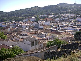
The Sierra de Villuercas and Santa Lucia Dam | |
| Highest point | |
| Peak | La Villuerca |
| Elevation | 1,603 m (5,259 ft) |
| Coordinates | 39°29′00″N5°24′00″W / 39.48333°N 5.40000°W Coordinates: 39°29′00″N5°24′00″W / 39.48333°N 5.40000°W |
| Dimensions | |
| Length | 62 km (39 mi)NW/SE |
| Width | 15 km (9.3 mi)NE/SW |
| Geography | |
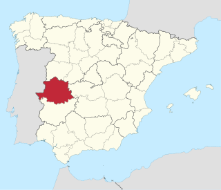
 Sierra de Villuercas Location in Spain | |
| Location | Extremadura |
| Country | Spain |
| Parent range | Montes de Toledo |
| Geology | |
| Orogeny | Alpine |
| Age of rock | Silurian |
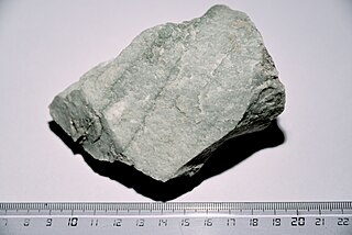
| Type of rock | Granite |


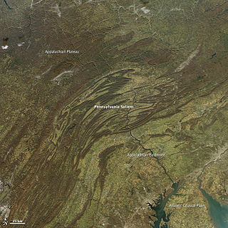
Sierra de Villuercas or Sierra de las Villuercas, also known as Sierra de Guadalupe after nearby Guadalupe town, is a mountain range in the greater Montes de Toledo range, Spain. It is located in province of Cáceres, autonomous community of Extremadura.

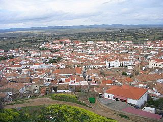
Guadalupe is a municipality located in Las Villuercas comarca, province of Cáceres, in Extremadura, Spain with currently just over 2,000 inhabitants. The monastery of Santa María de Guadalupe is situated here.

A mountain range or hill range is a series of mountains or hills ranged in a line and connected by high ground. A mountain system or mountain belt is a group of mountain ranges with similarity in form, structure, and alignment that have arisen from the same cause, usually an orogeny. Mountain ranges are formed by a variety of geological processes, but most of the significant ones on Earth are the result of plate tectonics. Mountain ranges are also found on many planetary mass objects in the Solar System and are likely a feature of most terrestrial planets.
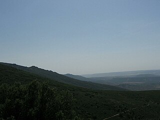
The Montes de Toledo are one of the main systems of mountain ranges in the Iberian Peninsula. They divide the drainage basin of the Tagus from the basin of the Guadiana. The highest peak is 1,603 m high La Villuerca.
Contents
Rivers Almonte and Ibor, tributaries of the Tagus, and the Ruecas and Guadalupe River, tributaries of the Guadiana, have their sources in this range.

The Almonte is a river in Spain. The 97 km long river is a left tributary of the Tajo, the longest river of the Iberian peninsula. It lies in its entirety in the Extremadura region.

The Tagus is the longest river in the Iberian Peninsula. It is 1,007 km (626 mi) long, 716 km (445 mi) in Spain, 47 km (29 mi) along the border between Portugal and Spain and 275 km (171 mi) in Portugal, where it empties into the Atlantic Ocean near Lisbon. It drains an area of 80,100 square kilometers (30,927 sq mi). The Tagus is highly utilized for most of its course. Several dams and diversions supply drinking water to places of central Spain and Portugal, while dozens of hydroelectric stations create power. Between dams it follows a very constricted course, but after Almourol it enters a wide alluvial valley, prone to flooding. Its mouth is a large estuary near the port city of Lisbon.

The Guadiana River, or Odiana, is an international river defining a long stretch of the Portugal-Spain border, separating Extremadura and Andalucia (Spain) from Alentejo and Algarve (Portugal). The river's basin extends from the eastern portion of Extremadura to the southern provinces of the Algarve; the river and its tributaries flow from east to west, then south through Portugal to the border towns of Vila Real de Santo António (Portugal) and Ayamonte (Spain), where it flows into the Gulf of Cádiz. With a course that covers a distance of 829 kilometres (515 mi), it is the fourth-longest in the Iberian peninsula, and its hydrological basin extends over an area of approximately 68,000 square kilometres (26,000 sq mi).