
In Spain, a comarca is either a traditional territorial division without any formal basis, or a group of municipalities, legally defined by an autonomous community for the purpose of providing common local government services. In English, a comarca is equivalent to a district, county, area or zone.

The Cerro de la Silla is a mountain and natural monument located within the metropolitan area of the city of Monterrey, Nuevo León, in northeastern Mexico. Named for its distinctive saddle-shaped profile when viewed from the west, it is a well-known symbol of the city of Monterrey, despite being located in the adjacent municipality of Guadalupe.

The Sierra Morena is one of the main systems of mountain ranges in Spain. It stretches for 450 kilometres from east to west across the south of the Iberian Peninsula, forming the southern border of the Meseta Central plateau and providing the watershed between the valleys of the Guadiana to the north and the west, and the Guadalquivir to the south.
The Cantabrian Mountains or Cantabrian Range are one of the main systems of mountain ranges in Spain. They stretch for over 300 km (180 miles) across northern Spain, from the western limit of the Pyrenees to the Galician Massif in Galicia, along the coast of the Cantabrian Sea. Their easternmost end meets the Sistema Ibérico.

Sierra Negra is an extinct volcano located in the Mexican state of Puebla, close to the border with Veracruz. At officially 4,580 metres (15,030 ft) above sea level, it is the fifth-highest peak in Mexico. Sierra Negra is overshadowed by nearby Pico de Orizaba.
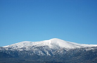
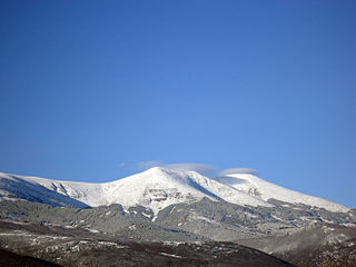
The Central System, Spanish and Portuguese: Sistema Central, is one of the main systems of mountain ranges in the Iberian Peninsula. The 2,592 m high Pico Almanzor is its highest summit.

The Sierra de Gredos is a mountain range in central Spain that spans the provinces of Ávila, Salamanca, Cáceres, Madrid, and Toledo. It is part of the much larger Sistema Central of mountain ranges. Its highest point is Pico Almanzor, at 2,592 meters and it has been declared a natural park by the Autonomous Community of Castile and León. The Sierra de Gredos is one of the most extensive mountain ranges of the Central System; it comprises five river valleys: the Alto Tormes, the Alto Alberche, the Tiétar Oriental, the Tiétar Occidental y la Vera, and the Valle del Ambroz. The first known inhabitants were the Vettones, a pre-Roman Celtic people. The central part of the range encomprises the Sierra de Gredos Regional Park.

Sierra de las Nieves is a mountain range of the Penibaetic System in Málaga Province, Andalusia, Spain with its highest point being La Torrecilla
Castilblanco is a municipality located in the province of Badajoz, Extremadura, Spain. According to the 2005 census (INE), the municipality has a population of 1146 inhabitants.

Guadalupe is a municipality of Spain located in the province of Cáceres, Extremadura. It has a total area of 68.19km2 and, as of 1 January 2021, a registered population of 1,822. The monastery of Santa María de Guadalupe is situated here.

The Sierra de Francia is a mountain range located in Sierra de Francia Comarca at the southern end of Salamanca Province, Castile and León, Spain. It is located about 70 km from Salamanca city. The region is sparsely inhabited and its few towns have great cultural value.
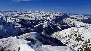
The Iberian System is one of the major systems of mountain ranges in Spain. It consists of a vast and complex area of mostly relatively high and rugged mountain chains and massifs located in the central region of the Iberian Peninsula, but reaching almost the Mediterranean coast in the Valencian Community in the east.
Pico de las Nieves is the highest peak and a stratovolcano on the island of Gran Canaria, Canary Islands, Spain. Its height is 1,949 metres (6,394 ft) above sea level. On its slopes, Canary Islands Pine was reintroduced in the 1950s.
The Montes de Toledo are one of the main systems of mountain ranges in the Iberian Peninsula. They divide the drainage basin of the Tagus from the basin of the Guadiana. The highest peak is 1,603 m (5,259 ft) high La Villuerca.

Las Villuercas is a comarca located in the province of Cáceres, western Spain. It belongs to the Autonomous Community of Extremadura.

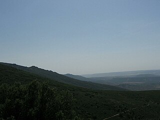
Sierra de Villuercas or Sierra de las Villuercas, also known as Sierra de Guadalupe after nearby Guadalupe town, is a mountain range in the greater Montes de Toledo range, Spain. It is located in province of Cáceres, autonomous community of Extremadura.

The Sierra Sur de Jaén is a mountain range that is part of the central belt of the Baetic System, Andalusia, Spain. Its name derives from its location in the southwestern part of Jaén Province. The highest summit in the range is 1,872 m high Pico Pandera; 1,722 m high Cerro de la Cruz is another notable peak.

Sierra de Algairén is a mountain range in Aragon, Spain, located between the comarcas of Campo de Cariñena and Comunidad de Calatayud. The ridge's highest summit is Pico de Valdemadera (1,276 m).
Sierra Norte de Sevilla or Sierra Norte is one of the western mountain ranges of the Sierra Morena, Andalusia, Spain. Its name derives from its location at the northern part of Sevilla Province. The highest point of the range is the 960 m high Cerro de La Capitana.

The Sierra de Francia is a comarca located at the southern end of Salamanca Province, Castile and León, Spain. It is located about 70 km from Salamanca city. It borders with the Las Hurdes and Las Batuecas comarcas of Extremadura to the south; the Campo Charro to the north and the Sierra de Béjar to the east. The region is sparsely inhabited and its few towns have great cultural value.


