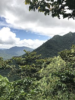
The Cumbres de Majalca National Park is a national park in the Mexican state of Chihuahua located 88 km northwest of the city of Chihuahua. The park showcases extraordinary rock formations that have been shaped by wind and water erosion. The park was created by presidential decree in 1939 encompassing 4,772 hectares to protect the endemic flora and fauna. The park is characterized by pine and oak forest. It is also one of the few areas in Mexico that are inhabited by black bear.

The Sierra de la Laguna pine–oak forests are a subtropical coniferous forest ecoregion, found in the Sierra de la Laguna mountain range at the southern tip of the Baja California Peninsula, Mexico.

The Sierra Madre Occidental pine–oak forests are a Temperate broadleaf and mixed forests ecoregion of the Sierra Madre Occidental range from the southwest USA region to the western part of Mexico. They are home to a large number of endemic plants and important habitat for wildlife.

The Veracruz moist forests is a tropical moist broadleaf forests ecoregion in eastern Mexico.

The Sierra Madre Oriental pine–oak forests are a Temperate broadleaf and mixed forests ecoregion of northeastern and Central Mexico, extending into the state of Texas in the United States.

The Trans-Mexican Volcanic Belt pine–oak forests is a subtropical coniferous forest ecoregion of the Trans-Mexican Volcanic Belt of central Mexico.

The Balsas dry forests is a tropical dry broadleaf forest ecoregion located in western and central Mexico.

The Central Mexican matorral is an ecoregion of the deserts and xeric shrublands biome of central Mexico. It is the southernmost ecoregion of the Nearctic realm.

The California coastal sage and chaparral is a Mediterranean forests, woodlands, and scrub ecoregion located in southwestern California and northwestern Baja California (Mexico). It is part of the larger California chaparral and woodlands ecoregion.

Sierra de Quila, officially the Sierra de Quila Flora and Fauna Protection Area, is a Mexican Flora and Fauna Protection Area in the state of Jalisco, Mexico. It has an area of 15,193 hectares, and is located within six municipalities: San Martín de Hidalgo, Tecolotlán, Cocula, Atengo, Tenamaxtlán, and Ameca.

The El Cielo Biosphere Reserve is located in the Sierra Madre Oriental in the southern part of the Mexican state of Tamaulipas near the town of Gómez Farias. The reserve protects the northernmost extension of tropical forest and cloud forest in Mexico. It has an area of 144,530 hectares made up mostly of steep mountains rising from about 200 metres (660 ft) to a maximum altitude of more than 2,300 metres (7,500 ft).

The Sierra de San Juan Biosphere Reserve is a protected area in Nayarit state of western Mexico. It was established in 2003, and has an area of 198.01 km2. It lies just southwest of the city of Tepic. It protects a portion of the Sierra de San Juan, a mountain range which lies between Tepic and the Pacific Ocean.
Bavispe Flora and Fauna Protection Area is a protected area in the state of Sonora in northwestern Mexico.
The Sierra de Huautla is a mountain range and biosphere reserve in central Mexico. Located in southern Morelos, the Sierra de Huautla is a southern extension of the Trans-Mexican Volcanic Belt range into the Balsas Basin. The dry forests of Sierra are home to a diverse community of animals and plants, and the reserve's outstanding biodiversity is recognized by UNESCO.
Los Mármoles National Park is a protected natural area in northeastern Mexico. It is located in the western Sierra Madre Oriental of northern Hidalgo.

El Triunfo Biosphere Reserve is a biosphere reserve in southern Mexico. It is in the Sierra Madre de Chiapas in southern Chiapas.
Cerro de Garnica National Park is a national park in Michoacán state of central Mexico. It protects 19.36 km2 in the mountains of the Trans-Mexican Volcanic Belt.

Insurgente José María Morelos y Pavón National Park is a national park in Michoacán state of central Mexico. It protects 71.92 km2 in the mountains of the Trans-Mexican Volcanic Belt.

El Tepozteco National Park is a national park in Morelos state of central Mexico. It protects 232.59 km2 in the mountains of the Trans-Mexican Volcanic Belt. The park includes El Tepozteco, an archeological site featuring an Aztec temple.

Sierra de Lobos is a mountain range in Guanajuato state of central Mexico, The mountains rise north of León. The range is a protected natural area, and provides surface water, groundwater recharge, wildlife habitat, and recreation for the surrounding region.


