
Interstate 45 (I-45) is a major Interstate Highway located entirely within the US state of Texas. While most Interstate routes which have numbers ending in "5" are cross-country north–south routes, I-45 is comparatively short, with the entire route located in Texas. Additionally, it has the shortest length of all the interstates that end in a "5." It connects the cities of Dallas and Houston, continuing southeast from Houston to Galveston over the Galveston Causeway to the Gulf of Mexico.

Mount Pleasant is a large suburban town in Charleston County, South Carolina, United States. In the Lowcountry, it is the fourth-most populous municipality in South Carolina, and for several years was one of the state's fastest-growing areas, doubling in population between 1990 and 2000. The population was 90,801 at the 2020 census. It is part of the Charleston metropolitan area.

The Arroyo Seco Parkway, also known as the Pasadena Freeway, is one of the oldest freeways built in the United States. It connects Los Angeles with Pasadena alongside the Arroyo Seco seasonal river. It is notable not only for being an early freeway, mostly opened in 1940, but for representing the transitional phase between early parkways and modern freeways. It conformed to modern standards when it was built, but is now regarded as a narrow, outdated roadway. A 1953 extension brought the south end to the Four Level Interchange in downtown Los Angeles and a connection with the rest of the freeway system.

U.S. Route 17 or U.S. Highway 17 (US 17), also known as the Coastal Highway, is a north–south United States Numbered Highway that spans in the Southeastern United States. It runs close to the Atlantic Coast for much of its length, with the exception of the portion between Punta Gorda and Jacksonville, Florida, and the portion from Fredericksburg to Winchester, Virginia, both of which follow a more inland route. Major metropolitan areas served along US 17's route include the Punta Gorda, Greater Orlando, and Jacksonville metropolitan areas in Florida, the Brunswick and Savannah metropolitan areas in Georgia, the Charleston and Myrtle Beach metropolitan areas in South Carolina, the Cape Fear and New Bern metropolitan areas in North Carolina, and the Hampton Roads and Winchester metropolitan areas in Virginia.
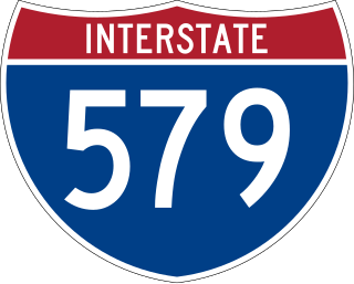
Interstate 579 (I-579) is a north–south Interstate Highway entirely within Pittsburgh, Pennsylvania. The highway is 2.73 miles (4.39 km) long. I-579 is also known as the Crosstown Boulevard since it crosses the backside of Downtown Pittsburgh.

A reversible lane is a managed lane in which traffic may travel in either direction, depending on certain conditions. Typically, it is meant to improve traffic flow during rush hours, by having overhead traffic lights and lighted street signs notifying drivers which lanes are open or closed to driving or turning.

The Cooper River is a mainly tidal river in the U.S. state of South Carolina. The cities of Mt. Pleasant, Charleston, North Charleston, Goose Creek, Moncks Corner, and Hanahan are located along the river. Short and wide, the river is joined first by the blackwater East Branch and then farther downstream at the tidal Wando River. Almost immediately thereafter, the Cooper River widens into its estuary and unites with the Ashley River to form the Charleston Harbor.

Interstate 526 (I-526) is a 19.56-mile (31.48 km) auxiliary route of I-26, providing a partial beltway around Charleston, South Carolina, in the United States. The route serves several purposes, firstly, as a bypass for through traffic on U.S. Route 17 (US 17) to avoid downtown Charleston, and, secondly, for traffic on I-26 bound for the coastal towns located north and south of Charleston. The route is not yet complete, as the western terminus it is planned for the route to be extended an additional 10 miles (16 km). After the eastern terminus, the roadway continues as a short business route, known as Interstate 526 Business.

The Arthur Ravenel Jr. Bridge is a cable-stayed bridge over the Cooper River in South Carolina, US, connecting downtown Charleston to Mount Pleasant. The bridge has a main span of 1,546 feet (471 m), the third longest among cable-stayed bridges in the Western Hemisphere. It was built using the design–build method and was designed by Parsons Brinckerhoff.
The Cooper River Bridge Run is a 10-kilometer (6.2 mi) one-way road running event across the Arthur Ravenel Jr. Bridge held in the cities of Mount Pleasant and Charleston in South Carolina, on the first Saturday in April. The Bridge Run is the only competition in South Carolina sanctioned by USA Track and Field as an elite event. Based on number of race finishers, the event is the third largest 10K and the fifth largest road race in the United States.

The John P. Grace Memorial Bridge, or the Cooper River Bridge as it was familiarly known, was a cantilever bridge that crossed the Cooper River in Charleston, South Carolina. It opened on August 8, 1929, and was built by the Cooper River Bridge Company. Shortridge Hardesty of Waddell & Hardesty, a New York City-based engineering firm, designed the bridge.

Interstate 95 (I-95) is an Interstate Highway running along the East Coast of the United States from Miami, Florida, north to the Canada–United States border in Houlton, Maine. In the state of Delaware, the route runs for 23.43 miles (37.71 km) across the Wilmington area in northern New Castle County from the Maryland state line near Newark northeast to the Pennsylvania state line in Claymont. I-95 is the only primary Interstate Highway that enters Delaware, although it also has two auxiliary routes within the state. Between the Maryland state line and Newport, I-95 follows the Delaware Turnpike, a toll road with a mainline toll plaza near the state line. Near Newport, the Interstate has a large interchange with Delaware Route 141 (DE 141) and the southern termini of I-295 and I-495. I-95 becomes the Wilmington Expressway from here to the Pennsylvania state line and heads north through Wilmington concurrent with U.S. Route 202 (US 202). Past Wilmington, I-95 continues northeast to Claymont, where I-495 rejoins the route right before the Pennsylvania state line.

Interstate 85 (I-85) in the US state of South Carolina runs northeast–southwest through Upstate South Carolina. Connecting regionally with Atlanta, Georgia, and Charlotte, North Carolina, it became the first Interstate Highway in South Carolina to have its originally planned mileage completed.

Interstate 64 (I-64) is an Interstate Highway in the US state of West Virginia. It travels east–west through the state for 189 miles (304 km) passing by the major towns and cities of Huntington, Charleston, Beckley, and Lewisburg.

Interstate 55 (I-55) in Tennessee lies entirely within the city of Memphis, located in Shelby County. The highway enters the city from Southaven in Desoto County, Mississippi, and passes through the Whitehaven area of the city, bypassing Memphis International Airport to the west.

Interstate 26 (I-26) is a South Carolina Interstate highway running generally east–west from near Landrum, in Spartanburg County, to U.S. Route 17 (US 17), in Charleston, South Carolina. It is also the longest Interstate Highway in South Carolina.
U.S. Highway 17 (US 17) is a 221.454-mile (356.396 km) north–south United States Numbered Highway in the U.S. state of South Carolina located near the Atlantic Ocean. The highway enters the state from Georgia at the Savannah River and serves Hardeeville, Charleston, Georgetown, and Myrtle Beach, before entering North Carolina near Calabash.
The Yadkin River bridges are bridges crossing the Yadkin River between Rowan and Davidson Counties near Spencer, North Carolina in the United States. The northbound span of the Yadkin River Veterans Memorial Bridge, the first of two carrying Interstate 85 / U.S. Highway 52, opened May 5, 2012, and on August 2, 2012, southbound traffic moved to that span as well. A southbound span of the same bridge was completed in October 2012 and opened to traffic in March 2013. Each span carries four lanes of traffic.
Pearman is a surname. Notable people with the surname include:
The Yadkin River Veterans Memorial Bridge is a pair of bridges, each carrying four lanes of I-85/US 52 across the Yadkin River between Rowan and Davidson Counties near Spencer, North Carolina in the United States. The northbound span opened May 5, 2012, and on August 2, 2012, southbound traffic moved to that span as well. A southbound span of the same bridge was completed in October 2012 and opened to traffic in March 2013. The pair of bridges replaces twin spans that carried I-85/US 52 from 1957 to 2012, which were separated by less than 1,000 feet (300 m). Adjacent are two Warren deck trusses carrying the North Carolina Railroad and Norfolk Southern, one bridge carrying US 29/US 70/NC 150, and the historic concrete arch Wil-Cox Bridge.

