
Hamirpur is a city and a municipal board in Hamirpur district in the Indian state of Uttar Pradesh. It is the administrative headquarters of Hamirpur district.

Bachhrawan is a town and nagar panchayat in Rae Bareli district in the state of Uttar Pradesh, India. It is the seat of a community development block. It is located on the main Raebareli-Lucknow road, at the intersection with roads leading to Maharajganj, Mallawan, Haidergarh, and Gurbakhshganj. The railway runs parallel with the Raebareli-Lucknow road, and there is a train station on the west side of town. First upgraded to municipal status in 1935, Bachhrawan hosts a Ramlila festival on Asvina Sudi 10, which involves a dramatic reenactment of the Ramayana. Vendors bring various everyday items to sell at the festival. As of 2011, the population of Bachhrawan is 12,521, in 2,359 households.
Dataganj is a town and a nagar palika in Badaun district in the state of Uttar Pradesh, India.

Deoria is a city in the state of Uttar Pradesh, India. It is one of five tehsils of the Deoria district. Deoria is located 51 km east of Gorakhpur and about 317 km from the state capital Lucknow. It shares its east border with Bihar.
Dhampur is a city and a municipal board in Bijnor district in the state of Uttar Pradesh, India. It is located at 29.51°N 78.50°E, and lies in Northern India. Dhampur is known for having one of the Asian largest Sugar Mills. Also is a popular place for students due to existence of two degree colleges.
Dhanuha is a census town in Jaunpur district in the state of Uttar Pradesh, India.
Dostpur is a town and a nagar panchayat in Sultanpur district in the state of Uttar Pradesh, India. The town borders Sultanpur and Ambedkarnagar. Purvanchal Expressway passes near the town.

Fatehpur Chaurasi is a town and a nagar panchayat in Unnao district in the state of Uttar Pradesh, India. First officially classified as a town for the 1981 census, Fatehpur Chaurasi is located on the north bank of the Kalyani river, a bit to the south of the main road from Unnao to Bangarmau. Local industries include the production of furniture, boxes, almirahs, shoes, and slippers. As of 2011, the town's population is 6,715, in 1,158 households.

Ganj Muradabad is a town and nagar panchayat in Safipur tehsil of Unnao district, Uttar Pradesh, India. It also serves as the headquarters of a community development block containing 86 rural villages. Handicrafts are a major industry here. As of 2011, Ganj Moradabad has a population of 10,957, in 1,723 households.
Jalalpur is a town, tehsil and a municipal board in Ambedkar Nagar district in the Indian state of Uttar Pradesh, India.
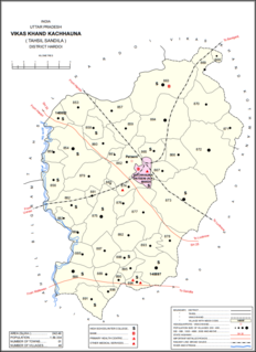
Kachhauna Patseni is a town and a nagar panchayat in Sandila tehsil of Hardoi district, Uttar Pradesh, India. It was first upgraded to urban status for the 1981 census. As of 2011, its population is 15,647, in 2,772 households. The Kachhauna community development block encompasses the rural areas surrounding the town.
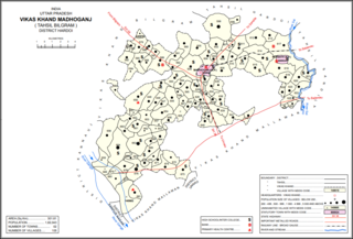
Madhoganj is a city and Nagar Panchayat in Bilgram tehsil of Hardoi district, Uttar Pradesh, India. It is located on the north side of the main road from Sitapur to Kanpur, with other roads leading to Bilgram to the northwest, Mallawan to the south, and Beniganj and Balamau to the east. As of 2011, the population of Madhoganj is 11,523, in 2,180 households. It is also the seat of a community development block.
Nyotini is a town and nagar panchayat in Hasanganj tehsil of Unnao district, Uttar Pradesh, India. Located 3 km southeast of Hasanganj on the right bank of the Sai river, Nyotini was historically one of the main centres of Muslim settlement in the district and it has several mosques and shrines. As of 2011, its population is 7,577, in 1,212 households.
Ugu is a town and a nagar panchayat in Unnao district in the Indian state of Uttar Pradesh. First officially classified as a town for the 1981 census, Ugu is an old town with medieval ruins that hosts a biweekly market and an annual mela. It is located on the main Unnao-Hardoi road, a bit northwest of Safipur. Some of the main items manufactured here are shoes, slippers, furniture, and lipstick cover. As of 2011, the population is 6,318, in 1,044 households.
Usawan is a town and a Nagar panchayat in Badaun District in the Indian state of Uttar Pradesh.
Hyderabad is a town and nagar panchayat in Hasanganj tehsil of Unnao District, Uttar Pradesh, India. It is located on the main Unnao-Sandila road, near its intersection with the road connecting Lucknow and Bangarmau. Major commodities produced in Hyderabad include roasted rice, food products, and earthenware pottery. As of 2011, its population is 7,697 people, in 1,328 households.
Antu is a town and a nagar panchayat in the Community Development Block Sandwa Chandrika, Pratapgarh Teshil, Pratapgarh district in the state of Uttar Pradesh, India, located 20.6 km northwest of the district administrative headquarter Bela Pratapgarh and 4.7 km northeast of Sandwa Chandrika. The territory of the town has 2 square kilometers. It is divided into 10 wards. The postal Zip Code is 230501.
Kursath, also spelled Kursat, is a town and nagar panchayat in Unnao district in the Indian state of Uttar Pradesh. It is watered by the Sai river, which flows about 1.5 km to the north, and the Bangarmau-Hasanganj road passes about 4 km to the south of the town. The soil here is mostly loam and clay, with a small amount of sand. The main crops are wheat, barley, bejhar, juwar, bajra, paddy, maize, and sugarcane. Irrigation is provided mainly by canal.
Dalheri is a village in Saharanpur district, Uttar Pradesh state, India.

Taudhakpur, also known as Mirzapur Urf Taudhakpur, is a remote village located in Raebareli district, in the state of Uttar Pradesh, India. The village is 31 km from Raebareli and 87 km from Lucknow. As of 2011, the village had the population of 833 with 70.43% literacy rate. With the introduction of a digitized information center and modern-age communication facilities in 2018, Taudhakpur became the first smart village of India.


