 Administrative Map | |
| Country | |
| State | |
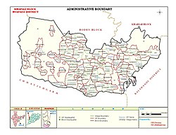
| District | Nuapada |
| Government | |
| • Type | Rural Local Self – Government |
| • Body | Panchayat Samiti |
| • BDO | Sarbeswar Jal, OAS [1] |
| • Tahasildar | Upanjali Majhi, OAS [1] |
| Area | |
• Total | 420.44 km2 (162.33 sq mi) |
| Population (2011) [2] | |
• Total | 109,870 |
| • Density | 260/km2 (680/sq mi) |
| PIN | 766108 [3] |
Sinapali is a Panchayat Samiti (Block) in Nuapada District of Odisha. There are five blocks in Nuapada and Sinapali one of them.