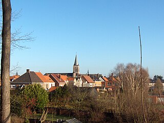
Sint-Martens-Lierde is a village which is part of the municipality of Lierde. It is located in the Denderstreek and in the Flemish Ardennes, the hilly southern part of the Belgian province of East Flanders.

Deftinge is a village which makes up part of the municipality of Lierde. It is located in the Denderstreek and in the Flemish Ardennes, the hilly southern part of the Belgian province of East Flanders. It was an independent municipality until 1977 when it was merged into Lierde.

Hemelveerdegem is a village and borough which makes up part of the municipality of Lierde in the Denderstreek in the Belgian province of East Flanders. The village and estate were ruled from 1752 by the armigerous Boelare family.

Kemzeke is a village in the Belgian municipality of Stekene in the province of East-Flanders. Until 1977, it was an independent municipality. It is located between the Dutch border and Sint-Niklaas.

Klein-Sinaai is a village near the Dutch border in the Belgian municipality of Stekene in the province of East Flanders. Until 1977 it was a part of the municipality of Sinaai.

Nederbrakel is a town in the municipality of Brakel. It is located in the Denderstreek and in the Flemish Ardennes, the hilly southern part of the province of East Flanders, Belgium. With 5,972 residents as of 2000, it forms the largest individual part of the municipality. Nederbrakel is located near the language border.
Michelbeke is a village in the municipality of Brakel, Belgium. It is located in the Denderstreek and in the Flemish Ardennes, the hilly southern part of the province of East Flanders, Belgium. It was itself a municipality until the fusion of the municipalities on 1 January 1971.
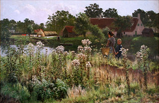
Sint-Maria-Oudenhove is a village in the Denderstreek and in the Flemish Ardennes, the hilly southern part of the province of East Flanders, Belgium.

Welden is a village in the municipality of Oudenaarde in the province of East Flanders, Belgium, and is situated along the Scheldt. It is located about 20 kilometres (12 mi) south of Ghent.

Opbrakel is a village and deelgemeente (sub-municipality) of the municipality of Brakel. It is located in the Denderstreek in the province of East Flanders in Belgium. It used to be an independent municipality until 1971 when it was merged into Brakel.

Erwetegem is a village and deelgemeente (sub-municipality) belonging to the municipality of Zottegem. It is located in the Denderstreek and in the Flemish Ardennes, the hilly southern part of the province of East Flanders, Belgium. Erwetegem used to an independent municipality until 1970.

Hansbeke is a village and deelgemeente (sub-municipality) in the municipality of Deinze in the Belgian province of East Flanders. The village is located about 13 kilometres (8.1 mi) west of Ghent.

Haasdonk is a village and deelgemeente (sub-municipality) of Beveren in East Flanders, Belgium. Haasdonk was an independent municipality until 1 January 1977, when it merged with Beveren as part of the fusion of municipalities in Belgium. It is located about 12 kilometres (7.5 mi) west of Antwerp.

Waarloos is a village and deelgemeente (sub-municipality) of the municipality of Kontich in the province of Antwerp, Belgium. The village is located about 13 kilometres (8.1 mi) south of the city of Antwerp.
Astene is a village and deelgemeente (sub-municipality) in the municipality of Deinze in the Belgian province of East Flanders. The village is located along the Leie River and about 13 kilometres (8.1 mi) south-west of Ghent.

Sleidinge is a village in the municipalities of Evergem in the province of East Flanders, Belgium. It is located about 10 kilometres (6.2 mi) north-west of Ghent.

Liezele is a village and deelgemeente (sub-municipality) of the municipality of Puurs-Sint-Amands in the province of Antwerp, Belgium. The village is located about 20 kilometres (12 mi) south-south-west of the city of Antwerp. On the night of 4 to 5 September 1914, the entire village was destroyed by the Belgian Army to deny the Germany Army cover.

Viane is a village in the Geraardsbergen municipality of the East Flanders province in the Flemish Community of Belgium. The village is situated in the Denderstreek in the south east of the province, on the border with Flemish Brabant and Hainaut. The river Mark separates the village from the rest of Geraardsbergen.

Kallo is a village and deelgemeente (sub-municipality) of Beveren in East Flanders, Belgium. Kallo was an independent municipality until 1 January 1977, when it merged with Beveren as part of the fusion of municipalities in Belgium. Most of the deelgemeente consists of harbours and industrial zones.
Bevere is a village in the municipality of Oudenaarde. It is located in the Flemish Ardennes, the hilly southern part of the province of East Flanders, Belgium. In the mid-19th century, it started to form a single urban area with Oudenaarde, but retained some rural parts.