Sipacapa

Last updated
Sipacapa
San Bartolomé Sipacapa
Guatemala location map.svg
Red pog.svg
Sipacapa
Location in Guatemala
Coordinates: 15°12′44″N91°38′05″W / 15.21222°N 91.63472°W / 15.21222; -91.63472
Country Flag of Guatemala.svg Guatemala
Department Vlagsanmarcos.gif San Marcos
Municipality Sipacapa
Government
  Type Municipal
  Mayor (2016-2020)Carlos Domingo [1] (LIDER)
Population
 (Census 2002) [2]
   Municipality of Guatemala 14,043
   Urban
623
  Ethnicities
Sipakapense Ladino
  Religions
Roman Catholicism Evangelicalism Maya
Climate Cwb

Sipacapa is a municipality in the San Marcos department, situated in the Western highlands of Guatemala. Sipacapa's population of around 14,000 is spread among 14 village communities, scattered over mountainous terrain. Sipacapa is considered a linguistic community, as Sipakapense is a Maya language unique to the municipality.

Contents

History

Bishop Pedro Cortes y Larraz portrait; he arrived to Tejutla in 1770. Pedrocortesylarraz.jpg
Bishop Pedro Cortés y Larraz portrait; he arrived to Tejutla in 1770.

In 1690, Tejutla had a large area and included the modern municipalities of Comitancillo, Ixchiguán, Concepción Tutuapa, Sipacapa, Sibinal, Tajumulco, Tacaná and part of what is now San Miguel Ixtahuacán. According to the historical writings from Recordación Florida of Francisco Antonio de Fuentes y Guzmán, Tejutla belonged to Quetzaltenango Department and it was a "prosperous land with rich weathers and comfortable forest with enough water". [3]

Tejutla was an important commercial and religious center; in August 1767, Joseph Domingo Hidalgo described Santiago Tejutla as "El Curato" -i.e., the focal center of commerce of all the towns that were around it− in the Gaceta de Guatemala, the official newspaper of the times. Then, in the last quarter of the 18th century, bishop Dr. Pedro Cortés y Larraz, who arrived from Cuilco in 1770 as part of the inspection he was doing of the Guatemalan dioceses, called Tejutla "Santiago en la Cima del Monte" (English: Santiago at the top of the hill" and reported that there were "sixty four families who lived very well" in the area. [4]

The Central American United Provinces constitution from 11 October 1821, showed Tejutla under modern San Marcos jurisdiction for the very first time.

In 1870 Tejutla reached "Villa" category and, due to its development, its authorities requested to the House of Representatives of Guatemala to be named a Department capital. The department was going to have the municipalities mentioned above, along with the modern municipalities of Cuilco, Santa Bárbara and San Gaspar, Huehuetenango, from the modern Huehuetenango Department. Besides, in those days, Motocintla, Cacahuatán and Tapachula—which would go definitively to México in 1892 due to the Herrera-Mariscal treaty [5] [6] — were under the jurisdiction of the Mercedarian convent located in Tejutla. Furthermore, Tejutla even had House representatives of its own in those days.

But power shifted when the conservatives led by Field Marshal Vicente Cerna were defeated by the liberal forces of generals Miguel Garcia Granados and Justo Rufino Barrios −who was a San Lorenzo native; once the liberals were in power, the expelled the regular clergy from Guatemala leaving Tejutla without their main administrative and leadership support, the Mercedarians. In fact, Barrios government confiscated monasteries, large extensions of farm land, sugar mills and Indian doctrines from the Mercedarians and other regular orders and then distributed it to his liberal friend and comrades, who became large landowners in the area. [7]

21st century

In 2009 Sipacapa was the center of a dispute between local residents, who primarily identified as (Sipakapense), and Goldcorp, a Canadian company that operates an open pit goldmine mostly the neighbouring municipality of San Miguel Ixtahuacán, but partially in Sipacapa. This dispute has been documented in a documentary film production, "Sipakapa No Se Vende" (Sipacapa Is Not For Sale). [8] [9] Further information on the mine and the dispute is contained in the article on Marlin mine.

Climate

Sipacapa has temperate climate (Köppen: Cwb).

Climate data for Sipacapa
MonthJanFebMarAprMayJunJulAugSepOctNovDecYear
Average high °C (°F)21.6
(70.9)
22.5
(72.5)
24.3
(75.7)
24.9
(76.8)
24.4
(75.9)
23.0
(73.4)
22.9
(73.2)
23.4
(74.1)
22.8
(73.0)
22.2
(72.0)
22.1
(71.8)
21.4
(70.5)
23.0
(73.3)
Daily mean °C (°F)14.6
(58.3)
15.1
(59.2)
16.8
(62.2)
17.8
(64.0)
18.2
(64.8)
17.7
(63.9)
17.4
(63.3)
17.4
(63.3)
17.2
(63.0)
16.7
(62.1)
15.8
(60.4)
14.8
(58.6)
16.6
(61.9)
Average low °C (°F)7.6
(45.7)
7.8
(46.0)
9.4
(48.9)
10.8
(51.4)
12.1
(53.8)
12.5
(54.5)
11.9
(53.4)
11.4
(52.5)
11.7
(53.1)
11.3
(52.3)
9.5
(49.1)
8.3
(46.9)
10.4
(50.6)
Average precipitation mm (inches)7
(0.3)
9
(0.4)
25
(1.0)
56
(2.2)
146
(5.7)
270
(10.6)
183
(7.2)
181
(7.1)
256
(10.1)
177
(7.0)
34
(1.3)
10
(0.4)
1,354
(53.3)
Source: Climate-Data.org [10]

Geographic location

Sipacapa is 85 km north of municipal capital, San Marcos. [11]

See also

Notes and references

Related Research Articles

<span class="mw-page-title-main">Huehuetenango Department</span> Department of Guatemala

Huehuetenango is one of the 22 departments of Guatemala. It is located in the western highlands and shares the borders with the Mexican state of Chiapas in the north and west; with El Quiché in the east, with Totonicapán, Quetzaltenango and San Marcos in the south. The capital is the city of Huehuetenango.

<span class="mw-page-title-main">San Marcos Department</span> Department of Guatemala

San Marcos is a department in northwestern Guatemala, on the Pacific Ocean and along the western Guatemala-Mexico border.

San Bartolomé Milpas Altas is a town and municipality in the Guatemalan department of Sacatepéquez.

<span class="mw-page-title-main">Chiantla</span> Municipality in Huehuetenango, Guatemala

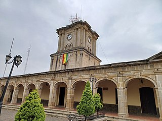
Chiantla is a town and municipality in the Guatemalan department of Huehuetenango. The municipality is situated at 2,000 metres above sea level and covers an area of 521 km2. The annual festival is on January 28.

<span class="mw-page-title-main">Jacaltenango</span> Municipality in Huehuetenango, Guatemala

Jacaltenango is a town and municipality situated in the Western Highlands of Guatemala. It is located in a valley surrounded by the Sierra Madre Mountains. Jacaltenango serves as the municipal seat for the surrounding municipality of the same name. In 2002, its urban population was about 23,500 but at the 2018 census the town's population has decreased to 22,533.

<span class="mw-page-title-main">San Pedro Soloma</span> Municipality in Huehuetenango, Guatemala

San Pedro Soloma is a town and municipality of Huehuetenango, a department of Guatemala. It is located in the Sierra de los Cuchumatanes at 2,300 m above sea level. The municipality covers a total area of 264 km2 with elevations ranging from 1,900 m to 3,500 m. Its population of 49,030 is spread over the town of Soloma, 19 villages and 50 smaller rural communities (caserios).

Concepción Chiquirichapa is a municipality in the Guatemalan department of Quetzaltenango in the Western Highlands of Guatemala, 14 kilometers west of the departmental capital of Quetzaltenango, and 214 kilometers west of the capital Guatemala City. The municipality has a population of 17,342, 98% of whom identify as indigenous Maya-Mam and speak a dialect of Southern Mam.

<span class="mw-page-title-main">San Juan Ostuncalco</span> Municipality and town in Quetzaltenango, Guatemala

San Juan Ostuncalco, is a town, with a population of 20,763, and a municipality in the Quetzaltenango department of Guatemala. Beside Spanish, local people speak the Mam language.

Comitancillo is a town and municipality in the San Marcos department of Guatemala.The spoken language is Mam.The municipality was founded by the Spaniards between 1633 and 1648 year. There is an archaeological site called Chipel, with remains of the Mam culture.

Concepción Tutuapa is a town and municipality in the San Marcos department of Guatemala. It had a population of 49,363 according to the census of 2002 and of the 2018 census there is a total population of 68,148.

<span class="mw-page-title-main">Ixchiguán</span> Place in San Marcos, Guatemala

Ixchiguán is a municipality in the San Marcos department of Guatemala. The economy is based on temporary work force on the coffee plantations, respectively on a male migrating work force in Mexico.

Malacatán is a town and municipality in the San Marcos department of Guatemala, located to the west of San Marcos town. It is fairly close to the border with Mexico - the border-crossing point is in the nearby village of El Carmen.

<span class="mw-page-title-main">Tejutla, San Marcos</span> Place in San Marcos, Guatemala

Tejutla is a municipality in the western highlands of Guatemala, in the department of San Marcos. Tejutla was officially founded on 25 July 1672, although it was already an important town within the Mam kingdom in 1524, at the time of the Spanish conquest of Guatemala. It is situated high in the mountains, the so-called "cold zone", at about 2500 m altitude.

San Miguel Ixtahuacán is a municipality in the San Marcos department of Guatemala. It comprises 19 villages, and the population is about 39,000 people. The majority of people are ethnically Maya- Mam and speak the Mam and Spanish languages. Most inhabitants subsist by farming, growing crops of corn, beans, vegetables and fruits, irrigated from the Cuilco River and its tributaries.

Sibinal is a municipality in the San Marcos department of Guatemala. Its name comes from mam tziben (English: "Writing" and nal, meaning "Bernard writings" It was founded in February 1799. It is a mountainous municipality at an altitude about 2500 m near the Mexican-Guatemalan border. The village of Sibinal is one of the points for climbing towards the Volcano Tacaná.

Tacaná is a town and municipality in the Guatemalan department of San Marcos.

Tajumulco is a municipality in the San Marcos department of Guatemala.

Concepción is a municipality in the Sololá department of Guatemala. The outstanding characteristic of the municipality is that 100% of its inhabitants are native people.

San Andrés Semetabaj is a municipality in the Sololá department of Guatemala. According to Jorge Luis Arriola's Geonimias de Guatemala, Semetabaj means "stone of glass-like appearance" and originates from the Spanish word "semet", which means : bottle or flask and, by extension, glass, and by the k'akch'iquel "abaj" which means "stone". Originally, it was called San Andrés Limetabaj.

<span class="mw-page-title-main">Pedro Cortés y Larraz</span>

Pedro Cortés y Larraz was Archbishop of Guatemala between 1767 and 1779 and bishop of Tortosa between 1780 and 1786.

References

  1. "San Marcos elige autoridades municipales". Prensa Libre (in Spanish). Guatemala. 8 September 2015. Retrieved 8 September 2015.
  2. "XI Censo Nacional de Poblacion y VI de Habitación (Censo 2002)". Instituto Nacional de Estadística. 2002.
  3. Fuentes y Guzmán 1932.
  4. Cortés y Larraz 1770.
  5. Comisión Guatemalteca de Límites con México (1900). Memoria sobre la cuestión de límites entre Guatemala y México (in Spanish). Guatemala: Tipografía Nacional. p. 325.
  6. "Nuestras fronteras". La Ilustración Guatemalteca (in Spanish). Guatemala: Síguere, Guirola y Cía. I (13). 1896.
  7. Castellanos Cambranes, Julio (1992). "5. Tendencias del desarrollo agrario en el siglo XIX y surgimiento de la propiedad capitalista de la tierra en Guatemala" (PDF). 500 años de lucha por la tierra. Estudios sobre propiedad rual y reforma agraria en Guatemala (in Spanish). Guatemala: FLACSO. 1.
  8. Mariano Aiello & Kristina Hille. "Open-pit mining of gold in Guatemala: Marlin Project". Manacudo Films. Archived from the original on 2008-05-05. Retrieved 2008-06-02.
  9. Dir. Álvaro Revenga. "Sipakapa No Se Vende". Caracol Producciones. Retrieved 2009-03-04.
  10. "Climate: Sipacapa". Climate-Data.org. Retrieved 5 September 2015.
  11. 1 2 3 SEGEPLAN. "Municipios del departamento de San Marcos". Secretaría General de Planificación (in Spanish). Archived from the original on 10 July 2015.

Bibliography

15°12′44″N91°38′05″W / 15.21222°N 91.63472°W / 15.21222; -91.63472