
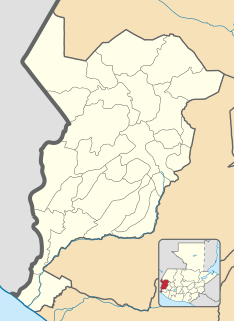
San Marcos (elevation: 7,868 feet is a city and municipality in Guatemala. It is the capital of the department of San Marcos. The municipality has a population of 47,063.

San Miguel Chicaj is a town and municipality in the Baja Verapaz department of Guatemala. San Miguel Chicaj has an area of 280 Km², which makes one of the largest municipality of Baja Verapaz Department. It has a population of 33,131, mostly of achí background.
Comitancillo is a town and municipality in the San Marcos department of Guatemala.The spoken language is Mam.The municipality was founded by the Spaniards between 1633 and 1648 year. There is an archaeological site called Chipel, with remains of the Mam culture.
Concepción Tutuapa is a town and municipality in the San Marcos department of Guatemala. It had a population of 49,363 according to the census of 2002 and of the 2018 census there is a total population of 68,148.
El Quetzal is a town and municipality in the San Marcos department of Guatemala. It was recognised as municipality on 19 June 1900. The major source of income is the agriculture.

Esquipulas Palo Gordo is a town and municipality in the San Marcos department of Guatemala. The town was founded on 24 December 1826 year. In the 1920s it was merged with San Marcos, but in 1948 it recovered its autonomy again.
Ixchiguán is a municipality in the San Marcos department of Guatemala. The economy is based on temporary work force on the coffee plantations, respectively on a male migrating work force in Mexico.

Ocós is a municipality in the San Marcos Department of Guatemala. It is situated on the Pacific Ocean coast, very close to the border with Mexico at 4 m (13 ft) altitude and two big rivers: the Suchiate and the Naranjo rivers. On 23 January 2014, it lost about 2/3 of its territory when La Blanca was named the thirtieth San Marcos Department municipality.
Pajapita is a town and municipality in the San Marcos department of Guatemala.It was created on 31 May 1920, after the station of Vado Ancho on the Panamerican Railroad of Guatemala was built. Due to its privileged location on the way from Guatemala to Mexico, Pajapita enjoyed considerable development while the Guatemalan railways were owned by International Railways of Central America (IRCA}, an American company that belonged to the United Fruit Company. However, with the decline of the rail that followed the constructions of major highways in the country the importance of the town of Vado Ancho diminished, to the point that in the early 21st century it was completely abandoned.
San Cristóbal Cucho is a town and municipality in the San Marcos department of Guatemala.It was found on 11 October 1825. It was annexed to San Pedro Sacatepéquez, in 1935, but it was named a municipality again on 12 July 1945.
San José Ojetenam is a municipality in the San Marcos department of Guatemala.
San Pablo is a town and municipality in the San Marcos department of Guatemala.
San Pedro Sacatepéquez is a city, with a population of 49,589, and a municipality in the San Marcos department of Guatemala. The municipality covers an area of 114 km2 at an altitude of 2330 metres and has a population of 79,158.

San Rafael Pie de la Cuesta is a municipality in the San Marcos department of Guatemala.
Sipacapa is a municipality in the San Marcos department, situated in the Western highlands of Guatemala. Sipacapa's population of around 14,000 is spread among 14 village communities, scattered over mountainous terrain. Sipacapa is considered a linguistic community, as Sipakapense is a Maya language unique to the municipality.
Tacaná is a town and municipality in the Guatemalan department of San Marcos.
Nuevo Progreso is a municipality in the San Marcos department of Guatemala.

Ayutla is a municipality in the San Marcos Department of Guatemala. It is situated along the Suchiate River natural border with Mexico in the southern part of the department. The municipality center is Ciudad Tecún Umán. There is a combined road and rail bridge known as Puente Rodolfo Robles linking Ayutla to Ciudad Hidalgo in Chiapas, Mexico.
La Reforma is a municipality in the San Marcos department of Guatemala. The population is mostly indigenous-Mam and they speak their own language and Spanish also. The Catholic Church and the local precolonial religious practices exist together. Coffee is the main source of income.
La Blanca is a municipality in the San Marcos department of Guatemala on the Pacific Ocean shore. It was created on 23 January 2014, when it was split from Ocos, along with Chiquirines and Pueblo Nuevo villages and became San Marcos Department thirtieth municipality. When created in 2014, La Blanca had about 25,000 inhabitants.


