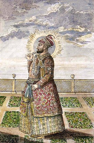
Hyder Ali was the Sultan and de facto ruler of the Kingdom of Mysore in southern India. Born as Hyder Ali, he distinguished himself as a soldier, eventually drawing the attention of Mysore's rulers. Rising to the post of Dalavayi (commander-in-chief) to Krishnaraja Wodeyar II, he came to dominate the titular monarch and the Mysore government. He became the de facto ruler, King of Mysore as Sarvadhikari by 1761. During intermittent conflicts against the East India Company during the First and Second Anglo–Mysore Wars, Hyder Ali was the military leader.

Kolar district is a district in the state of Karnataka, India.

Bijapur is the district headquarters of Bijapur district of the Karnataka state of India. It is also the headquarters for Bijapur Taluk. Bijapur city is well known for its historical monuments of architectural importance built during the rule of the Adil Shahi dynasty. It is also well known for the popular Karnataka premier league team, the Bijapur Bulls. Bijapur is located 519 km (322 mi) northwest of the state capital Bangalore and about 550 km (340 mi) from Mumbai and 210 km (130 mi) north east of the city of Belgaum.

Mirza Aziz-ud-Din Muhammad, better known by his regnal name Alamgir II, was the fifteenth Mughal emperor from 1754 to 1759. He was the son of Jahandar Shah.
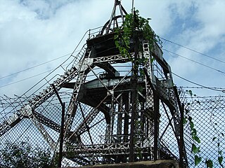
Kolar Gold Fields (K.G.F.) is a mining region in K.G.F. taluk (township), Kolar district, Karnataka, India. It is headquartered in Robertsonpet, where employees of Bharat Gold Mines Limited (BGML) and BEML Limited and their families live. K.G.F. is about 30 kilometres (19 mi) from Kolar, 100 kilometres (62 mi) from Bengaluru, capital of Karnataka. Over a century, the town has been known for gold mining. The mine closed on 28 February 2001 due to a fall in gold prices, despite gold still being present there. One of India's first power-generation units was built in 1889 to support mining operations. The mine complex hosted some particle physics experiments between the 1960s and 1992.

Hassan is one of the 31 districts of Karnataka, India. The district headquarter is Hassan. It was part of Manjarabad Faujdari between 1832-81. In 1882, it was reduced into a sub-division under erstwhile Kadur district. But in 1886, the Hassan district was restored to its current form.

Sadali is a hobli headquarters in Chikballapur district, Karnataka, India. It is located at a distance of about 100 km from Bangalore. It is equidistant from five taluk headquarters: Shidlaghatta, Chintamani, Bagepalli, Gudibanda and Chikballapur.
Nayakas of Chitradurga (1588–1779) were an Indian dynasty that ruled parts of eastern Karnataka during the post-Vijayanagara period, centered at Chitradurga. During the rule of the Hoysala Empire and the Vijayanagara Empire, they served as a feudatory chiefdom. Later, after the fall of the Vijayanagara Empire, they ruled at times as an independent chiefdom and at other times as a vassal of the Mysore Kingdom, Mughal Empire and Maratha Empire. Their territories merged into the Kingdom of Mysore under British rule.

Nayakas of Keladi (1499–1763), also known as Nayakas of Bednore and Ikkeri Nayakas, were an Indian dynasty based in Keladi in present-day Shimoga district of Karnataka, India. They were an important ruling dynasty in post-medieval Karnataka. They initially ruled as a vassal of the famous Vijayanagar Empire. After the fall of the empire in 1565, they gained independence and ruled significant parts of Malnad region of the Western Ghats in present-day Karnataka, most areas in the coastal regions of Karnataka and the central plains along the Tungabhadra river. In 1763 AD, with their defeat to Hyder Ali, they were absorbed into the Kingdom of Mysore. They played an important part in the history of Karnataka, during a time of confusion and fragmentation that generally prevailed in South India after the fall of the Vijayanagar Empire. The Keladi rulers were of the Vokkaliga and Banajiga castes and were Veerashaivas by faith. The Haleri Kingdom that ruled over Coorg between 1600 A.D and 1834 A.D. was founded by a member of the Keladi family.

The History of Karnataka goes back several millennia. Several great empires and dynasties have ruled over Karnataka and have contributed greatly to the history, culture and development of Karnataka as well as the entire Indian subcontinent. The Chindaka Nagas of central India Gangas, Rashtrakutas of Manyakheta, Chalukyas of Vengi, Yadava Dynasty of Devagiri were all of Kannada origin who later took to encouraging local languages.
Sira is a city and taluk headquarters of Sira Taluk of Tumkur district in the state of Karnataka, India. It lies on the AH 47, NH 48. It is the second largest city in the district after the headquarters by population, area and economy. It is the fastest developing city in the district. The State Capital city, Bengaluru, is 120 km from Sira. It is known for its historical significance as a political and military center and for being the capital of Imperial Sira Subah in the early 1700s.
Kaggaladu is a village in the Sira Taluk of Tumkur district in the south of Karnataka, India. It is located 9 km to the northwest of Sira, a town on the Sira-Changavara Main Road. Since 1999, trees in Kaggaladu have been a breeding ground and haven for painted storks and grey herons. The heronry was first made known to the outside world in 1999 by Wildlife Aware Nature Club, an NGO based in Tumkur.

The political history of the region on the Deccan Plateau in west-central peninsular India that was later divided into Mysore state and Coorg province saw many changes after the fall of the Hindu Vijayanagara Empire in 1565. The rise of Sultan Haidar Ali in 1761 introduced a new period.
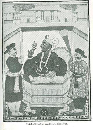
Devaraja Wodeyar II was the fourteenth maharaja of the Kingdom of Mysore from 1673 to 1704. During this time, Mysore saw further significant expansion after his predecessors. During his rule, centralised military power increased to an unprecedented degree for the region.

The Subah of Sira, also known as Carnatic-Balaghat, was a subah of the Mughal empire in South India that was established in 1687 by conquering emperor Aurangzeb and lasted until 1757. The province, which comprised the Carnatic region south of the Tungabhadra river, had its capital in the town of Sira. It was composed of seven parganas (districts): Basavapatna, Budihal, Sira, Penukonda, Dod-Ballapur, Hoskote and Kolar; in addition, Harpanahalli, Kondarpi, Anegundi, Bednur, Chitaldroog and Mysore were considered by the Mughals to be tributary states of the province.

The siege of Trichinopoly was part of an extended series of conflicts between the Nizam of Hyderabad and the Maratha Empire for control of the Carnatic region. On 29 August 1743, after a six-month siege, Murari Rao surrendered, giving Nizam ul Mulk (Nizam) the suzerainty of Trichinopoly. By the end of 1743, the Nizam had regained full control of Deccan. This stopped the Maratha interference in the region and ended their hegemony over the Carnatic. The Nizam resolved the internal conflicts among the regional hereditary nobles (Nawabs) for the seat of governor (Subedar) of Arcot State, and monitored the activities of the British East India company and French East India Company by limiting their access to ports and trading.
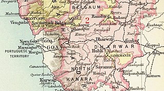
Savanur State, Nawab of Savanur was one of the princely states in British India. The last ruler of the state acceded to the Dominion of India on 8 March 1948, becoming part of the Bombay State. Later in 1956, it transferred to Mysore State in what is now Karnataka.
Thimmanahalli Boraiah Jayachandra is an Indian politician and former member of the Karnataka Legislative Assembly from the Indian National Congress. He served as the Minister of Law and Parliamentary Affairs for Karnataka before losing his seat in 2018 assembly elections.
The Kasturi Rangappa Nayaka Fort in Sira in Tumkur district of Karnataka is named after the Nayaka ruler Kasturi Rangappa Nayaka, who had ruled over Sira in the early 17th century as a palegar under the Vijayanagar Empire. After their rule, the fort and the Province of Sira came under the control of several rulers. Restoration works have been carried out by the Archaeology Department of Karnataka.
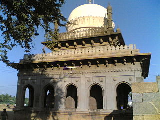
Malik Rihan Dargah, also known as Malik Rihan tomb, is a mausoleum in Sira, Karnataka, India. It contains the grave of Malik Rihan who was the governor of Sira province in the 17th-century. It has a square plan and illustrates the Indo-Saracenic style in Deccan architecture.


